Property Record
567 S Valley View Dr, Saint George, UT 84770

NEARBY LISTINGS FOR SALE OR LEASE
Property Detail
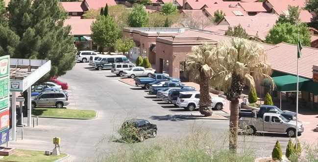
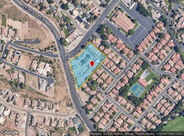
567 S Valley View Dr
0283799
S: 26 T: 42S R: 16W BEG AT PT ON E R/W/L OF VALLEY VIEW DR BEING S41*0253 E 1975.11 FT FM W1/4 COR SEC 26 T42S R16W;TH S49*1130 E 241.84 FT; TH S41*30 W 459.1 FT TO N R/W/L GREEN VALLEY RD; TH N16* W 306.74 FT ALG N R/W/L GREEN VALLEY RD TO PT CUR OF
Commercialnec
Washington
X
Utah
49053C1026G
2.12 AC
2024
Cedar City & St George
2025
Other Market Areas
270601
St. George, UT
20,595 SF
DEMOGRAPHICS near 567 S Valley View Dr
1 Mile
3 Mile
5 Mile
2024 Total Population
8,989
49,318
94,422
2029 Population
11,427
61,347
117,194
Pop Growth 2024-2029
+ 27.12%
+ 24.39%
+ 24.12%
Average Age
44
40
41
2024 Total Households
3,408
17,744
33,807
HH Growth 2024-2029
+ 28.02%
+ 25.12%
+ 24.78%
Median Household Inc
$70,128
$58,740
$61,981
Avg Household Size
2.50
2.60
2.70
2024 Avg HH Vehicles
2.00
2.00
2.00
Median Home Value
$391,097
$387,081
$412,799
Median Year Built
2000
1994
1998
Nearby Places
Map Layers
Map Styles
 Street
 Aerial
- Restaurants
- Banks
- Shops
- Fitness
- Groceries
PUBLIC TRANSPORTATION
AIRPORT
St George Regional
DRIVE
WALK
Distance
St George Regional
11 min
3.7 mi
Freight Ports
Port of Long Beach
DRIVE
WALK
Distance
Port of Long Beach
443 min
402.3 mi
Nearby Properties
Address
Land Use
TOTAL SIZE
Lot Size
Zoning
Address
Land Use
TOTAL SIZE
Lot Size
Zoning
163,605 SF
13.51 AC
C3
Address
Land Use
TOTAL SIZE
Lot Size
Zoning
252,737 SF
3.95 AC
C-4
Address
Land Use
TOTAL SIZE
Lot Size
Zoning
175,817 SF
30.20 AC
Address
Land Use
TOTAL SIZE
Lot Size
Zoning
206,801 SF
12.60 AC
PD
Address
Land Use
TOTAL SIZE
Lot Size
Zoning
9,037 SF
188.69 AC
C2
Address
Land Use
TOTAL SIZE
Lot Size
Zoning
141,567 SF
1.31 AC
C-4
Address
Land Use
TOTAL SIZE
Lot Size
Zoning
196,334 SF
22.87 AC
PDCOM
Address
Land Use
TOTAL SIZE
Lot Size
Zoning
280,428 SF
1.96 AC
C-4
Address
Land Use
TOTAL SIZE
Lot Size
Zoning
68,899 SF
7.36 AC
C3
Address
Land Use
TOTAL SIZE
Lot Size
Zoning
97,202 SF
2.92 AC
C3
Address
Land Use
TOTAL SIZE
Lot Size
Zoning
94,810 SF
3.15 AC
C-3
Address
Land Use
TOTAL SIZE
Lot Size
Zoning
59,500 SF
4.93 AC
R110
Address
Land Use
TOTAL SIZE
Lot Size
Zoning
57,312 SF
3.14 AC
PDCOM
Address
Land Use
TOTAL SIZE
Lot Size
Zoning
115,588 SF
7.61 AC
R3
Address
Land Use
TOTAL SIZE
Lot Size
Zoning
6,642 SF
67.70 AC
R110
Address
Land Use
TOTAL SIZE
Lot Size
Zoning
67,139 SF
1.25 AC
Address
Land Use
TOTAL SIZE
Lot Size
Zoning
158,638 SF
4.67 AC
C-3
Address
Land Use
TOTAL SIZE
Lot Size
Zoning
82,440 SF
2.88 AC
Address
Land Use
TOTAL SIZE
Lot Size
Zoning
67,892 SF
4.99 AC
Address
Land Use
TOTAL SIZE
Lot Size
Zoning
54,787 SF
4.30 AC
R110
Address
Land Use
TOTAL SIZE
Lot Size
Zoning
68,433 SF
0.38 AC
Address
Land Use
TOTAL SIZE
Lot Size
Zoning
61,825 SF
5.20 AC
Address
Land Use
TOTAL SIZE
Lot Size
Zoning
76,560 SF
2.32 AC
Address
Land Use
TOTAL SIZE
Lot Size
Zoning
33,930 SF
11.65 AC
Address
Land Use
TOTAL SIZE
Lot Size
Zoning
48,597 SF
0.42 AC
Address
Land Use
TOTAL SIZE
Lot Size
Zoning
63,519 SF
1.86 AC
Address
Land Use
TOTAL SIZE
Lot Size
Zoning
254,253 SF
17.33 AC
Address
Land Use
TOTAL SIZE
Lot Size
Zoning
68,244 SF
7.48 AC
C-3
Address
Land Use
TOTAL SIZE
Lot Size
Zoning
106,168 SF
11.56 AC
C-3
Address
Land Use
TOTAL SIZE
Lot Size
Zoning
49,299 SF
1.85 AC
C-3
The World's #1 Commercial Real Estate Marketplace
Connect with us
© 2025 CoStar Group
The information above has been obtained from sources believed reliable. While we do not doubt its accuracy we have not verified it and make no guarantee, warranty or representation about it. It is your responsibility to independently confirm its accuracy and completeness. Any projections, opinions, assumptions, or estimates used are for example only and do not represent the current or future performance of the property. The value of this transaction to you depends on tax and other factors which should be evaluated by your tax, financial, and legal advisors. You and your advisors should conduct a careful, independent investigation of the property to determine to your satisfaction the suitability of the property for your needs.