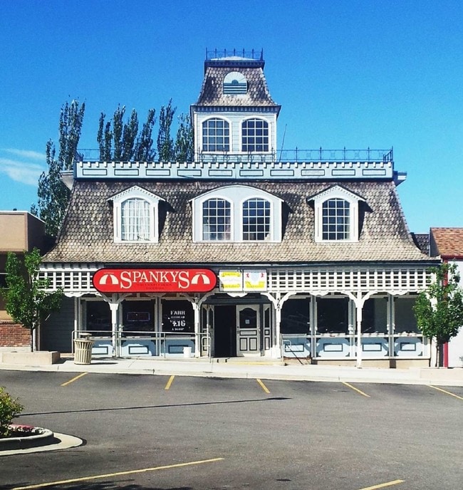
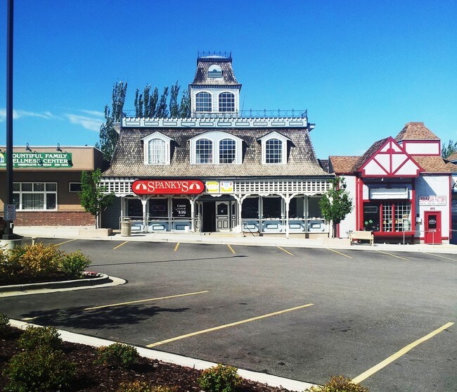
Property Record
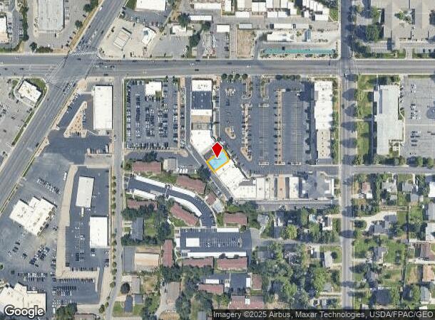
567 W 2600 S, Bountiful, UT 84010

NEARBY LISTINGS FOR SALE OR LEASE
Property Detail
567 W 2600 S
Ogden, UT
Colonial Square
06-098-0063
ALL OF LOTS 13 & 14, COLONIAL SQUARE. CONT. 0.094 ACRES
Stripcommercialcenter
Davis
X
Utah
49011C0507F
13-14
2025
0.09 AC
2025
Davis/Weber Counties
126902
Salt Lake City
4,100 SF
DEMOGRAPHICS near 567 W 2600 S
1 Mile
3 Mile
5 Mile
2024 Total Population
15,005
78,156
104,555
2029 Population
15,790
82,383
109,728
Pop Growth 2024-2029
+ 5.23%
+ 5.41%
+ 4.95%
Average Age
36
36
36
2024 Total Households
5,129
25,748
34,352
HH Growth 2024-2029
+ 5.30%
+ 5.48%
+ 5.04%
Median Household Inc
$74,487
$91,333
$91,896
Avg Household Size
2.90
3.00
3.00
2024 Avg HH Vehicles
2.00
2.00
2.00
Median Home Value
$380,713
$455,214
$452,728
Median Year Built
1974
1982
1982
Nearby Places
Map Layers
Map Styles
 Street
 Aerial
- Restaurants
- Banks
- Shops
- Fitness
- Groceries
PUBLIC TRANSPORTATION
COMMUTER RAIL
Woods Cross (FrontRunner North - Utah Transit Authority (UTA))
DRIVE
WALK
Distance
Woods Cross (FrontRunner North - Utah Transit Authority (UTA))
6 min
2.1 mi
DRIVE
WALK
Distance
12 min
6.5 mi
AIRPORT
Salt Lake City International
DRIVE
WALK
Distance
Salt Lake City International
17 min
11.7 mi
SALE & LEASE HISTORY
LISTING DATE
SALE/LEASE

Sep 25, 2016
For Lease
Sep 24, 2016
For Sale
Nearby Properties
Address
Land Use
TOTAL SIZE
Lot Size
Zoning
Address
Land Use
TOTAL SIZE
Lot Size
Zoning
123,416 SF
14.85 AC
R4
Address
Land Use
TOTAL SIZE
Lot Size
Zoning
181,804 SF
24.72 AC
Address
Land Use
TOTAL SIZE
Lot Size
Zoning
83,092 SF
9.07 AC
R3
Address
Land Use
TOTAL SIZE
Lot Size
Zoning
240,104 SF
37.03 AC
C2
Address
Land Use
TOTAL SIZE
Lot Size
Zoning
657,526 SF
35.95 AC
MD
Address
Land Use
TOTAL SIZE
Lot Size
Zoning
4,241 SF
8.67 AC
P
Address
Land Use
TOTAL SIZE
Lot Size
Zoning
208,638 SF
56.05 AC
Address
Land Use
TOTAL SIZE
Lot Size
Zoning
3,026 SF
14.42 AC
P
Address
Land Use
TOTAL SIZE
Lot Size
Zoning
13,126 SF
7.83 AC
P
Address
Land Use
TOTAL SIZE
Lot Size
Zoning
168,369 SF
10.14 AC
H
Address
Land Use
TOTAL SIZE
Lot Size
Zoning
113,419 SF
16.45 AC
R4
Address
Land Use
TOTAL SIZE
Lot Size
Zoning
92,796 SF
2.22 AC
DN
Address
Land Use
TOTAL SIZE
Lot Size
Zoning
113,265 SF
0.55 AC
CG
Address
Land Use
TOTAL SIZE
Lot Size
Zoning
230,020 SF
27.33 AC
MD
Address
Land Use
TOTAL SIZE
Lot Size
Zoning
156,694 SF
7.67 AC
Address
Land Use
TOTAL SIZE
Lot Size
Zoning
167,410 SF
12.89 AC
CG
Address
Land Use
TOTAL SIZE
Lot Size
Zoning
259,942 SF
18.52 AC
MD
Address
Land Use
TOTAL SIZE
Lot Size
Zoning
155,896 SF
8.96 AC
Address
Land Use
TOTAL SIZE
Lot Size
Zoning
58,273 SF
3.80 AC
I1
Address
Land Use
TOTAL SIZE
Lot Size
Zoning
280,221 SF
30.36 AC
R4
Address
Land Use
TOTAL SIZE
Lot Size
Zoning
19,299 SF
3.06 AC
Address
Land Use
TOTAL SIZE
Lot Size
Zoning
113,197 SF
3.62 AC
Address
Land Use
TOTAL SIZE
Lot Size
Zoning
3,986 SF
13 AC
CG
Address
Land Use
TOTAL SIZE
Lot Size
Zoning
119,710 SF
13.15 AC
R4
Address
Land Use
TOTAL SIZE
Lot Size
Zoning
6,050 SF
59.94 AC
Address
Land Use
TOTAL SIZE
Lot Size
Zoning
101,110 SF
8.12 AC
Address
Land Use
TOTAL SIZE
Lot Size
Zoning
57,830 SF
3.54 AC
Address
Land Use
TOTAL SIZE
Lot Size
Zoning
9,747 SF
7.73 AC
R4
Address
Land Use
TOTAL SIZE
Lot Size
Zoning
37,334 SF
9.72 AC
RM19
Address
Land Use
TOTAL SIZE
Lot Size
Zoning
166.84 AC
R-F
The World's #1 Commercial Real Estate Marketplace
Connect with us
© 2026 CoStar Group
The information above has been obtained from sources believed reliable. While we do not doubt its accuracy we have not verified it and make no guarantee, warranty or representation about it. It is your responsibility to independently confirm its accuracy and completeness. Any projections, opinions, assumptions, or estimates used are for example only and do not represent the current or future performance of the property. The value of this transaction to you depends on tax and other factors which should be evaluated by your tax, financial, and legal advisors. You and your advisors should conduct a careful, independent investigation of the property to determine to your satisfaction the suitability of the property for your needs.