Property Record
5670 Laurel Ave, Key West, FL 33040
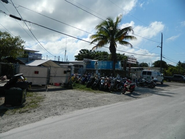


This Property Is For Sale
Property Detail
5670 Laurel Ave
00124410-000000
BK 31 LT 7 AND LT 8 STOCK ISLAND MALONEY SUB PB1-55 G67-18 G73-110 OR624-88 OR624-89 OR522-377 OR796-2190 OR826-1492 OR882-2065 OR947-1625 OR1084-758AFF OR1084-759R/S OR1216-593/94 OR1216-595/603 OR1650-1624 OR1883-840 OR2736-1565
Commercialnec
Monroe
MU
Florida
AE The base floodplain where base flood elevations are provided. AE Zones are now used on new format FIRMs instead of A1-A30 Zones.
7,8
2024
0.29 AC
2025
Key West
971800
Other Market Areas
5,258 SF
Key West-Key Largo, FL
NEARBY LISTINGS FOR SALE OR LEASE
DEMOGRAPHICS near 5670 Laurel Ave
1 mile
3 mile
5 mile
2025 Total Population
5,742
16,287
27,769
2030 Population
5,360
15,297
26,184
Pop Growth 2025-2030
(6.65%)
(6.08%)
(5.71%)
Average Age
41
41
43
2025 Total Households
2,043
6,155
11,646
HH Growth 2025-2030
(7.10%)
(6.43%)
(5.86%)
Median Household Inc
$87,809
$85,501
$83,845
Avg Household Size
2.60
2.40
2.20
2025 Avg HH Vehicles
2.00
2.00
1.00
Median Home Value
$821,247
$774,760
$858,345
Median Year Built
1979
1977
1972
Nearby Places
Map Layers
Map Styles
 Street
 Aerial
Layers
 Traffic
 Biking
Places
Listings with unknown addresses are not visible on the map
- Restaurants
- Banks
- Shops
- Fitness
- Groceries
PUBLIC TRANSPORTATION
AIRPORT
Key West International
Drive
Walk
Distance
Key West International
11 min
3.7 mi
Nearby Properties
Address
Land Use
TOTAL SIZE
Lot Size
Zoning
Address
Land Use
TOTAL SIZE
Lot Size
Zoning
98,815 SF
341.08 AC
M
Address
Land Use
TOTAL SIZE
Lot Size
Zoning
309.74 AC
MF
Address
Land Use
TOTAL SIZE
Lot Size
Zoning
105.78 AC
COW
Address
Land Use
TOTAL SIZE
Lot Size
Zoning
58,091 SF
4.87 AC
CT
Address
Land Use
TOTAL SIZE
Lot Size
Zoning
300,215 SF
13.94 AC
PS
Address
Land Use
TOTAL SIZE
Lot Size
Zoning
225,221 SF
17.11 AC
HDR
Address
Land Use
TOTAL SIZE
Lot Size
Zoning
115,501 SF
96.47 AC
Address
Land Use
TOTAL SIZE
Lot Size
Zoning
126,563 SF
6.07 AC
HDR
Address
Land Use
TOTAL SIZE
Lot Size
Zoning
109,118 SF
7.80 AC
MU
Address
Land Use
TOTAL SIZE
Lot Size
Zoning
219,839 SF
7.52 AC
URM
Address
Land Use
TOTAL SIZE
Lot Size
Zoning
228,039 SF
18.85 AC
PS
Address
Land Use
TOTAL SIZE
Lot Size
Zoning
147,707 SF
6.24 AC
MDR
Address
Land Use
TOTAL SIZE
Lot Size
Zoning
90,585 SF
2 AC
CG
Address
Land Use
TOTAL SIZE
Lot Size
Zoning
222,433 SF
25.69 AC
PS
Address
Land Use
TOTAL SIZE
Lot Size
Zoning
232,414 SF
17.63 AC
CG
Address
Land Use
TOTAL SIZE
Lot Size
Zoning
2,594 SF
22.38 AC
MDR
Address
Land Use
TOTAL SIZE
Lot Size
Zoning
189,418 SF
17.41 AC
CG
Address
Land Use
TOTAL SIZE
Lot Size
Zoning
178,252 SF
15.21 AC
CG
Address
Land Use
TOTAL SIZE
Lot Size
Zoning
85,189 SF
1.91 AC
Address
Land Use
TOTAL SIZE
Lot Size
Zoning
64,746 SF
3.83 AC
CG
Address
Land Use
TOTAL SIZE
Lot Size
Zoning
68,168 SF
3.06 AC
CG
Address
Land Use
TOTAL SIZE
Lot Size
Zoning
60,305 SF
5.10 AC
CT
Address
Land Use
TOTAL SIZE
Lot Size
Zoning
254,529 SF
21.61 AC
M
Address
Land Use
TOTAL SIZE
Lot Size
Zoning
33,925 SF
3.14 AC
CG
Address
Land Use
TOTAL SIZE
Lot Size
Zoning
60,580 SF
3.78 AC
MDR
Address
Land Use
TOTAL SIZE
Lot Size
Zoning
293,187 SF
168.13 AC
A
Address
Land Use
TOTAL SIZE
Lot Size
Zoning
56,115 SF
3.31 AC
CG
Address
Land Use
TOTAL SIZE
Lot Size
Zoning
43,942 SF
34.27 AC
PS
Address
Land Use
TOTAL SIZE
Lot Size
Zoning
43,019 SF
2.03 AC
CG
Address
Land Use
TOTAL SIZE
Lot Size
Zoning
63,357 SF
9.21 AC
PS
The World's #1 Commercial Real Estate Marketplace
Connect with us
© 2026 CoStar Group
The information above has been obtained from sources believed reliable. While we do not doubt its accuracy we have not verified it and make no guarantee, warranty or representation about it. It is your responsibility to independently confirm its accuracy and completeness. Any projections, opinions, assumptions, or estimates used are for example only and do not represent the current or future performance of the property. The value of this transaction to you depends on tax and other factors which should be evaluated by your tax, financial, and legal advisors. You and your advisors should conduct a careful, independent investigation of the property to determine to your satisfaction the suitability of the property for your needs.