Property Record
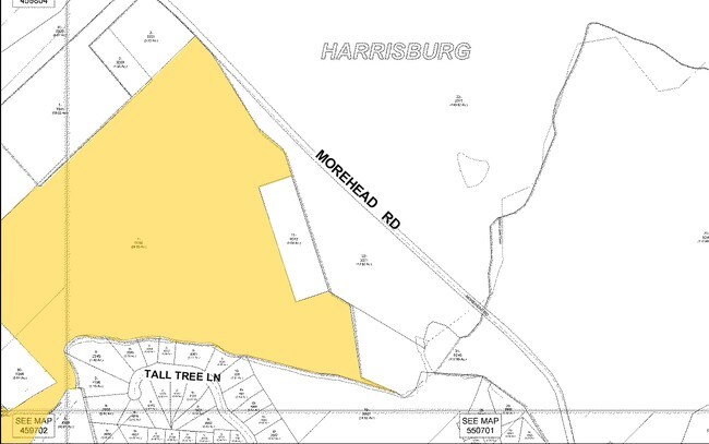
5800 Morehead Rd, Harrisburg, NC 28075
This Property Is For Sale
NEARBY LISTINGS FOR SALE OR LEASE
Property Detail
5800 Morehead Rd
Charlotte-Concord-Gastonia, NC-SC
Charlotte Motor Speedway
5508-10-9776-0000
SW SIDE MOREHEAD RD
Commercialnec
Cabarrus
AE
North Carolina
3710550800K
8.93 AC
2025
Cabarrus County
2025
Charlotte
042603
DEMOGRAPHICS near 5800 Morehead Rd
1 Mile
3 Mile
5 Mile
2024 Total Population
1,814
47,191
127,564
2029 Population
2,027
51,575
139,109
Pop Growth 2024-2029
+ 11.74%
+ 9.29%
+ 9.05%
Average Age
41
37
36
2024 Total Households
640
17,251
48,140
HH Growth 2024-2029
+ 10.31%
+ 8.47%
+ 8.28%
Median Household Inc
$93,055
$86,321
$79,521
Avg Household Size
2.80
2.70
2.60
2024 Avg HH Vehicles
2.00
2.00
2.00
Median Home Value
$279,877
$280,039
$300,732
Median Year Built
1999
2002
2002
Nearby Places
Map Layers
Map Styles
 Street
 Aerial
- Restaurants
- Banks
- Shops
- Fitness
- Groceries
PUBLIC TRANSPORTATION
AIRPORT
Concord-Padgett Regional
DRIVE
WALK
Distance
Concord-Padgett Regional
12 min
6.1 mi
Charlotte/Douglas International
DRIVE
WALK
Distance
Charlotte/Douglas International
36 min
22.8 mi
Freight Ports
North Charleston Terminal
DRIVE
WALK
Distance
North Charleston Terminal
249 min
215.0 mi
Nearby Properties
Address
Land Use
TOTAL SIZE
Lot Size
Zoning
Address
Land Use
TOTAL SIZE
Lot Size
Zoning
154,304 SF
857.72 AC
PID
Address
Land Use
TOTAL SIZE
Lot Size
Zoning
324,349 SF
4.69 AC
C-2
Address
Land Use
TOTAL SIZE
Lot Size
Zoning
33,090 SF
19.43 AC
C-2
Address
Land Use
TOTAL SIZE
Lot Size
Zoning
5,048 SF
26.66 AC
C-2
Address
Land Use
TOTAL SIZE
Lot Size
Zoning
300,275 SF
20.78 AC
MX2
Address
Land Use
TOTAL SIZE
Lot Size
Zoning
333,498 SF
17.66 AC
R3
Address
Land Use
TOTAL SIZE
Lot Size
Zoning
260,820 SF
14.72 AC
R3
Address
Land Use
TOTAL SIZE
Lot Size
Zoning
360,683 SF
16.84 AC
R12MF
Address
Land Use
TOTAL SIZE
Lot Size
Zoning
262,196 SF
21.30 AC
Address
Land Use
TOTAL SIZE
Lot Size
Zoning
196,893 SF
43.82 AC
MDR
Address
Land Use
TOTAL SIZE
Lot Size
Zoning
226,355 SF
99.26 AC
O-I
Address
Land Use
TOTAL SIZE
Lot Size
Zoning
367,468 SF
20.10 AC
R17MFCD
Address
Land Use
TOTAL SIZE
Lot Size
Zoning
282,743 SF
25.96 AC
NS
Address
Land Use
TOTAL SIZE
Lot Size
Zoning
245,838 SF
6.13 AC
Address
Land Use
TOTAL SIZE
Lot Size
Zoning
350,339 SF
77.60 AC
RM-1
Address
Land Use
TOTAL SIZE
Lot Size
Zoning
322,202 SF
17.29 AC
R22MF
Address
Land Use
TOTAL SIZE
Lot Size
Zoning
252,810 SF
6.87 AC
UR-C(CD)
Address
Land Use
TOTAL SIZE
Lot Size
Zoning
115,192 SF
67.77 AC
R3
Address
Land Use
TOTAL SIZE
Lot Size
Zoning
205,940 SF
16.55 AC
MX2
Address
Land Use
TOTAL SIZE
Lot Size
Zoning
7,566 SF
19.98 AC
RC
Address
Land Use
TOTAL SIZE
Lot Size
Zoning
175,978 SF
63.81 AC
O-I
Address
Land Use
TOTAL SIZE
Lot Size
Zoning
307,198 SF
20.96 AC
I-2-CD
Address
Land Use
TOTAL SIZE
Lot Size
Zoning
143,040 SF
8.05 AC
I-2
Address
Land Use
TOTAL SIZE
Lot Size
Zoning
142,368 SF
13.32 AC
MX2
Address
Land Use
TOTAL SIZE
Lot Size
Zoning
21,714 SF
15.02 AC
RC
Address
Land Use
TOTAL SIZE
Lot Size
Zoning
13.17 AC
Address
Land Use
TOTAL SIZE
Lot Size
Zoning
102,977 SF
8.09 AC
R17MFCD
Address
Land Use
TOTAL SIZE
Lot Size
Zoning
360,400 SF
20.32 AC
EC
Address
Land Use
TOTAL SIZE
Lot Size
Zoning
56,476 SF
21.24 AC
C-2
Address
Land Use
TOTAL SIZE
Lot Size
Zoning
125,245 SF
21.47 AC
O-I
The World's #1 Commercial Real Estate Marketplace
Connect with us
© 2026 CoStar Group
The information above has been obtained from sources believed reliable. While we do not doubt its accuracy we have not verified it and make no guarantee, warranty or representation about it. It is your responsibility to independently confirm its accuracy and completeness. Any projections, opinions, assumptions, or estimates used are for example only and do not represent the current or future performance of the property. The value of this transaction to you depends on tax and other factors which should be evaluated by your tax, financial, and legal advisors. You and your advisors should conduct a careful, independent investigation of the property to determine to your satisfaction the suitability of the property for your needs.