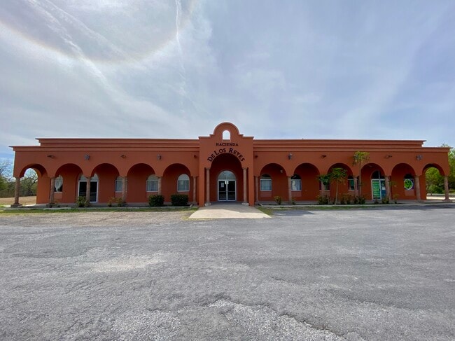
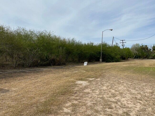
Property Record
5674 Maverick Rd, Brownsville, TX 78521

NEARBY LISTINGS FOR SALE OR LEASE
Property Detail
5674 Maverick Rd
Brownsville-Harlingen, TX
El Jardin Resubdivision
747540-1030-001000
EL JARDIN RESUBDIVISION, 10.723 ACRES OUT OF 11.730 AC OUT OF LOT 1 BLK 103
Commercialnec
Cameron
A
Texas
48061C0595F
1
2024
10.72 AC
2025
Greater Brownsville
014101
Brownsville/Harlingen
7,088 SF
DEMOGRAPHICS near 5674 Maverick Rd
1 Mile
3 Mile
5 Mile
2024 Total Population
8,014
39,027
103,354
2029 Population
8,178
40,062
106,469
Pop Growth 2024-2029
+ 2.05%
+ 2.65%
+ 3.01%
Average Age
34
35
35
2024 Total Households
2,071
11,259
31,104
HH Growth 2024-2029
+ 2.17%
+ 2.79%
+ 2.99%
Median Household Inc
$37,591
$35,537
$35,248
Avg Household Size
3.70
3.40
3.20
2024 Avg HH Vehicles
2.00
2.00
2.00
Median Home Value
$60,259
$62,273
$71,962
Median Year Built
1993
1989
1989
Nearby Places
Map Layers
Map Styles
 Street
 Aerial
- Restaurants
- Banks
- Shops
- Fitness
- Groceries
PUBLIC TRANSPORTATION
AIRPORT
Brownsville/South Padre Island International
DRIVE
WALK
Distance
Brownsville/South Padre Island International
7 min
2.7 mi
Valley International
DRIVE
WALK
Distance
Valley International
43 min
32.0 mi
Freight Ports
Port of Brownsville
DRIVE
WALK
Distance
Port of Brownsville
11 min
6.4 mi
SALE & LEASE HISTORY
LISTING DATE
SALE/LEASE

Jan 19, 2021
For Sale
Nearby Properties
Address
Land Use
TOTAL SIZE
Lot Size
Zoning
Address
Land Use
TOTAL SIZE
Lot Size
Zoning
328,021 SF
70.19 AC
SD6
Address
Land Use
TOTAL SIZE
Lot Size
Zoning
248,857 SF
37.16 AC
Address
Land Use
TOTAL SIZE
Lot Size
Zoning
167,737 SF
29.87 AC
Address
Land Use
TOTAL SIZE
Lot Size
Zoning
87,909 SF
12 AC
Address
Land Use
TOTAL SIZE
Lot Size
Zoning
392,622 SF
55 AC
I
Address
Land Use
TOTAL SIZE
Lot Size
Zoning
195,810 SF
26.95 AC
Address
Land Use
TOTAL SIZE
Lot Size
Zoning
462.60 AC
Address
Land Use
TOTAL SIZE
Lot Size
Zoning
102,316 SF
10.93 AC
Address
Land Use
TOTAL SIZE
Lot Size
Zoning
56,918 SF
2.95 AC
Address
Land Use
TOTAL SIZE
Lot Size
Zoning
85,803 SF
2.75 AC
Address
Land Use
TOTAL SIZE
Lot Size
Zoning
82,098 SF
20.25 AC
Address
Land Use
TOTAL SIZE
Lot Size
Zoning
151,872 SF
Address
Land Use
TOTAL SIZE
Lot Size
Zoning
53,035 SF
2 AC
Address
Land Use
TOTAL SIZE
Lot Size
Zoning
75,196 SF
15.86 AC
Address
Land Use
TOTAL SIZE
Lot Size
Zoning
141,320 SF
10.01 AC
B
Address
Land Use
TOTAL SIZE
Lot Size
Zoning
191,664 SF
39.75 AC
Address
Land Use
TOTAL SIZE
Lot Size
Zoning
67,743 SF
6.32 AC
A-C
Address
Land Use
TOTAL SIZE
Lot Size
Zoning
62,358 SF
3 AC
Address
Land Use
TOTAL SIZE
Lot Size
Zoning
100,000 SF
6.05 AC
Address
Land Use
TOTAL SIZE
Lot Size
Zoning
86,780 SF
5.96 AC
Address
Land Use
TOTAL SIZE
Lot Size
Zoning
101,500 SF
5.72 AC
Address
Land Use
TOTAL SIZE
Lot Size
Zoning
100,000 SF
5.94 AC
Address
Land Use
TOTAL SIZE
Lot Size
Zoning
58,931 SF
7.29 AC
C
Address
Land Use
TOTAL SIZE
Lot Size
Zoning
119,820 SF
3.57 AC
Address
Land Use
TOTAL SIZE
Lot Size
Zoning
20,430 SF
15.70 AC
Address
Land Use
TOTAL SIZE
Lot Size
Zoning
28,796 SF
6.10 AC
Address
Land Use
TOTAL SIZE
Lot Size
Zoning
112,638 SF
10.95 AC
Address
Land Use
TOTAL SIZE
Lot Size
Zoning
60,400 SF
184.22 AC
Address
Land Use
TOTAL SIZE
Lot Size
Zoning
30,599 SF
3.80 AC
Address
Land Use
TOTAL SIZE
Lot Size
Zoning
89,714 SF
7.10 AC
The World's #1 Commercial Real Estate Marketplace
Connect with us
© 2025 CoStar Group
The information above has been obtained from sources believed reliable. While we do not doubt its accuracy we have not verified it and make no guarantee, warranty or representation about it. It is your responsibility to independently confirm its accuracy and completeness. Any projections, opinions, assumptions, or estimates used are for example only and do not represent the current or future performance of the property. The value of this transaction to you depends on tax and other factors which should be evaluated by your tax, financial, and legal advisors. You and your advisors should conduct a careful, independent investigation of the property to determine to your satisfaction the suitability of the property for your needs.