Property Record
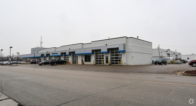
5675 N Glen Park Rd, Glendale, WI 53209

NEARBY LISTINGS FOR SALE OR LEASE
Property Detail
5675 N Glen Park Rd
168-9985-000
COM 537.18' N OF SE COR OF W1/2 OF SE1/4 SEC 30-8-22 TH N 307.50' W 797. 08' S 48D58M20S E 468.45' TH E 446.23' 10 BEG EXC E 30' OF N 274.68' FOR STREET & INCL EASEMENTS.
Commercialnec
Milwaukee
X
Wisconsin
55079C0081E
4.38 AC
2024
Milwaukee NW
2024
Milwaukee/Madison
001000
Milwaukee-Waukesha-West Allis, WI
DEMOGRAPHICS near 5675 N Glen Park Rd
1 Mile
3 Mile
5 Mile
2024 Total Population
8,686
112,288
322,466
2029 Population
8,474
110,599
317,318
Pop Growth 2024-2029
(2.44%)
(1.50%)
(1.60%)
Average Age
41
37
36
2024 Total Households
3,831
44,614
130,993
HH Growth 2024-2029
(2.48%)
(1.64%)
(1.76%)
Median Household Inc
$58,563
$47,231
$47,683
Avg Household Size
2.20
2.40
2.30
2024 Avg HH Vehicles
1.00
1.00
1.00
Median Home Value
$218,140
$191,337
$177,344
Median Year Built
1954
1950
1951
Nearby Places
Map Layers
Map Styles
 Street
 Aerial
- Restaurants
- Banks
- Shops
- Fitness
- Groceries
PUBLIC TRANSPORTATION
COMMUTER RAIL
Milwaukee (Empire Builder - Amtrak)
DRIVE
WALK
Distance
Milwaukee (Empire Builder - Amtrak)
14 min
7.2 mi
AIRPORT
General Mitchell International
DRIVE
WALK
Distance
General Mitchell International
24 min
13.8 mi
Freight Ports
Port Milwaukee
DRIVE
WALK
Distance
Port Milwaukee
17 min
9.6 mi
Nearby Properties
Address
Land Use
TOTAL SIZE
Lot Size
Zoning
Address
Land Use
TOTAL SIZE
Lot Size
Zoning
305,573 SF
3.20 AC
Address
Land Use
TOTAL SIZE
Lot Size
Zoning
66,245 SF
10.21 AC
Address
Land Use
TOTAL SIZE
Lot Size
Zoning
527,776 SF
33.23 AC
Address
Land Use
TOTAL SIZE
Lot Size
Zoning
685,390 SF
26.20 AC
Address
Land Use
TOTAL SIZE
Lot Size
Zoning
152,640 SF
10.50 AC
Address
Land Use
TOTAL SIZE
Lot Size
Zoning
171,170 SF
25.88 AC
Address
Land Use
TOTAL SIZE
Lot Size
Zoning
224,756 SF
12 AC
RESIDENTIA
Address
Land Use
TOTAL SIZE
Lot Size
Zoning
145,218 SF
10.23 AC
Address
Land Use
TOTAL SIZE
Lot Size
Zoning
145,605 SF
2.64 AC
Address
Land Use
TOTAL SIZE
Lot Size
Zoning
241,520 SF
6.60 AC
Address
Land Use
TOTAL SIZE
Lot Size
Zoning
Address
Land Use
TOTAL SIZE
Lot Size
Zoning
165,296 SF
1.04 AC
Address
Land Use
TOTAL SIZE
Lot Size
Zoning
294,553 SF
6.19 AC
Address
Land Use
TOTAL SIZE
Lot Size
Zoning
113,542 SF
2.31 AC
Address
Land Use
TOTAL SIZE
Lot Size
Zoning
213,218 SF
11 AC
Address
Land Use
TOTAL SIZE
Lot Size
Zoning
235,364 SF
7.20 AC
Address
Land Use
TOTAL SIZE
Lot Size
Zoning
90,714 SF
4.18 AC
Address
Land Use
TOTAL SIZE
Lot Size
Zoning
195,507 SF
1.92 AC
Address
Land Use
TOTAL SIZE
Lot Size
Zoning
298,666 SF
5.09 AC
PD
Address
Land Use
TOTAL SIZE
Lot Size
Zoning
2.15 AC
RT4
Address
Land Use
TOTAL SIZE
Lot Size
Zoning
72,676 SF
6.22 AC
Address
Land Use
TOTAL SIZE
Lot Size
Zoning
66.42 AC
IL1
Address
Land Use
TOTAL SIZE
Lot Size
Zoning
74,526 SF
5.42 AC
Address
Land Use
TOTAL SIZE
Lot Size
Zoning
194,400 SF
8.09 AC
Address
Land Use
TOTAL SIZE
Lot Size
Zoning
137,100 SF
6.69 AC
IL2
Address
Land Use
TOTAL SIZE
Lot Size
Zoning
48,540 SF
4.28 AC
Address
Land Use
TOTAL SIZE
Lot Size
Zoning
127,584 SF
3.28 AC
Address
Land Use
TOTAL SIZE
Lot Size
Zoning
18.54 AC
RS6
Address
Land Use
TOTAL SIZE
Lot Size
Zoning
61,910 SF
7.84 AC
Address
Land Use
TOTAL SIZE
Lot Size
Zoning
36,755 SF
6.44 AC
The World's #1 Commercial Real Estate Marketplace
Connect with us
© 2025 CoStar Group
The information above has been obtained from sources believed reliable. While we do not doubt its accuracy we have not verified it and make no guarantee, warranty or representation about it. It is your responsibility to independently confirm its accuracy and completeness. Any projections, opinions, assumptions, or estimates used are for example only and do not represent the current or future performance of the property. The value of this transaction to you depends on tax and other factors which should be evaluated by your tax, financial, and legal advisors. You and your advisors should conduct a careful, independent investigation of the property to determine to your satisfaction the suitability of the property for your needs.