Property Record
5685 N Scottsdale Rd, Scottsdale, AZ 85250


This Property Is For Sale
NEARBY LISTINGS FOR SALE OR LEASE
Property Detail
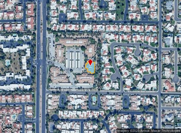
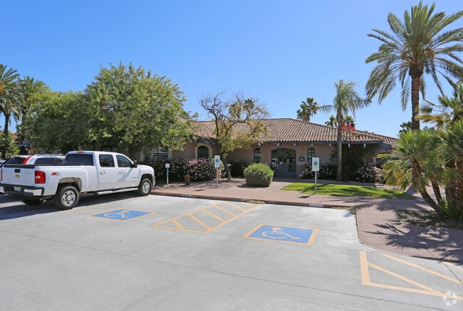
5685 N Scottsdale Rd
Phoenix-Mesa-Scottsdale, AZ
Scottsdale Place Office Condominium & Mo
173-14-189
SCOTTSDALE PLACE OFFICE CONDOMINIUM & MOD MCR 656-26 UNIT E (PLEASE NOTE: FOR LEGAL DESCRIPTION REFERENCES REGARDING THE PERCENTAGE OF OWNERSHIP OF THE COMMON AREA(S), PLEASE REFER TO THE RECORDED COVENANTS, CONDITIONS AND RESTRICTIONS (CCR) ASSOCIAT
Officecondo
Maricopa
X
Arizona
04013C1770M
e
2025
0.24 AC
2025
Scottsdale South
217001
Phoenix
10,082 SF
DEMOGRAPHICS near 5685 N Scottsdale Rd
1 Mile
3 Mile
5 Mile
2024 Total Population
13,224
89,197
199,369
2029 Population
14,965
98,848
219,191
Pop Growth 2024-2029
+ 13.17%
+ 10.82%
+ 9.94%
Average Age
49
44
43
2024 Total Households
7,648
45,961
95,791
HH Growth 2024-2029
+ 13.21%
+ 11.11%
+ 10.17%
Median Household Inc
$100,996
$90,184
$88,528
Avg Household Size
1.70
1.90
2.00
2024 Avg HH Vehicles
2.00
2.00
2.00
Median Home Value
$655,071
$612,827
$624,120
Median Year Built
1985
1979
1978
Nearby Places
Map Layers
Map Styles
 Street
 Aerial
- Restaurants
- Banks
- Shops
- Fitness
- Groceries
PUBLIC TRANSPORTATION
AIRPORT
Phoenix Sky Harbor International
DRIVE
WALK
Distance
Phoenix Sky Harbor International
20 min
10.3 mi
Phoenix-Mesa Gateway
DRIVE
WALK
Distance
Phoenix-Mesa Gateway
44 min
30.2 mi
Nearby Properties
Address
Land Use
TOTAL SIZE
Lot Size
Zoning
Address
Land Use
TOTAL SIZE
Lot Size
Zoning
Address
Land Use
TOTAL SIZE
Lot Size
Zoning
2,636,740 SF
21.88 AC
C-DT
Address
Land Use
TOTAL SIZE
Lot Size
Zoning
33,483 SF
7.82 AC
PF
Address
Land Use
TOTAL SIZE
Lot Size
Zoning
1,457,213 SF
41.78 AC
PUD
Address
Land Use
TOTAL SIZE
Lot Size
Zoning
9,160 SF
2.57 AC
DDMU2
Address
Land Use
TOTAL SIZE
Lot Size
Zoning
981,325 SF
8.31 AC
Address
Land Use
TOTAL SIZE
Lot Size
Zoning
440,573 SF
19.10 AC
SUPR
Address
Land Use
TOTAL SIZE
Lot Size
Zoning
1,229,384 SF
4.81 AC
Address
Land Use
TOTAL SIZE
Lot Size
Zoning
517,502 SF
21.26 AC
SUPR
Address
Land Use
TOTAL SIZE
Lot Size
Zoning
457,979 SF
9.26 AC
CO
Address
Land Use
TOTAL SIZE
Lot Size
Zoning
392,172 SF
7.50 AC
DM2
Address
Land Use
TOTAL SIZE
Lot Size
Zoning
268,262 SF
1.15 AC
C-DT
Address
Land Use
TOTAL SIZE
Lot Size
Zoning
439,600 SF
8.52 AC
DDCC2
Address
Land Use
TOTAL SIZE
Lot Size
Zoning
617,776 SF
4.53 AC
DDMU2
Address
Land Use
TOTAL SIZE
Lot Size
Zoning
22,630 SF
1.06 AC
SUPP
Address
Land Use
TOTAL SIZE
Lot Size
Zoning
289,633 SF
9.11 AC
R-10
Address
Land Use
TOTAL SIZE
Lot Size
Zoning
530,384 SF
5.24 AC
C-DT
Address
Land Use
TOTAL SIZE
Lot Size
Zoning
Address
Land Use
TOTAL SIZE
Lot Size
Zoning
590,903 SF
9.41 AC
C-DT
Address
Land Use
TOTAL SIZE
Lot Size
Zoning
1,137 SF
76.71 AC
RE35
Address
Land Use
TOTAL SIZE
Lot Size
Zoning
18,758 SF
312
Address
Land Use
TOTAL SIZE
Lot Size
Zoning
153,890 SF
8.54 AC
C-R
Address
Land Use
TOTAL SIZE
Lot Size
Zoning
514,973 SF
4.14 AC
DDMU2
Address
Land Use
TOTAL SIZE
Lot Size
Zoning
355,399 SF
7.13 AC
C-C
Address
Land Use
TOTAL SIZE
Lot Size
Zoning
153,300 SF
8.78 AC
R5
Address
Land Use
TOTAL SIZE
Lot Size
Zoning
121,740 SF
22.13 AC
SUPR
Address
Land Use
TOTAL SIZE
Lot Size
Zoning
158,895 SF
6.83 AC
R-43
Address
Land Use
TOTAL SIZE
Lot Size
Zoning
345,713 SF
18.25 AC
M-H
Address
Land Use
TOTAL SIZE
Lot Size
Zoning
489,367 SF
4.39 AC
PUD
Address
Land Use
TOTAL SIZE
Lot Size
Zoning
341,324 SF
1.93 AC
The World's #1 Commercial Real Estate Marketplace
Connect with us
© 2025 CoStar Group
The information above has been obtained from sources believed reliable. While we do not doubt its accuracy we have not verified it and make no guarantee, warranty or representation about it. It is your responsibility to independently confirm its accuracy and completeness. Any projections, opinions, assumptions, or estimates used are for example only and do not represent the current or future performance of the property. The value of this transaction to you depends on tax and other factors which should be evaluated by your tax, financial, and legal advisors. You and your advisors should conduct a careful, independent investigation of the property to determine to your satisfaction the suitability of the property for your needs.