Property Record
5690 W Beverly Ln, Glendale, AZ 85306

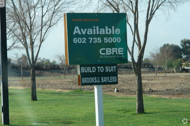

Property Detail
5690 W Beverly Ln
Phoenix-Mesa-Chandler, AZ
TALAVI MCR 331-44
200-50-186
MARICOPA
Industrialacreage
Arizona
PAD
21
C and X Area of minimal flood hazard, usually depicted on FIRMs as above the 500-year flood level.
0.92 AC
2025
Deer Valley/Airport
2025
Phoenix
104214
NEARBY LISTINGS FOR SALE OR LEASE
DEMOGRAPHICS near 5690 W Beverly Ln
1 mile
3 mile
5 mile
2025 Total Population
13,152
120,540
363,432
2030 Population
13,575
124,160
375,797
Pop Growth 2025-2030
+ 3.22%
+ 3.00%
+ 3.40%
Average Age
41
40
40
2025 Total Households
4,949
44,497
138,052
HH Growth 2025-2030
+ 3.13%
+ 3.01%
+ 3.58%
Median Household Inc
$85,425
$92,215
$80,822
Avg Household Size
2.50
2.60
2.50
2025 Avg HH Vehicles
2.00
2.00
2.00
Median Home Value
$412,919
$436,175
$410,521
Median Year Built
1981
1985
1986
Nearby Places
Map Layers
Map Styles
 Street
 Aerial
Layers
 Traffic
 Biking
Places
Listings with unknown addresses are not visible on the map
- Restaurants
- Banks
- Shops
- Fitness
- Groceries
PUBLIC TRANSPORTATION
AIRPORT
Phoenix Sky Harbor International
Drive
Walk
Distance
Phoenix Sky Harbor International
36 min
24.4 mi
Freight Ports
Port of San Diego
Drive
Walk
Distance
Port of San Diego
404 min
360.2 mi
Nearby Properties
Address
Land Use
TOTAL SIZE
Lot Size
Zoning
Address
Land Use
TOTAL SIZE
Lot Size
Zoning
45,900 SF
11.09 AC
PAD
Address
Land Use
TOTAL SIZE
Lot Size
Zoning
1,019,640 SF
32.10 AC
GO
Address
Land Use
TOTAL SIZE
Lot Size
Zoning
1,360,424 SF
88.31 AC
C-BP
Address
Land Use
TOTAL SIZE
Lot Size
Zoning
7,916 SF
5.26 AC
C-C
Address
Land Use
TOTAL SIZE
Lot Size
Zoning
742,601 SF
295.89 AC
R-8
Address
Land Use
TOTAL SIZE
Lot Size
Zoning
812,333 SF
31.75 AC
SR-30
Address
Land Use
TOTAL SIZE
Lot Size
Zoning
284,223 SF
10.02 AC
C-C
Address
Land Use
TOTAL SIZE
Lot Size
Zoning
708,928 SF
44.86 AC
Address
Land Use
TOTAL SIZE
Lot Size
Zoning
1.93 AC
C-C
Address
Land Use
TOTAL SIZE
Lot Size
Zoning
360,026 SF
74.94 AC
R-6
Address
Land Use
TOTAL SIZE
Lot Size
Zoning
0.47 AC
Address
Land Use
TOTAL SIZE
Lot Size
Zoning
19.95 AC
AG
Address
Land Use
TOTAL SIZE
Lot Size
Zoning
401,879 SF
67.89 AC
Address
Land Use
TOTAL SIZE
Lot Size
Zoning
226,169 SF
20.48 AC
Address
Land Use
TOTAL SIZE
Lot Size
Zoning
348,803 SF
15.91 AC
PAD
Address
Land Use
TOTAL SIZE
Lot Size
Zoning
314,839 SF
39 AC
R-18
Address
Land Use
TOTAL SIZE
Lot Size
Zoning
240,863 SF
35.55 AC
Address
Land Use
TOTAL SIZE
Lot Size
Zoning
241,669 SF
12.78 AC
PAD
Address
Land Use
TOTAL SIZE
Lot Size
Zoning
219,122 SF
33 AC
R-6
Address
Land Use
TOTAL SIZE
Lot Size
Zoning
440,494 SF
26.25 AC
PAD
Address
Land Use
TOTAL SIZE
Lot Size
Zoning
392,885 SF
17.67 AC
M-H
Address
Land Use
TOTAL SIZE
Lot Size
Zoning
126,781 SF
10.06 AC
C-C
Address
Land Use
TOTAL SIZE
Lot Size
Zoning
344,908 SF
20.69 AC
C-C
Address
Land Use
TOTAL SIZE
Lot Size
Zoning
378,106 SF
19.18 AC
R-3
Address
Land Use
TOTAL SIZE
Lot Size
Zoning
126,814 SF
31.56 AC
R17
Address
Land Use
TOTAL SIZE
Lot Size
Zoning
244,979 SF
35.16 AC
C-BP
Address
Land Use
TOTAL SIZE
Lot Size
Zoning
200,658 SF
23.14 AC
C-BP
Address
Land Use
TOTAL SIZE
Lot Size
Zoning
245,400 SF
22.90 AC
PAD
Address
Land Use
TOTAL SIZE
Lot Size
Zoning
319,723 SF
10.79 AC
PAD
Address
Land Use
TOTAL SIZE
Lot Size
Zoning
153,980 SF
20.11 AC
R-8
The World's #1 Commercial Real Estate Marketplace
Connect with us
© 2026 CoStar Group
The information above has been obtained from sources believed reliable. While we do not doubt its accuracy we have not verified it and make no guarantee, warranty or representation about it. It is your responsibility to independently confirm its accuracy and completeness. Any projections, opinions, assumptions, or estimates used are for example only and do not represent the current or future performance of the property. The value of this transaction to you depends on tax and other factors which should be evaluated by your tax, financial, and legal advisors. You and your advisors should conduct a careful, independent investigation of the property to determine to your satisfaction the suitability of the property for your needs.