Property Record
57 Breland Dr, Henderson, NC 27537

This Property Is For Sale
NEARBY LISTINGS FOR SALE OR LEASE
-
-
View all Henderson listings for sale on LoopNet.com
Property Detail
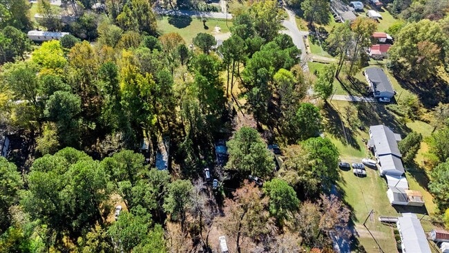
57 Breland Dr
Other Market Areas
E H & Margaret M Butler
Henderson, NC
Vance
0214B03005
North Carolina
Residentialnec
0.96 AC
X
North Carolina Northeast Area
3720198200K
DEMOGRAPHICS near 57 Breland Dr
1 Mile
3 Mile
5 Mile
2024 Total Population
2,222
18,061
26,880
2029 Population
2,235
18,224
26,976
Pop Growth 2024-2029
+ 0.59%
+ 0.90%
+ 0.36%
Average Age
38
40
41
2024 Total Households
862
7,130
10,752
HH Growth 2024-2029
+ 0.70%
+ 0.94%
+ 0.33%
Median Household Inc
$28,245
$39,168
$43,805
Avg Household Size
2.60
2.50
2.40
2024 Avg HH Vehicles
2.00
2.00
2.00
Median Home Value
$75,908
$116,737
$141,961
Median Year Built
1974
1970
1974
Nearby Places
Map Layers
Map Styles
 Street
 Aerial
- Restaurants
- Banks
- Shops
- Fitness
- Groceries
Nearby Properties
Address
Land Use
TOTAL SIZE
Lot Size
Zoning
Address
Land Use
TOTAL SIZE
Lot Size
Zoning
149,688 SF
131.64 AC
HI2
Address
Land Use
TOTAL SIZE
Lot Size
Zoning
96,081 SF
1.33 AC
HB1
Address
Land Use
TOTAL SIZE
Lot Size
Zoning
51,768 SF
40.75 AC
HR8M
Address
Land Use
TOTAL SIZE
Lot Size
Zoning
104,496 SF
14.95 AC
HR6
Address
Land Use
TOTAL SIZE
Lot Size
Zoning
64,208 SF
1.90 AC
HB1
Address
Land Use
TOTAL SIZE
Lot Size
Zoning
167,900 SF
70.82 AC
HR15
Address
Land Use
TOTAL SIZE
Lot Size
Zoning
230,400 SF
69.68 AC
HI2
Address
Land Use
TOTAL SIZE
Lot Size
Zoning
22,572 SF
88.80 AC
HR15M
Address
Land Use
TOTAL SIZE
Lot Size
Zoning
157,874 SF
40 AC
OI
Address
Land Use
TOTAL SIZE
Lot Size
Zoning
214,900 SF
25.24 AC
HI2
Address
Land Use
TOTAL SIZE
Lot Size
Zoning
54,090 SF
7.61 AC
HB3
Address
Land Use
TOTAL SIZE
Lot Size
Zoning
54,793 SF
47.70 AC
HR15
Address
Land Use
TOTAL SIZE
Lot Size
Zoning
85,355 SF
13.80 AC
HB4
Address
Land Use
TOTAL SIZE
Lot Size
Zoning
27,784 SF
2.04 AC
HB1
Address
Land Use
TOTAL SIZE
Lot Size
Zoning
78,661 SF
4.84 AC
HOI
Address
Land Use
TOTAL SIZE
Lot Size
Zoning
1,824 SF
13 AC
HR8
Address
Land Use
TOTAL SIZE
Lot Size
Zoning
56,315 SF
8.69 AC
HB4
Address
Land Use
TOTAL SIZE
Lot Size
Zoning
48,490 SF
6.14 AC
HB2A
Address
Land Use
TOTAL SIZE
Lot Size
Zoning
29,400 SF
8.24 AC
HB2
Address
Land Use
TOTAL SIZE
Lot Size
Zoning
67,977 SF
17.65 AC
HOI
Address
Land Use
TOTAL SIZE
Lot Size
Zoning
12,000 SF
1.50 AC
HI2
Address
Land Use
TOTAL SIZE
Lot Size
Zoning
65,156 SF
46.85 AC
HI2
Address
Land Use
TOTAL SIZE
Lot Size
Zoning
213,673 SF
8.05 AC
HI2
Address
Land Use
TOTAL SIZE
Lot Size
Zoning
33,600 SF
9.83 AC
HB2
Address
Land Use
TOTAL SIZE
Lot Size
Zoning
14,672 SF
2.85 AC
HB4
Address
Land Use
TOTAL SIZE
Lot Size
Zoning
35,775 SF
11.97 AC
HB4
Address
Land Use
TOTAL SIZE
Lot Size
Zoning
96,000 SF
14.98 AC
HI2
Address
Land Use
TOTAL SIZE
Lot Size
Zoning
12,664 SF
9.14 AC
HB4
Address
Land Use
TOTAL SIZE
Lot Size
Zoning
59,800 SF
16.41 AC
HB3
Address
Land Use
TOTAL SIZE
Lot Size
Zoning
33,815 SF
0.81 AC
HB1
The World's #1 Commercial Real Estate Marketplace
Connect with us
© 2025 CoStar Group
The information above has been obtained from sources believed reliable. While we do not doubt its accuracy we have not verified it and make no guarantee, warranty or representation about it. It is your responsibility to independently confirm its accuracy and completeness. Any projections, opinions, assumptions, or estimates used are for example only and do not represent the current or future performance of the property. The value of this transaction to you depends on tax and other factors which should be evaluated by your tax, financial, and legal advisors. You and your advisors should conduct a careful, independent investigation of the property to determine to your satisfaction the suitability of the property for your needs.