Property Record
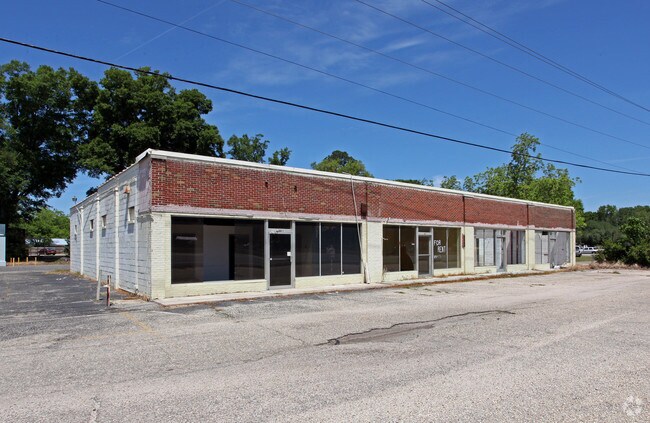
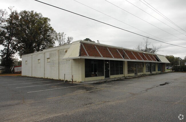
57 Highway 43, Satsuma, AL 36572

Property Detail
57 Highway 43
19-05-22-4-002-054.001
ALL THAT PART OF BLK 33 ACC TO THE PLAT OF SATUSMA LYING W OF U S HWY 43 MORE PARTIC DESC AS FOLL BEG AT THE SW COR OF SD BLK
Storesoffices
MOBILE
B and X Area of moderate flood hazard, usually the area between the limits of the 100-year and 500-year floods.
Alabama
2025
1 AC
2025
Outlying Mobile County
005601
Mobile
2,550 SF
Mobile, AL
NEARBY LISTINGS FOR SALE OR LEASE
DEMOGRAPHICS near 57 Highway 43
1 mile
3 mile
5 mile
2025 Total Population
3,264
12,652
23,089
2030 Population
3,225
12,505
22,859
Pop Growth 2025-2030
(1.19%)
(1.16%)
(1.00%)
Average Age
40
41
40
2025 Total Households
1,217
4,839
8,919
HH Growth 2025-2030
(1.15%)
(1.18%)
(1.00%)
Median Household Inc
$101,038
$75,675
$70,914
Avg Household Size
2.60
2.60
2.60
2025 Avg HH Vehicles
2.00
2.00
2.00
Median Home Value
$210,137
$224,871
$231,170
Median Year Built
1977
1977
1978
Nearby Places
Map Layers
Map Styles
 Street
 Aerial
Layers
 Traffic
 Biking
Places
Listings with unknown addresses are not visible on the map
- Restaurants
- Banks
- Shops
- Fitness
- Groceries
PUBLIC TRANSPORTATION
AIRPORT
Mobile International
Drive
Walk
Distance
Mobile International
28 min
17.3 mi
Mobile Regional
Drive
Walk
Distance
Mobile Regional
37 min
21.3 mi
Freight Ports
Port of Mobile
Drive
Walk
Distance
Port of Mobile
19 min
12.2 mi
Nearby Properties
Address
Land Use
TOTAL SIZE
Lot Size
Zoning
Address
Land Use
TOTAL SIZE
Lot Size
Zoning
1,104 SF
6.01 AC
Address
Land Use
TOTAL SIZE
Lot Size
Zoning
6,233 SF
27 AC
Address
Land Use
TOTAL SIZE
Lot Size
Zoning
125,239 SF
11.20 AC
Address
Land Use
TOTAL SIZE
Lot Size
Zoning
35,952 SF
5.37 AC
Address
Land Use
TOTAL SIZE
Lot Size
Zoning
142,692 SF
11.60 AC
Address
Land Use
TOTAL SIZE
Lot Size
Zoning
114,942 SF
29 AC
Address
Land Use
TOTAL SIZE
Lot Size
Zoning
73,680 SF
27 AC
Address
Land Use
TOTAL SIZE
Lot Size
Zoning
21,800 SF
6 AC
Address
Land Use
TOTAL SIZE
Lot Size
Zoning
6,150 SF
46.96 AC
Address
Land Use
TOTAL SIZE
Lot Size
Zoning
55,927 SF
5.87 AC
Address
Land Use
TOTAL SIZE
Lot Size
Zoning
41,607 SF
2.96 AC
Address
Land Use
TOTAL SIZE
Lot Size
Zoning
7,146 SF
2.96 AC
Address
Land Use
TOTAL SIZE
Lot Size
Zoning
14,688 SF
5.70 AC
Address
Land Use
TOTAL SIZE
Lot Size
Zoning
52,786 SF
8.94 AC
Address
Land Use
TOTAL SIZE
Lot Size
Zoning
64,302 SF
2.34 AC
Address
Land Use
TOTAL SIZE
Lot Size
Zoning
53,966 SF
22 AC
Address
Land Use
TOTAL SIZE
Lot Size
Zoning
4,926 SF
2.96 AC
Address
Land Use
TOTAL SIZE
Lot Size
Zoning
34,504 SF
12 AC
Address
Land Use
TOTAL SIZE
Lot Size
Zoning
10,356 SF
8.20 AC
Address
Land Use
TOTAL SIZE
Lot Size
Zoning
7,978 SF
1.52 AC
Address
Land Use
TOTAL SIZE
Lot Size
Zoning
61,472 SF
3.49 AC
Address
Land Use
TOTAL SIZE
Lot Size
Zoning
9,317 SF
1.64 AC
Address
Land Use
TOTAL SIZE
Lot Size
Zoning
7,552 SF
1.67 AC
Address
Land Use
TOTAL SIZE
Lot Size
Zoning
39,002 SF
1.70 AC
Address
Land Use
TOTAL SIZE
Lot Size
Zoning
34,387 SF
2.52 AC
Address
Land Use
TOTAL SIZE
Lot Size
Zoning
31,164 SF
2.05 AC
Address
Land Use
TOTAL SIZE
Lot Size
Zoning
14,482 SF
2.13 AC
Address
Land Use
TOTAL SIZE
Lot Size
Zoning
13,444 SF
1.02 AC
Address
Land Use
TOTAL SIZE
Lot Size
Zoning
60,480 SF
8.91 AC
Address
Land Use
TOTAL SIZE
Lot Size
Zoning
7,178 SF
1.54 AC
The World's #1 Commercial Real Estate Marketplace
Connect with us
© 2026 CoStar Group
The information above has been obtained from sources believed reliable. While we do not doubt its accuracy we have not verified it and make no guarantee, warranty or representation about it. It is your responsibility to independently confirm its accuracy and completeness. Any projections, opinions, assumptions, or estimates used are for example only and do not represent the current or future performance of the property. The value of this transaction to you depends on tax and other factors which should be evaluated by your tax, financial, and legal advisors. You and your advisors should conduct a careful, independent investigation of the property to determine to your satisfaction the suitability of the property for your needs.