Property Record
570 Headlands Rd, Painesville, OH 44077

NEARBY LISTINGS FOR SALE OR LEASE
-
-
View all Painesville listings for sale on LoopNet.com
Property Detail
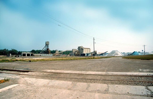
570 Headlands Rd
Cleveland-Elyria, OH
Driftwood 14
11-B-067-0-00-004
LOT 26 TRACT 4
Miningfacilityoilgasmineralpreciousmetals
Lake
AE
Ohio
39085C0018G
26
0
36.67 AC
2024
East Lake County
206200
Cleveland
80,155 SF
DEMOGRAPHICS near 570 Headlands Rd
1 Mile
3 Mile
5 Mile
2024 Total Population
2,828
20,528
61,188
2029 Population
2,787
20,527
61,128
Pop Growth 2024-2029
(1.45%)
0.00%
(0.10%)
Average Age
44
39
41
2024 Total Households
1,357
8,141
25,068
HH Growth 2024-2029
(1.40%)
(0.06%)
(0.14%)
Median Household Inc
$52,483
$62,368
$70,443
Avg Household Size
2.00
2.40
2.40
2024 Avg HH Vehicles
2.00
2.00
2.00
Median Home Value
$135,098
$150,983
$172,252
Median Year Built
1948
1962
1973
Nearby Places
Map Layers
Map Styles
 Street
 Aerial
- Restaurants
- Banks
- Shops
- Fitness
- Groceries
Nearby Properties
Address
Land Use
TOTAL SIZE
Lot Size
Zoning
Address
Land Use
TOTAL SIZE
Lot Size
Zoning
160,976 SF
3.31 AC
B-4
Address
Land Use
TOTAL SIZE
Lot Size
Zoning
89,317 SF
7.64 AC
Address
Land Use
TOTAL SIZE
Lot Size
Zoning
57,904 SF
3.61 AC
Address
Land Use
TOTAL SIZE
Lot Size
Zoning
113,375 SF
2.73 AC
B-3
Address
Land Use
TOTAL SIZE
Lot Size
Zoning
111,506 SF
9.84 AC
Address
Land Use
TOTAL SIZE
Lot Size
Zoning
198,502 SF
39.56 AC
Address
Land Use
TOTAL SIZE
Lot Size
Zoning
Address
Land Use
TOTAL SIZE
Lot Size
Zoning
57,744 SF
3.29 AC
Address
Land Use
TOTAL SIZE
Lot Size
Zoning
163,586 SF
24.91 AC
Address
Land Use
TOTAL SIZE
Lot Size
Zoning
59,448 SF
Address
Land Use
TOTAL SIZE
Lot Size
Zoning
Address
Land Use
TOTAL SIZE
Lot Size
Zoning
196,026 SF
23 AC
B-2
Address
Land Use
TOTAL SIZE
Lot Size
Zoning
400,874 SF
26.37 AC
I-2
Address
Land Use
TOTAL SIZE
Lot Size
Zoning
136,138 SF
15.25 AC
Address
Land Use
TOTAL SIZE
Lot Size
Zoning
153,534 SF
36.47 AC
I2
Address
Land Use
TOTAL SIZE
Lot Size
Zoning
51,576 SF
Address
Land Use
TOTAL SIZE
Lot Size
Zoning
74,502 SF
11.47 AC
R-1
Address
Land Use
TOTAL SIZE
Lot Size
Zoning
1,372 SF
90.54 AC
I-2
Address
Land Use
TOTAL SIZE
Lot Size
Zoning
8,556 SF
74.61 AC
R-1
Address
Land Use
TOTAL SIZE
Lot Size
Zoning
74,502 SF
6.35 AC
R-1
Address
Land Use
TOTAL SIZE
Lot Size
Zoning
47,934 SF
0.73 AC
B-4
Address
Land Use
TOTAL SIZE
Lot Size
Zoning
142,393 SF
11.81 AC
Address
Land Use
TOTAL SIZE
Lot Size
Zoning
42,200 SF
2.83 AC
Address
Land Use
TOTAL SIZE
Lot Size
Zoning
125,994 SF
12.54 AC
Address
Land Use
TOTAL SIZE
Lot Size
Zoning
Address
Land Use
TOTAL SIZE
Lot Size
Zoning
75,593 SF
2.49 AC
B-3
Address
Land Use
TOTAL SIZE
Lot Size
Zoning
68,656 SF
6.74 AC
Address
Land Use
TOTAL SIZE
Lot Size
Zoning
116,755 SF
11.12 AC
Address
Land Use
TOTAL SIZE
Lot Size
Zoning
95,628 SF
8.95 AC
R-3
Address
Land Use
TOTAL SIZE
Lot Size
Zoning
45,568 SF
5.90 AC
The World's #1 Commercial Real Estate Marketplace
Connect with us
© 2025 CoStar Group
The information above has been obtained from sources believed reliable. While we do not doubt its accuracy we have not verified it and make no guarantee, warranty or representation about it. It is your responsibility to independently confirm its accuracy and completeness. Any projections, opinions, assumptions, or estimates used are for example only and do not represent the current or future performance of the property. The value of this transaction to you depends on tax and other factors which should be evaluated by your tax, financial, and legal advisors. You and your advisors should conduct a careful, independent investigation of the property to determine to your satisfaction the suitability of the property for your needs.