Property Record
3801 S Moulton Dr, Oklahoma City, OK 73179


NEARBY LISTINGS FOR SALE OR LEASE
Property Detail
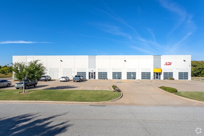
3801 S Moulton Dr
141942590
Unpltd Pt Sec 15 11N 4W
Warehouse
UNPLTD PT SEC 15 11N 4W 000 000 PT SW4 SEC 15 11N 4W BEG 678.05FT E & 15FT S OF NW/C SW4 TH E111.21FT SE35.36FT S159.62FT TH ON A CURVE TO THE LEFT 238.06FT TH ALONG A CURVE TO THE RIGHT 206.65FT S235.71FT W150FT N316.27FT NWLY200FT N355.52FT TO BEG
AE
Oklahoma
40027C0040J
Oklahoma
2023
5.46 AC
2024
Southwest
108604
Oklahoma City
37,650 SF
Oklahoma City, OK
DEMOGRAPHICS near 3801 S Moulton Dr
1 Mile
3 Mile
5 Mile
2024 Total Population
229
24,894
156,443
2029 Population
238
25,565
164,528
Pop Growth 2024-2029
+ 3.93%
+ 2.70%
+ 5.17%
Average Age
39
34
35
2024 Total Households
87
8,862
55,883
HH Growth 2024-2029
+ 4.60%
+ 2.82%
+ 5.18%
Median Household Inc
$75,658
$42,673
$47,422
Avg Household Size
2.50
2.70
2.70
2024 Avg HH Vehicles
2.00
2.00
2.00
Median Home Value
$82,894
$82,780
$124,700
Median Year Built
1980
1967
1968
Nearby Places
Map Layers
Map Styles
 Street
 Aerial
- Restaurants
- Banks
- Shops
- Fitness
- Groceries
PUBLIC TRANSPORTATION
COMMUTER RAIL
DRIVE
WALK
Distance
14 min
9.1 mi
AIRPORT
Will Rogers World
DRIVE
WALK
Distance
Will Rogers World
12 min
4.0 mi
Nearby Properties
Address
Land Use
TOTAL SIZE
Lot Size
Zoning
Address
Land Use
TOTAL SIZE
Lot Size
Zoning
1,976,300 SF
217.95 AC
I-2
Address
Land Use
TOTAL SIZE
Lot Size
Zoning
1,953,545 SF
111.96 AC
PUD
Address
Land Use
TOTAL SIZE
Lot Size
Zoning
1,563,794 SF
127.94 AC
PUD
Address
Land Use
TOTAL SIZE
Lot Size
Zoning
2,141,947 SF
98.48 AC
I-2
Address
Land Use
TOTAL SIZE
Lot Size
Zoning
653,359 SF
142.11 AC
I-2
Address
Land Use
TOTAL SIZE
Lot Size
Zoning
1,013,603 SF
66.29 AC
PUD
Address
Land Use
TOTAL SIZE
Lot Size
Zoning
647,520 SF
28.23 AC
PUD
Address
Land Use
TOTAL SIZE
Lot Size
Zoning
784,972 SF
68.99 AC
I-2
Address
Land Use
TOTAL SIZE
Lot Size
Zoning
246,774 SF
55.60 AC
PUD
Address
Land Use
TOTAL SIZE
Lot Size
Zoning
195,412 SF
4.42 AC
I-1
Address
Land Use
TOTAL SIZE
Lot Size
Zoning
300,000 SF
123.06 AC
R-1
Address
Land Use
TOTAL SIZE
Lot Size
Zoning
720,640 SF
52.69 AC
PUD
Address
Land Use
TOTAL SIZE
Lot Size
Zoning
259,726 SF
19.94 AC
PUD
Address
Land Use
TOTAL SIZE
Lot Size
Zoning
211,626 SF
12.67 AC
PUD
Address
Land Use
TOTAL SIZE
Lot Size
Zoning
279,224 SF
18.75 AC
PUD
Address
Land Use
TOTAL SIZE
Lot Size
Zoning
181,946 SF
4.42 AC
C-4
Address
Land Use
TOTAL SIZE
Lot Size
Zoning
192,771 SF
11.20 AC
I-3
Address
Land Use
TOTAL SIZE
Lot Size
Zoning
371,946 SF
31.38 AC
I-2
Address
Land Use
TOTAL SIZE
Lot Size
Zoning
143,450 SF
21.45 AC
Address
Land Use
TOTAL SIZE
Lot Size
Zoning
305,154 SF
33.30 AC
I-2
Address
Land Use
TOTAL SIZE
Lot Size
Zoning
538,787 SF
34.39 AC
I-2
Address
Land Use
TOTAL SIZE
Lot Size
Zoning
336,750 SF
15.53 AC
I-3
Address
Land Use
TOTAL SIZE
Lot Size
Zoning
215,392 SF
63.71 AC
I-2
Address
Land Use
TOTAL SIZE
Lot Size
Zoning
9.28 AC
I-2
Address
Land Use
TOTAL SIZE
Lot Size
Zoning
615,435 SF
35.60 AC
I-3
Address
Land Use
TOTAL SIZE
Lot Size
Zoning
141,204 SF
6.10 AC
I-2
Address
Land Use
TOTAL SIZE
Lot Size
Zoning
256,500 SF
19.46 AC
I-3
Address
Land Use
TOTAL SIZE
Lot Size
Zoning
257,100 SF
33.19 AC
I-2
Address
Land Use
TOTAL SIZE
Lot Size
Zoning
223,600 SF
25.57 AC
I-2
Address
Land Use
TOTAL SIZE
Lot Size
Zoning
124,208 SF
21.48 AC
I-2
The World's #1 Commercial Real Estate Marketplace
Connect with us
© 2026 CoStar Group
The information above has been obtained from sources believed reliable. While we do not doubt its accuracy we have not verified it and make no guarantee, warranty or representation about it. It is your responsibility to independently confirm its accuracy and completeness. Any projections, opinions, assumptions, or estimates used are for example only and do not represent the current or future performance of the property. The value of this transaction to you depends on tax and other factors which should be evaluated by your tax, financial, and legal advisors. You and your advisors should conduct a careful, independent investigation of the property to determine to your satisfaction the suitability of the property for your needs.