Property Record
5701 Matlock Rd, Arlington, TX 76018
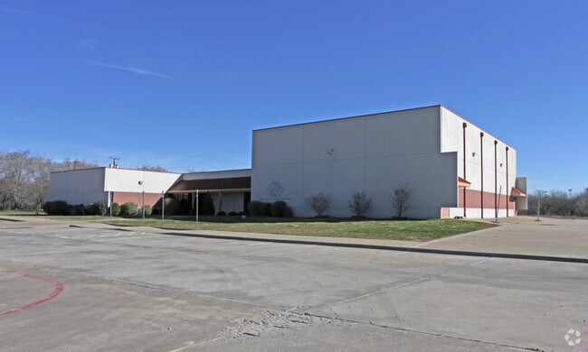


Property Detail
5701 Matlock Rd
Dallas-Fort Worth-Arlington, TX
CRAVENS PARK ADDITION BLOCK 1 LOT 1
06624995
TARRANT
Commercialnec
Texas
AE The base floodplain where base flood elevations are provided. AE Zones are now used on new format FIRMs instead of A1-A30 Zones.
1
0
85.58 AC
2025
Arlington/Mansfield
111540
Dallas/Ft Worth
18,956 SF
NEARBY LISTINGS FOR SALE OR LEASE
-
-
View all Arlington listings for sale on LoopNet.com
DEMOGRAPHICS near 5701 Matlock Rd
1 mile
3 mile
5 mile
2025 Total Population
21,771
119,300
318,875
2030 Population
22,668
124,584
333,948
Pop Growth 2025-2030
+ 4.12%
+ 4.43%
+ 4.73%
Average Age
36
37
37
2025 Total Households
6,858
39,194
108,502
HH Growth 2025-2030
+ 4.24%
+ 4.59%
+ 4.88%
Median Household Inc
$83,553
$87,623
$85,215
Avg Household Size
3.10
3.00
2.90
2025 Avg HH Vehicles
2.00
2.00
2.00
Median Home Value
$276,318
$316,208
$326,957
Median Year Built
1989
1991
1990
Nearby Places
Map Layers
Map Styles
 Street
 Aerial
Transit
 Traffic
 Biking
Places
Listings with unknown addresses are not visible on the map
- Restaurants
- Banks
- Shops
- Fitness
- Groceries
PUBLIC TRANSPORTATION
AIRPORT
Dallas-Fort Worth International
Drive
Walk
Distance
Dallas-Fort Worth International
33 min
22.1 mi
Dallas Love Field
Drive
Walk
Distance
Dallas Love Field
43 min
30.8 mi
Nearby Properties
Address
Land Use
TOTAL SIZE
Lot Size
Zoning
Address
Land Use
TOTAL SIZE
Lot Size
Zoning
1,342,617 SF
40.67 AC
Address
Land Use
TOTAL SIZE
Lot Size
Zoning
569,876 SF
47.80 AC
Address
Land Use
TOTAL SIZE
Lot Size
Zoning
537,189 SF
29.08 AC
Address
Land Use
TOTAL SIZE
Lot Size
Zoning
799,893 SF
19.43 AC
Address
Land Use
TOTAL SIZE
Lot Size
Zoning
529,992 SF
35.21 AC
Address
Land Use
TOTAL SIZE
Lot Size
Zoning
1,114,563 SF
89.72 AC
Address
Land Use
TOTAL SIZE
Lot Size
Zoning
453,257 SF
121.21 AC
Address
Land Use
TOTAL SIZE
Lot Size
Zoning
377,463 SF
19.50 AC
Address
Land Use
TOTAL SIZE
Lot Size
Zoning
419,875 SF
108.14 AC
Address
Land Use
TOTAL SIZE
Lot Size
Zoning
462,396 SF
25.76 AC
Address
Land Use
TOTAL SIZE
Lot Size
Zoning
280,000 SF
10.85 AC
Address
Land Use
TOTAL SIZE
Lot Size
Zoning
821,502 SF
45.37 AC
Address
Land Use
TOTAL SIZE
Lot Size
Zoning
352,999 SF
60.81 AC
Address
Land Use
TOTAL SIZE
Lot Size
Zoning
246,204 SF
15.16 AC
Address
Land Use
TOTAL SIZE
Lot Size
Zoning
252,416 SF
15.86 AC
Address
Land Use
TOTAL SIZE
Lot Size
Zoning
858,995 SF
41.93 AC
Address
Land Use
TOTAL SIZE
Lot Size
Zoning
202,262 SF
12.59 AC
Address
Land Use
TOTAL SIZE
Lot Size
Zoning
557,478 SF
28.73 AC
Address
Land Use
TOTAL SIZE
Lot Size
Zoning
171,820 SF
59.63 AC
Address
Land Use
TOTAL SIZE
Lot Size
Zoning
268,340 SF
70 AC
Address
Land Use
TOTAL SIZE
Lot Size
Zoning
258,465 SF
8.99 AC
Address
Land Use
TOTAL SIZE
Lot Size
Zoning
425,000 SF
21.26 AC
Address
Land Use
TOTAL SIZE
Lot Size
Zoning
415,800 SF
20.97 AC
Address
Land Use
TOTAL SIZE
Lot Size
Zoning
230,960 SF
9.63 AC
Address
Land Use
TOTAL SIZE
Lot Size
Zoning
425,000 SF
21.82 AC
Address
Land Use
TOTAL SIZE
Lot Size
Zoning
226,623 SF
22.90 AC
Address
Land Use
TOTAL SIZE
Lot Size
Zoning
281,009 SF
16.39 AC
Address
Land Use
TOTAL SIZE
Lot Size
Zoning
278,273 SF
9.09 AC
Address
Land Use
TOTAL SIZE
Lot Size
Zoning
376,297 SF
41.50 AC
Address
Land Use
TOTAL SIZE
Lot Size
Zoning
202,827 SF
11.96 AC
The World's #1 Commercial Real Estate Marketplace
Connect with us
© 2026 CoStar Group
The information above has been obtained from sources believed reliable. While we do not doubt its accuracy we have not verified it and make no guarantee, warranty or representation about it. It is your responsibility to independently confirm its accuracy and completeness. Any projections, opinions, assumptions, or estimates used are for example only and do not represent the current or future performance of the property. The value of this transaction to you depends on tax and other factors which should be evaluated by your tax, financial, and legal advisors. You and your advisors should conduct a careful, independent investigation of the property to determine to your satisfaction the suitability of the property for your needs.