Property Record
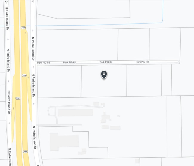
5701 Park Pid Rd, Corpus Christi, TX 78406
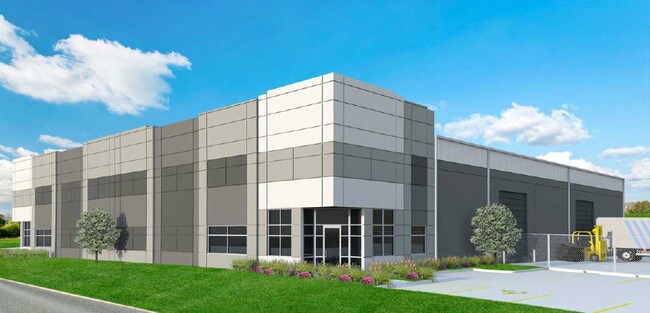
Property Detail
5701 Park Pid Rd
Corpus Christi, TX
NUECES
586300
Texas
Commercialnec
2.84 AC
B and X Area of moderate flood hazard, usually the area between the limits of the 100-year and 500-year floods.
West Side
24,852 SF
Corpus Christi
NEARBY LISTINGS FOR SALE OR LEASE
DEMOGRAPHICS near 5701 Park Pid Rd
1 mile
3 mile
5 mile
2025 Total Population
1,079
36,789
103,113
2030 Population
1,080
36,268
102,317
Pop Growth 2025-2030
+ 0.09%
(1.42%)
(0.77%)
Average Age
37
39
39
2025 Total Households
356
12,684
36,567
HH Growth 2025-2030
0.00%
(1.56%)
(0.77%)
Median Household Inc
$27,037
$45,496
$48,583
Avg Household Size
2.50
2.80
2.70
2025 Avg HH Vehicles
1.00
2.00
2.00
Median Home Value
$116,428
$78,982
$115,788
Median Year Built
2001
1965
1962
Nearby Places
Map Layers
Map Styles
 Street
 Aerial
Layers
 Traffic
 Biking
Places
Listings with unknown addresses are not visible on the map
- Restaurants
- Banks
- Shops
- Fitness
- Groceries
PUBLIC TRANSPORTATION
AIRPORT
Corpus Christi International
Drive
Walk
Distance
Corpus Christi International
9 min
3.9 mi
Freight Ports
Port of Corpus Christi
Drive
Walk
Distance
Port of Corpus Christi
11 min
7.5 mi
SALE & LEASE HISTORY
LISTING DATE
SALE/LEASE

Sep 10, 2018
For Lease
Dec 13, 2021
For Sale
Nearby Properties
Address
Land Use
TOTAL SIZE
Lot Size
Zoning
Address
Land Use
TOTAL SIZE
Lot Size
Zoning
382,448 SF
14.98 AC
Address
Land Use
TOTAL SIZE
Lot Size
Zoning
174,650 SF
1.95 AC
I3
Address
Land Use
TOTAL SIZE
Lot Size
Zoning
233,436 SF
Address
Land Use
TOTAL SIZE
Lot Size
Zoning
278,919 SF
39.27 AC
R1B
Address
Land Use
TOTAL SIZE
Lot Size
Zoning
105,979 SF
25 AC
I2SP92
Address
Land Use
TOTAL SIZE
Lot Size
Zoning
74,247 SF
6.39 AC
Address
Land Use
TOTAL SIZE
Lot Size
Zoning
67,009 SF
6.99 AC
R1B
Address
Land Use
TOTAL SIZE
Lot Size
Zoning
85,871 SF
18.68 AC
R1B
Address
Land Use
TOTAL SIZE
Lot Size
Zoning
11,109 SF
76.58 AC
R1B
Address
Land Use
TOTAL SIZE
Lot Size
Zoning
89,537 SF
11.35 AC
R1B
Address
Land Use
TOTAL SIZE
Lot Size
Zoning
101,912 SF
13.89 AC
I-2
Address
Land Use
TOTAL SIZE
Lot Size
Zoning
74,261 SF
4.44 AC
R1B
Address
Land Use
TOTAL SIZE
Lot Size
Zoning
105.49 AC
R1B
Address
Land Use
TOTAL SIZE
Lot Size
Zoning
42,984 SF
5.20 AC
Address
Land Use
TOTAL SIZE
Lot Size
Zoning
129,210 SF
11.63 AC
R1B
Address
Land Use
TOTAL SIZE
Lot Size
Zoning
83,499 SF
5.38 AC
III
Address
Land Use
TOTAL SIZE
Lot Size
Zoning
95,860 SF
10.80 AC
R1B
Address
Land Use
TOTAL SIZE
Lot Size
Zoning
72,689 SF
4.07 AC
B-4&B-1
Address
Land Use
TOTAL SIZE
Lot Size
Zoning
120,822 SF
0.50 AC
I3
Address
Land Use
TOTAL SIZE
Lot Size
Zoning
97,550 SF
9.53 AC
B-4
Address
Land Use
TOTAL SIZE
Lot Size
Zoning
57,600 SF
9.97 AC
I2
Address
Land Use
TOTAL SIZE
Lot Size
Zoning
122,706 SF
25.85 AC
R1B
Address
Land Use
TOTAL SIZE
Lot Size
Zoning
83,539 SF
13.77 AC
I2
Address
Land Use
TOTAL SIZE
Lot Size
Zoning
108,360 SF
8.12 AC
B4
Address
Land Use
TOTAL SIZE
Lot Size
Zoning
131,238 SF
16.51 AC
I-2
Address
Land Use
TOTAL SIZE
Lot Size
Zoning
61,226 SF
2.99 AC
R-1B
Address
Land Use
TOTAL SIZE
Lot Size
Zoning
71,125 SF
8.83 AC
R1B
Address
Land Use
TOTAL SIZE
Lot Size
Zoning
4,850 SF
17.97 AC
FR
Address
Land Use
TOTAL SIZE
Lot Size
Zoning
194,327 SF
21.72 AC
Address
Land Use
TOTAL SIZE
Lot Size
Zoning
25,526 SF
9.48 AC
R1B
The World's #1 Commercial Real Estate Marketplace
Connect with us
© 2026 CoStar Group
The information above has been obtained from sources believed reliable. While we do not doubt its accuracy we have not verified it and make no guarantee, warranty or representation about it. It is your responsibility to independently confirm its accuracy and completeness. Any projections, opinions, assumptions, or estimates used are for example only and do not represent the current or future performance of the property. The value of this transaction to you depends on tax and other factors which should be evaluated by your tax, financial, and legal advisors. You and your advisors should conduct a careful, independent investigation of the property to determine to your satisfaction the suitability of the property for your needs.