Property Record
5702 Summitview Ave, Yakima, WA 98908
NEARBY LISTINGS FOR SALE OR LEASE
Property Detail
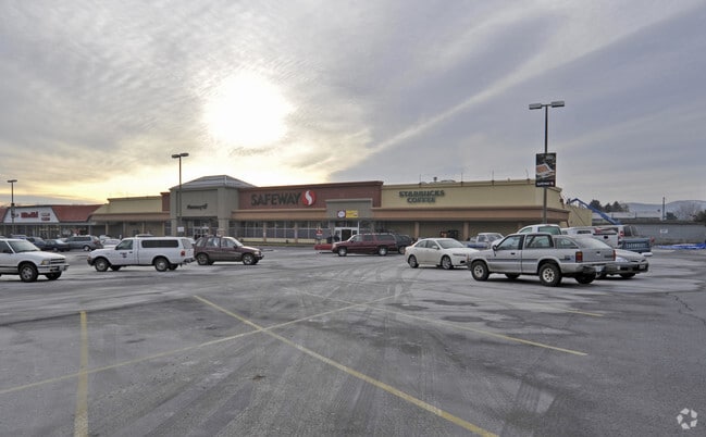
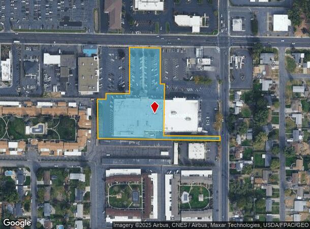
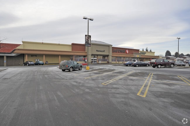
5702 Summitview Ave
181321-31039
Easements With Covenants And Restriction
Supermarket
BEG N 88^51'25W 345 FT & 38 FT S OF NE 178.56 FT,TH S 187 FT,TH N 88 D 51'25 W 21.5 FT TO TRUE POB COR NE1/4 NE1/4 SW1/4,TH S 187 FT,TH E 21.9 FT,TJ S 01^08'25W 273.55 FT,TH S 88^51'35E 298.94 FT,TH S 30.01 FT,TH N 88^51'35W 644.03 FT,TH N 03'20E 220
X
Yakima
53077C1030E
Washington
2025
3.36 AC
2025
Greater Yakima
000903
Yakima
45,595 SF
Yakima, WA
DEMOGRAPHICS near 5702 Summitview Ave
1 Mile
3 Mile
5 Mile
2024 Total Population
10,984
66,235
121,887
2029 Population
11,098
66,944
122,772
Pop Growth 2024-2029
+ 1.04%
+ 1.07%
+ 0.73%
Average Age
43
40
37
2024 Total Households
4,549
25,868
44,363
HH Growth 2024-2029
+ 0.92%
+ 1.05%
+ 0.70%
Median Household Inc
$67,529
$64,029
$57,408
Avg Household Size
2.40
2.50
2.60
2024 Avg HH Vehicles
2.00
2.00
2.00
Median Home Value
$325,356
$281,504
$264,607
Median Year Built
1974
1975
1973
Nearby Places
- Restaurants
- Banks
- Shops
- Fitness
- Groceries
PUBLIC TRANSPORTATION
AIRPORT
Yakima Air Trml/McAllister Field
DRIVE
WALK
Distance
Yakima Air Trml/McAllister Field
9 min
3.8 mi
Freight Ports
Port of Tacoma
DRIVE
WALK
Distance
Port of Tacoma
189 min
158.2 mi
Nearby Properties
Address
Land Use
TOTAL SIZE
Lot Size
Zoning
Address
Land Use
TOTAL SIZE
Lot Size
Zoning
331,736 SF
34.95 AC
R1
Address
Land Use
TOTAL SIZE
Lot Size
Zoning
409,453 SF
8.25 AC
R3
Address
Land Use
TOTAL SIZE
Lot Size
Zoning
326,323 SF
30.05 AC
R2
Address
Land Use
TOTAL SIZE
Lot Size
Zoning
193,955 SF
9.94 AC
C1
Address
Land Use
TOTAL SIZE
Lot Size
Zoning
226,069 SF
12.81 AC
C1
Address
Land Use
TOTAL SIZE
Lot Size
Zoning
235,222 SF
14.23 AC
M1
Address
Land Use
TOTAL SIZE
Lot Size
Zoning
329,388 SF
16.13 AC
M1
Address
Land Use
TOTAL SIZE
Lot Size
Zoning
501,270 SF
21.09 AC
M1
Address
Land Use
TOTAL SIZE
Lot Size
Zoning
205,680 SF
24.88 AC
C1
Address
Land Use
TOTAL SIZE
Lot Size
Zoning
119,023 SF
7.42 AC
R3
Address
Land Use
TOTAL SIZE
Lot Size
Zoning
69,675 SF
7.49 AC
R1
Address
Land Use
TOTAL SIZE
Lot Size
Zoning
65,606 SF
3.39 AC
R2
Address
Land Use
TOTAL SIZE
Lot Size
Zoning
114,192 SF
5.07 AC
C1
Address
Land Use
TOTAL SIZE
Lot Size
Zoning
69,675 SF
10.48 AC
R1
Address
Land Use
TOTAL SIZE
Lot Size
Zoning
107,078 SF
14.96 AC
R1
Address
Land Use
TOTAL SIZE
Lot Size
Zoning
132,213 SF
4 AC
R3
Address
Land Use
TOTAL SIZE
Lot Size
Zoning
162,216 SF
11 AC
M1
Address
Land Use
TOTAL SIZE
Lot Size
Zoning
130,114 SF
27.76 AC
R1
Address
Land Use
TOTAL SIZE
Lot Size
Zoning
105,756 SF
6.89 AC
R3
Address
Land Use
TOTAL SIZE
Lot Size
Zoning
128,789 SF
6.65 AC
R3
Address
Land Use
TOTAL SIZE
Lot Size
Zoning
93,286 SF
8.87 AC
R3
Address
Land Use
TOTAL SIZE
Lot Size
Zoning
162,933 SF
14.96 AC
SCC
Address
Land Use
TOTAL SIZE
Lot Size
Zoning
99,000 SF
5.44 AC
C1
Address
Land Use
TOTAL SIZE
Lot Size
Zoning
97,976 SF
3.98 AC
SCC
Address
Land Use
TOTAL SIZE
Lot Size
Zoning
196,486 SF
10.61 AC
M1
Address
Land Use
TOTAL SIZE
Lot Size
Zoning
118,830 SF
5.34 AC
LCC
Address
Land Use
TOTAL SIZE
Lot Size
Zoning
53,278 SF
5.44 AC
M1
Address
Land Use
TOTAL SIZE
Lot Size
Zoning
86,547 SF
4.41 AC
R3
Address
Land Use
TOTAL SIZE
Lot Size
Zoning
89,850 SF
14.03 AC
R1
Address
Land Use
TOTAL SIZE
Lot Size
Zoning
65,968 SF
1.51 AC
R2
The World's #1 Commercial Real Estate Marketplace
Connect with us
© 2025 CoStar Group
The information above has been obtained from sources believed reliable. While we do not doubt its accuracy we have not verified it and make no guarantee, warranty or representation about it. It is your responsibility to independently confirm its accuracy and completeness. Any projections, opinions, assumptions, or estimates used are for example only and do not represent the current or future performance of the property. The value of this transaction to you depends on tax and other factors which should be evaluated by your tax, financial, and legal advisors. You and your advisors should conduct a careful, independent investigation of the property to determine to your satisfaction the suitability of the property for your needs.