Property Record
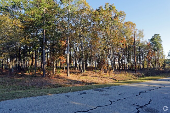
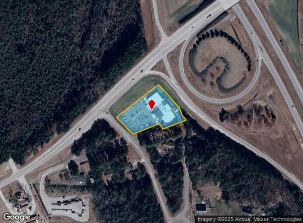
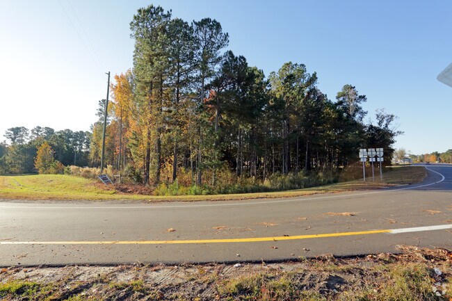
5702 W Grover Ln W, Sims, NC 27880
NEARBY LISTINGS FOR SALE OR LEASE
-
-
View all Sims listings for sale on LoopNet.com
Property Detail
5702 W Grover Ln W
2783-72-7897.000
Property Bonnie Lee Glover Jr
Animalhospitalvet
5702 GROVER LN 1.76AC
X
Wilson
3720278300K
North Carolina
2024
1.76 AC
2025
Rocky Mount/Wilson
001502
Other Market Areas
17,431 SF
Wilson, NC
DEMOGRAPHICS near 5702 W Grover Ln W
1 Mile
3 Mile
5 Mile
2024 Total Population
488
3,378
20,973
2029 Population
483
3,396
21,190
Pop Growth 2024-2029
(1.02%)
+ 0.53%
+ 1.03%
Average Age
40
39
40
2024 Total Households
198
1,309
8,507
HH Growth 2024-2029
(1.01%)
+ 0.46%
+ 1.00%
Median Household Inc
$57,272
$57,600
$56,166
Avg Household Size
2.50
2.50
2.40
2024 Avg HH Vehicles
2.00
2.00
2.00
Median Home Value
$150,450
$147,843
$159,492
Median Year Built
1992
1994
1994
Nearby Places
Map Layers
Map Styles
 Street
 Aerial
- Restaurants
- Banks
- Shops
- Fitness
- Groceries
PUBLIC TRANSPORTATION
COMMUTER RAIL
Wilson (Carolinian - Amtrak, Palmetto - Amtrak)
DRIVE
WALK
Distance
Wilson (Carolinian - Amtrak, Palmetto - Amtrak)
14 min
8.5 mi
Freight Ports
Port of Morehead City
DRIVE
WALK
Distance
Port of Morehead City
169 min
130.5 mi
Nearby Properties
Address
Land Use
TOTAL SIZE
Lot Size
Zoning
Address
Land Use
TOTAL SIZE
Lot Size
Zoning
125,586 SF
61.33 AC
HI
Address
Land Use
TOTAL SIZE
Lot Size
Zoning
624 SF
216.49 AC
M2
Address
Land Use
TOTAL SIZE
Lot Size
Zoning
232,805 SF
49.53 AC
HI
Address
Land Use
TOTAL SIZE
Lot Size
Zoning
11,375 SF
29.21 AC
HI
Address
Land Use
TOTAL SIZE
Lot Size
Zoning
338,739 SF
29.79 AC
HI
Address
Land Use
TOTAL SIZE
Lot Size
Zoning
135,620 SF
31.85 AC
HI
Address
Land Use
TOTAL SIZE
Lot Size
Zoning
138,421 SF
49.29 AC
HI
Address
Land Use
TOTAL SIZE
Lot Size
Zoning
34,093 SF
2.04 AC
GC
Address
Land Use
TOTAL SIZE
Lot Size
Zoning
104,976 SF
11.72 AC
Address
Land Use
TOTAL SIZE
Lot Size
Zoning
39,291 SF
1.94 AC
GC
Address
Land Use
TOTAL SIZE
Lot Size
Zoning
2,792 SF
54.22 AC
R40
Address
Land Use
TOTAL SIZE
Lot Size
Zoning
39,675 SF
10 AC
HI
Address
Land Use
TOTAL SIZE
Lot Size
Zoning
47,386 SF
1.95 AC
GC
Address
Land Use
TOTAL SIZE
Lot Size
Zoning
46,064 SF
2 AC
GC
Address
Land Use
TOTAL SIZE
Lot Size
Zoning
17,080 SF
3.71 AC
GC
Address
Land Use
TOTAL SIZE
Lot Size
Zoning
56,792 SF
2.08 AC
GC
Address
Land Use
TOTAL SIZE
Lot Size
Zoning
29,040 SF
2.34 AC
GC
Address
Land Use
TOTAL SIZE
Lot Size
Zoning
98,307 SF
10.05 AC
HI
Address
Land Use
TOTAL SIZE
Lot Size
Zoning
6,724 SF
7.24 AC
GC
Address
Land Use
TOTAL SIZE
Lot Size
Zoning
9,404 SF
1.97 AC
GC
Address
Land Use
TOTAL SIZE
Lot Size
Zoning
10,761 SF
6.61 AC
GC
Address
Land Use
TOTAL SIZE
Lot Size
Zoning
5,954 SF
1.94 AC
GC
Address
Land Use
TOTAL SIZE
Lot Size
Zoning
129,409 SF
12.63 AC
HI
Address
Land Use
TOTAL SIZE
Lot Size
Zoning
26,320 SF
1.70 AC
GC
Address
Land Use
TOTAL SIZE
Lot Size
Zoning
9,600 SF
7.08 AC
GC
Address
Land Use
TOTAL SIZE
Lot Size
Zoning
50,000 SF
13.23 AC
HI
Address
Land Use
TOTAL SIZE
Lot Size
Zoning
4,928 SF
1.90 AC
GC
Address
Land Use
TOTAL SIZE
Lot Size
Zoning
40,084 SF
4.60 AC
LI
Address
Land Use
TOTAL SIZE
Lot Size
Zoning
9,128 SF
3 AC
GC
Address
Land Use
TOTAL SIZE
Lot Size
Zoning
988 SF
115.48 AC
B2
The World's #1 Commercial Real Estate Marketplace
Connect with us
© 2026 CoStar Group
The information above has been obtained from sources believed reliable. While we do not doubt its accuracy we have not verified it and make no guarantee, warranty or representation about it. It is your responsibility to independently confirm its accuracy and completeness. Any projections, opinions, assumptions, or estimates used are for example only and do not represent the current or future performance of the property. The value of this transaction to you depends on tax and other factors which should be evaluated by your tax, financial, and legal advisors. You and your advisors should conduct a careful, independent investigation of the property to determine to your satisfaction the suitability of the property for your needs.