Property Record
5706 Root Rd, Spring, TX 77389

Save to a Folder
{{folder.Name}}
{{folder.ListingIds.length}} Properties
{{folder.ListingIds.length}} Property
Create a New Folder
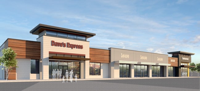
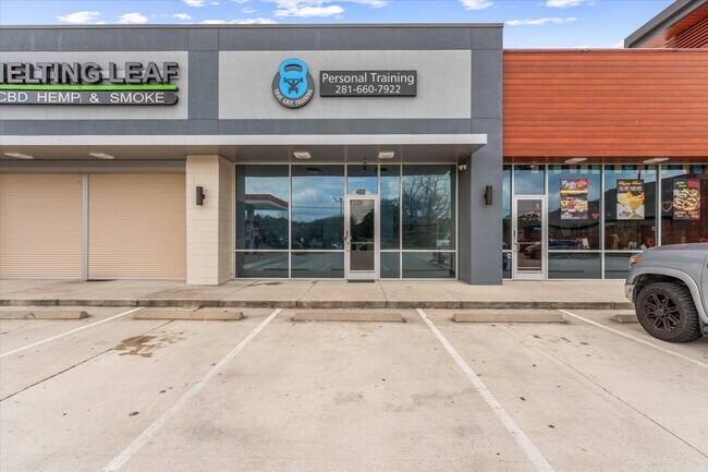
Property Detail
5706 Root Rd
1399620010001
RES A BLK 1 UMETIA INC
Storebuilding
HARRIS
B and X Area of moderate flood hazard, usually the area between the limits of the 100-year and 500-year floods.
Texas
2025
1.29 AC
2025
Far North
554902
Houston
12,972 SF
Houston-Pasadena-The Woodlands, TX
NEARBY LISTINGS FOR SALE OR LEASE
DEMOGRAPHICS near 5706 Root Rd
1 mile
3 mile
5 mile
2025 Total Population
7,263
76,014
230,162
2030 Population
7,903
82,191
250,900
Pop Growth 2025-2030
+ 8.81%
+ 8.13%
+ 9.01%
Average Age
37
37
37
2025 Total Households
2,355
25,784
81,640
HH Growth 2025-2030
+ 8.92%
+ 8.56%
+ 9.68%
Median Household Inc
$116,339
$112,183
$104,856
Avg Household Size
3.00
2.90
2.80
2025 Avg HH Vehicles
2.00
2.00
2.00
Median Home Value
$342,371
$333,373
$348,970
Median Year Built
2007
2006
2004
Nearby Places
Map Layers
Map Styles
 Street
 Aerial
Layers
 Traffic
 Biking
Places
Listings with unknown addresses are not visible on the map
- Restaurants
- Banks
- Shops
- Fitness
- Groceries
PUBLIC TRANSPORTATION
AIRPORT
George Bush Intcntl/Houston
Drive
Walk
Distance
George Bush Intcntl/Houston
25 min
21.0 mi
Freight Ports
Port of Houston
Drive
Walk
Distance
Port of Houston
48 min
36.7 mi
SALE & LEASE HISTORY
LISTING DATE
SALE/LEASE

Oct 16, 2025
For Lease
Jun 28, 2021
For Lease
Feb 07, 2025
For Lease
Nearby Properties
Address
Land Use
TOTAL SIZE
Lot Size
Zoning
Address
Land Use
TOTAL SIZE
Lot Size
Zoning
382,636 SF
25.51 AC
Address
Land Use
TOTAL SIZE
Lot Size
Zoning
379,180 SF
15.52 AC
Address
Land Use
TOTAL SIZE
Lot Size
Zoning
454,599 SF
22.79 AC
Address
Land Use
TOTAL SIZE
Lot Size
Zoning
320,507 SF
25.29 AC
Address
Land Use
TOTAL SIZE
Lot Size
Zoning
156,885 SF
26.24 AC
Address
Land Use
TOTAL SIZE
Lot Size
Zoning
368,000 SF
8.65 AC
Address
Land Use
TOTAL SIZE
Lot Size
Zoning
467,928 SF
6 AC
Address
Land Use
TOTAL SIZE
Lot Size
Zoning
375,293 SF
19.29 AC
Address
Land Use
TOTAL SIZE
Lot Size
Zoning
343,806 SF
17.76 AC
Address
Land Use
TOTAL SIZE
Lot Size
Zoning
335,258 SF
12.18 AC
Address
Land Use
TOTAL SIZE
Lot Size
Zoning
328,692 SF
18.47 AC
Address
Land Use
TOTAL SIZE
Lot Size
Zoning
454,330 SF
9.77 AC
Address
Land Use
TOTAL SIZE
Lot Size
Zoning
322,733 SF
18.40 AC
Address
Land Use
TOTAL SIZE
Lot Size
Zoning
323,119 SF
14.37 AC
Address
Land Use
TOTAL SIZE
Lot Size
Zoning
266,594 SF
10.71 AC
Address
Land Use
TOTAL SIZE
Lot Size
Zoning
343,521 SF
9.88 AC
Address
Land Use
TOTAL SIZE
Lot Size
Zoning
306,815 SF
14.88 AC
Address
Land Use
TOTAL SIZE
Lot Size
Zoning
296,117 SF
21.52 AC
Address
Land Use
TOTAL SIZE
Lot Size
Zoning
241,113 SF
6.29 AC
Address
Land Use
TOTAL SIZE
Lot Size
Zoning
188,265 SF
15.65 AC
Address
Land Use
TOTAL SIZE
Lot Size
Zoning
175,000 SF
14.63 AC
Address
Land Use
TOTAL SIZE
Lot Size
Zoning
300,000 SF
22.66 AC
6
Address
Land Use
TOTAL SIZE
Lot Size
Zoning
135.95 AC
Address
Land Use
TOTAL SIZE
Lot Size
Zoning
219,000 SF
46.59 AC
Address
Land Use
TOTAL SIZE
Lot Size
Zoning
800 SF
23.53 AC
Address
Land Use
TOTAL SIZE
Lot Size
Zoning
114,917 SF
18.61 AC
Address
Land Use
TOTAL SIZE
Lot Size
Zoning
180,080 SF
14.24 AC
Address
Land Use
TOTAL SIZE
Lot Size
Zoning
96,300 SF
21.59 AC
Address
Land Use
TOTAL SIZE
Lot Size
Zoning
120,220 SF
13.49 AC
Address
Land Use
TOTAL SIZE
Lot Size
Zoning
211,876 SF
21.78 AC
The World's #1 Commercial Real Estate Marketplace
Connect with us
© 2026 CoStar Group
The information above has been obtained from sources believed reliable. While we do not doubt its accuracy we have not verified it and make no guarantee, warranty or representation about it. It is your responsibility to independently confirm its accuracy and completeness. Any projections, opinions, assumptions, or estimates used are for example only and do not represent the current or future performance of the property. The value of this transaction to you depends on tax and other factors which should be evaluated by your tax, financial, and legal advisors. You and your advisors should conduct a careful, independent investigation of the property to determine to your satisfaction the suitability of the property for your needs.