Property Record
5709 Us Highway 51, Mcfarland, WI 53558

NEARBY LISTINGS FOR SALE OR LEASE
-
-
View all Mcfarland listings for sale on LoopNet.com
Property Detail
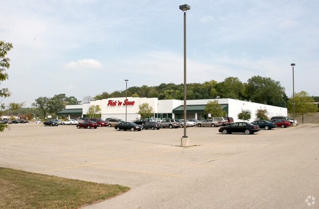
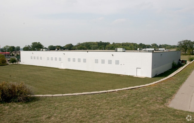
5709 Us Highway 51
Madison, WI
Certified Surv Map #7733
0610-032-1150-6
LOT 2 CSM 7733 CS40/256&258-2/10/95 F/K/A ASSESSORS PLAT VILLAGE OF MCFARLAND PR T OUTLOT 50 DESCR AS SEC 3-6-10 PRT NW1/4 (6.536 ACRES) EXC TO VIL OF MCFARLAND IN R32984/3
Commercialnec
Dane
X
Wisconsin
55025C0443J
2
2024
6.54 AC
2024
Southeast Madison
010504
Milwaukee/Madison
DEMOGRAPHICS near 5709 Us Highway 51
1 Mile
3 Mile
5 Mile
2024 Total Population
6,884
18,705
57,319
2029 Population
7,150
19,436
59,476
Pop Growth 2024-2029
+ 3.86%
+ 3.91%
+ 3.76%
Average Age
40
40
41
2024 Total Households
2,862
7,668
24,810
HH Growth 2024-2029
+ 4.02%
+ 4.03%
+ 3.89%
Median Household Inc
$81,826
$91,382
$79,734
Avg Household Size
2.40
2.40
2.20
2024 Avg HH Vehicles
2.00
2.00
2.00
Median Home Value
$326,731
$332,238
$306,164
Median Year Built
1987
1988
1978
Nearby Places
Map Layers
Map Styles
 Street
 Aerial
- Restaurants
- Banks
- Shops
- Fitness
- Groceries
PUBLIC TRANSPORTATION
AIRPORT
Dane County Regional/Truax Field
DRIVE
WALK
Distance
Dane County Regional/Truax Field
17 min
10.5 mi
Nearby Properties
Address
Land Use
TOTAL SIZE
Lot Size
Zoning
Address
Land Use
TOTAL SIZE
Lot Size
Zoning
168,685 SF
14.05 AC
IL
Address
Land Use
TOTAL SIZE
Lot Size
Zoning
2.03 AC
Address
Land Use
TOTAL SIZE
Lot Size
Zoning
3.59 AC
Address
Land Use
TOTAL SIZE
Lot Size
Zoning
2.38 AC
Address
Land Use
TOTAL SIZE
Lot Size
Zoning
19.81 AC
Address
Land Use
TOTAL SIZE
Lot Size
Zoning
5.53 AC
Address
Land Use
TOTAL SIZE
Lot Size
Zoning
3.49 AC
Address
Land Use
TOTAL SIZE
Lot Size
Zoning
6,868 SF
18.35 AC
IL
Address
Land Use
TOTAL SIZE
Lot Size
Zoning
202,800 SF
13.05 AC
IL
Address
Land Use
TOTAL SIZE
Lot Size
Zoning
16.40 AC
IL
Address
Land Use
TOTAL SIZE
Lot Size
Zoning
10.45 AC
IL
Address
Land Use
TOTAL SIZE
Lot Size
Zoning
49,562 SF
4.42 AC
SE
Address
Land Use
TOTAL SIZE
Lot Size
Zoning
17,980 SF
6.25 AC
SR-V2
Address
Land Use
TOTAL SIZE
Lot Size
Zoning
9,030 SF
6.59 AC
SR-V2
Address
Land Use
TOTAL SIZE
Lot Size
Zoning
113,341 SF
11.66 AC
IL
Address
Land Use
TOTAL SIZE
Lot Size
Zoning
131,874 SF
8.98 AC
IL
Address
Land Use
TOTAL SIZE
Lot Size
Zoning
14.34 AC
IL
Address
Land Use
TOTAL SIZE
Lot Size
Zoning
11.76 AC
Address
Land Use
TOTAL SIZE
Lot Size
Zoning
1.23 AC
Address
Land Use
TOTAL SIZE
Lot Size
Zoning
7.98 AC
Address
Land Use
TOTAL SIZE
Lot Size
Zoning
221,410 SF
19.70 AC
IL
Address
Land Use
TOTAL SIZE
Lot Size
Zoning
7.24 AC
C-2
Address
Land Use
TOTAL SIZE
Lot Size
Zoning
14,946 SF
13.29 AC
IG
Address
Land Use
TOTAL SIZE
Lot Size
Zoning
3,600 SF
50.85 AC
PMHP
Address
Land Use
TOTAL SIZE
Lot Size
Zoning
2.07 AC
Address
Land Use
TOTAL SIZE
Lot Size
Zoning
10,440 SF
9.53 AC
IL
Address
Land Use
TOTAL SIZE
Lot Size
Zoning
86,400 SF
6.53 AC
IL
Address
Land Use
TOTAL SIZE
Lot Size
Zoning
7.52 AC
IL
The World's #1 Commercial Real Estate Marketplace
Connect with us
© 2026 CoStar Group
The information above has been obtained from sources believed reliable. While we do not doubt its accuracy we have not verified it and make no guarantee, warranty or representation about it. It is your responsibility to independently confirm its accuracy and completeness. Any projections, opinions, assumptions, or estimates used are for example only and do not represent the current or future performance of the property. The value of this transaction to you depends on tax and other factors which should be evaluated by your tax, financial, and legal advisors. You and your advisors should conduct a careful, independent investigation of the property to determine to your satisfaction the suitability of the property for your needs.