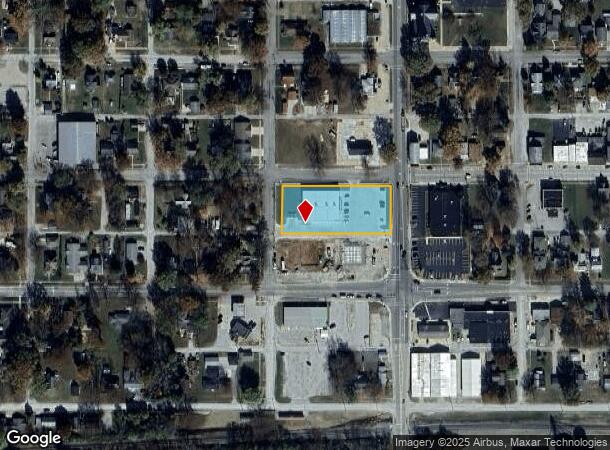
Property Record
571 12Th St, Carlyle, IL 62231


NEARBY LISTINGS FOR SALE OR LEASE
Property Detail
571 12Th St
St. Louis
Ridge View Sub
St. Louis, MO-IL
RIDGE VIEW SUB LOT 1
08-07-13-478-006
Clinton
Commercialnec
Illinois
2024
1
2024
1.11 AC
900403
Clinton County
DEMOGRAPHICS near 571 12Th St
1 Mile
3 Mile
5 Mile
2024 Total Population
3,337
4,205
6,196
2029 Population
3,389
4,264
6,261
Pop Growth 2024-2029
+ 1.56%
+ 1.40%
+ 1.05%
Average Age
43
43
43
2024 Total Households
1,401
1,757
2,577
HH Growth 2024-2029
+ 1.43%
+ 1.31%
+ 1.01%
Median Household Inc
$56,919
$58,501
$62,478
Avg Household Size
2.20
2.20
2.30
2024 Avg HH Vehicles
2.00
2.00
2.00
Median Home Value
$136,259
$143,144
$152,380
Median Year Built
1965
1968
1973
Nearby Places
Map Layers
Map Styles
 Street
 Aerial
- Restaurants
- Banks
- Shops
- Fitness
- Groceries
SALE & LEASE HISTORY
LISTING DATE
SALE/LEASE

Jun 01, 2017
For Sale
Jan 30, 2019
For Sale
Nearby Properties
Address
Land Use
TOTAL SIZE
Lot Size
Zoning
Address
Land Use
TOTAL SIZE
Lot Size
Zoning
99,320 SF
17.05 AC
51
Address
Land Use
TOTAL SIZE
Lot Size
Zoning
7.69 AC
Address
Land Use
TOTAL SIZE
Lot Size
Zoning
119,400 SF
19.23 AC
51
Address
Land Use
TOTAL SIZE
Lot Size
Zoning
8.08 AC
Address
Land Use
TOTAL SIZE
Lot Size
Zoning
18,970 SF
3.52 AC
51
Address
Land Use
TOTAL SIZE
Lot Size
Zoning
100,085 SF
6.35 AC
51
Address
Land Use
TOTAL SIZE
Lot Size
Zoning
27,458 SF
Address
Land Use
TOTAL SIZE
Lot Size
Zoning
3,360 SF
5 AC
51
Address
Land Use
TOTAL SIZE
Lot Size
Zoning
45,830 SF
6.26 AC
51
Address
Land Use
TOTAL SIZE
Lot Size
Zoning
11,932 SF
1.16 AC
51
Address
Land Use
TOTAL SIZE
Lot Size
Zoning
14,286 SF
9.50 AC
51
Address
Land Use
TOTAL SIZE
Lot Size
Zoning
12,000 SF
6.66 AC
51
Address
Land Use
TOTAL SIZE
Lot Size
Zoning
218.76 AC
Address
Land Use
TOTAL SIZE
Lot Size
Zoning
21,776 SF
2.58 AC
51
Address
Land Use
TOTAL SIZE
Lot Size
Zoning
2,716 SF
6.60 AC
51
Address
Land Use
TOTAL SIZE
Lot Size
Zoning
10,368 SF
0.64 AC
51
Address
Land Use
TOTAL SIZE
Lot Size
Zoning
10,660 SF
4.72 AC
51
Address
Land Use
TOTAL SIZE
Lot Size
Zoning
4,320 SF
1.43 AC
51
Address
Land Use
TOTAL SIZE
Lot Size
Zoning
Address
Land Use
TOTAL SIZE
Lot Size
Zoning
6,240 SF
2.38 AC
51
Address
Land Use
TOTAL SIZE
Lot Size
Zoning
12,476 SF
1.07 AC
51
Address
Land Use
TOTAL SIZE
Lot Size
Zoning
15,680 SF
2.49 AC
41
Address
Land Use
TOTAL SIZE
Lot Size
Zoning
4,232 SF
0.50 AC
51
Address
Land Use
TOTAL SIZE
Lot Size
Zoning
0.88 AC
51
Address
Land Use
TOTAL SIZE
Lot Size
Zoning
30,202 SF
4.16 AC
51
Address
Land Use
TOTAL SIZE
Lot Size
Zoning
10,550 SF
2.14 AC
51
Address
Land Use
TOTAL SIZE
Lot Size
Zoning
3,200 SF
45.23 AC
2131
Address
Land Use
TOTAL SIZE
Lot Size
Zoning
57,750 SF
4.50 AC
51
Address
Land Use
TOTAL SIZE
Lot Size
Zoning
3,508 SF
1.78 AC
51
The World's #1 Commercial Real Estate Marketplace
Connect with us
© 2026 CoStar Group
The information above has been obtained from sources believed reliable. While we do not doubt its accuracy we have not verified it and make no guarantee, warranty or representation about it. It is your responsibility to independently confirm its accuracy and completeness. Any projections, opinions, assumptions, or estimates used are for example only and do not represent the current or future performance of the property. The value of this transaction to you depends on tax and other factors which should be evaluated by your tax, financial, and legal advisors. You and your advisors should conduct a careful, independent investigation of the property to determine to your satisfaction the suitability of the property for your needs.