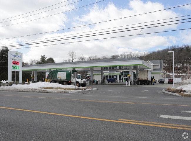
Property Record
571 Maple Ave, Saratoga Springs, NY 12866


NEARBY LISTINGS FOR SALE OR LEASE
Property Detail
571 Maple Ave
Albany-Schenectady-Troy, NY
Saratoga
415600 153.-1-4.2
New York
Servicestationmarket
4.002
2024
2.63 AC
2024
Saratoga County
061201
Albany/Schenectady/Troy
5,144 SF
DEMOGRAPHICS near 571 Maple Ave
1 Mile
3 Mile
5 Mile
2024 Total Population
1,997
29,172
46,491
2029 Population
2,078
30,526
48,725
Pop Growth 2024-2029
+ 4.06%
+ 4.64%
+ 4.81%
Average Age
46
45
44
2024 Total Households
811
13,805
21,082
HH Growth 2024-2029
+ 4.07%
+ 4.74%
+ 4.90%
Median Household Inc
$104,203
$86,163
$87,732
Avg Household Size
2.40
2.00
2.10
2024 Avg HH Vehicles
2.00
2.00
2.00
Median Home Value
$441,517
$423,993
$393,972
Median Year Built
1994
1983
1989
Nearby Places
Map Layers
Map Styles
 Street
 Aerial
- Restaurants
- Banks
- Shops
- Fitness
- Groceries
PUBLIC TRANSPORTATION
COMMUTER RAIL
Saratoga Springs Amtrak Station (Adirondack - Amtrak, Ethan Allen Express - Amtrak)
DRIVE
WALK
Distance
Saratoga Springs Amtrak Station (Adirondack - Amtrak, Ethan Allen Express - Amtrak)
8 min
3.8 mi
AIRPORT
Albany International
DRIVE
WALK
Distance
Albany International
39 min
29.4 mi
Freight Ports
Albany, NY Port
DRIVE
WALK
Distance
Albany, NY Port
54 min
39.8 mi
Nearby Properties
Address
Land Use
TOTAL SIZE
Lot Size
Zoning
Address
Land Use
TOTAL SIZE
Lot Size
Zoning
22,880 SF
295.11 AC
INSED
Address
Land Use
TOTAL SIZE
Lot Size
Zoning
249,750 SF
10.47 AC
C4
Address
Land Use
TOTAL SIZE
Lot Size
Zoning
3,000 SF
37.95 AC
C-1
Address
Land Use
TOTAL SIZE
Lot Size
Zoning
214,000 SF
127.30 AC
INSHT
Address
Land Use
TOTAL SIZE
Lot Size
Zoning
Address
Land Use
TOTAL SIZE
Lot Size
Zoning
3,863 SF
27.70 AC
PUDD
Address
Land Use
TOTAL SIZE
Lot Size
Zoning
173,482 SF
5.27 AC
C1
Address
Land Use
TOTAL SIZE
Lot Size
Zoning
606,904 SF
93.59 AC
C-1
Address
Land Use
TOTAL SIZE
Lot Size
Zoning
178,182 SF
36.63 AC
OR
Address
Land Use
TOTAL SIZE
Lot Size
Zoning
76,938 SF
10.53 AC
PUD
Address
Land Use
TOTAL SIZE
Lot Size
Zoning
42,840 SF
8.07 AC
C-1
Address
Land Use
TOTAL SIZE
Lot Size
Zoning
90,950 SF
12.09 AC
INSED
Address
Land Use
TOTAL SIZE
Lot Size
Zoning
200,242 SF
21.65 AC
C-1
Address
Land Use
TOTAL SIZE
Lot Size
Zoning
78,848 SF
6.54 AC
PUD
Address
Land Use
TOTAL SIZE
Lot Size
Zoning
35,733 SF
6.71 AC
INSED
Address
Land Use
TOTAL SIZE
Lot Size
Zoning
1,380 SF
55 AC
R-M
Address
Land Use
TOTAL SIZE
Lot Size
Zoning
219,498 SF
9.79 AC
H-1
Address
Land Use
TOTAL SIZE
Lot Size
Zoning
1,818 SF
14.31 AC
RB-1
Address
Land Use
TOTAL SIZE
Lot Size
Zoning
113,052 SF
2.86 AC
UR5
Address
Land Use
TOTAL SIZE
Lot Size
Zoning
39,632 SF
19.11 AC
C7
Address
Land Use
TOTAL SIZE
Lot Size
Zoning
7,680 SF
19.78 AC
RB-1
Address
Land Use
TOTAL SIZE
Lot Size
Zoning
137,617 SF
19.08 AC
C-1
Address
Land Use
TOTAL SIZE
Lot Size
Zoning
14,397 SF
25.31 AC
PUDD
Address
Land Use
TOTAL SIZE
Lot Size
Zoning
198,381 SF
10.06 AC
PUD
Address
Land Use
TOTAL SIZE
Lot Size
Zoning
143,268 SF
11.59 AC
C-1
Address
Land Use
TOTAL SIZE
Lot Size
Zoning
2,700 SF
162.85 AC
C1
Address
Land Use
TOTAL SIZE
Lot Size
Zoning
5,276 SF
9.20 AC
C-1
Address
Land Use
TOTAL SIZE
Lot Size
Zoning
102,147 SF
3.07 AC
C3
Address
Land Use
TOTAL SIZE
Lot Size
Zoning
47,740 SF
6.02 AC
PUD
Address
Land Use
TOTAL SIZE
Lot Size
Zoning
186,791 SF
3.67 AC
C1
The World's #1 Commercial Real Estate Marketplace
Connect with us
© 2026 CoStar Group
The information above has been obtained from sources believed reliable. While we do not doubt its accuracy we have not verified it and make no guarantee, warranty or representation about it. It is your responsibility to independently confirm its accuracy and completeness. Any projections, opinions, assumptions, or estimates used are for example only and do not represent the current or future performance of the property. The value of this transaction to you depends on tax and other factors which should be evaluated by your tax, financial, and legal advisors. You and your advisors should conduct a careful, independent investigation of the property to determine to your satisfaction the suitability of the property for your needs.