Property Record
5710 183Rd Ave E, Lake Tapps, WA 98391

NEARBY LISTINGS FOR SALE OR LEASE
-
-
View all Lake Tapps listings for sale on LoopNet.com
Property Detail
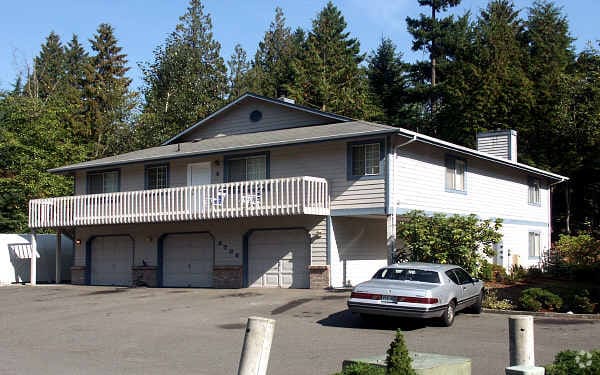
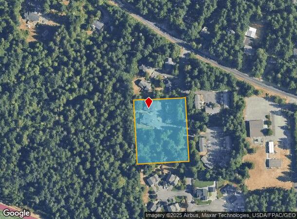
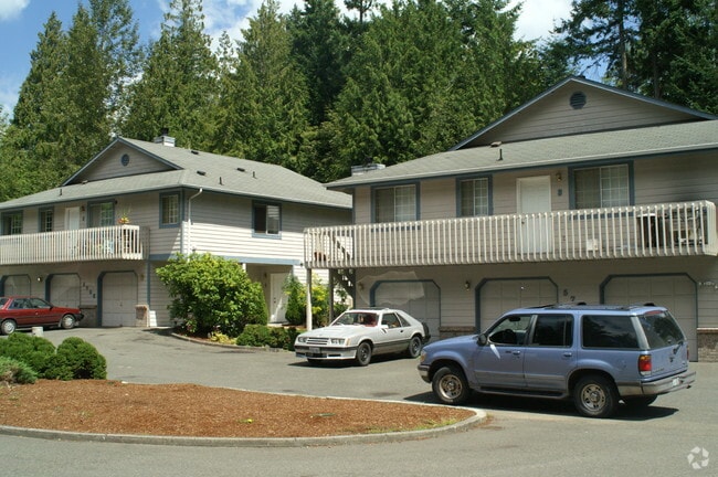
5710 183Rd Ave E
Seattle-Tacoma-Bellevue, WA
Pierce County Short Plat No 76 216
052021-7013
SECTION 21 TOWNSHIP 20 RANGE 05 QUARTER 32 : LOT 2 OF SH PLAT 76-216 OUT OF 3-007 SEG K-0166 OJ (DCWJES11-9-82)
Multifamilydwelling
Pierce
X
Washington
53053C0358E
2
2024
2.25 AC
2025
Outlying Puyallup
070313
Seattle/Puget Sound
13,968 SF
DEMOGRAPHICS near 5710 183Rd Ave E
1 Mile
3 Mile
5 Mile
2024 Total Population
4,609
44,326
114,556
2029 Population
4,743
45,683
117,714
Pop Growth 2024-2029
+ 2.91%
+ 3.06%
+ 2.76%
Average Age
40
39
39
2024 Total Households
1,669
15,947
41,109
HH Growth 2024-2029
+ 3.00%
+ 3.09%
+ 2.80%
Median Household Inc
$109,039
$104,714
$105,669
Avg Household Size
2.70
2.70
2.70
2024 Avg HH Vehicles
3.00
2.00
2.00
Median Home Value
$498,108
$546,473
$501,433
Median Year Built
1982
1991
1993
Nearby Places
Map Layers
Map Styles
 Street
 Aerial
- Restaurants
- Banks
- Shops
- Fitness
- Groceries
PUBLIC TRANSPORTATION
COMMUTER RAIL
Sumner Station (Sounder South Line - Central Puget Sound Regional Transit Authority Rail (Link Light Rail/Sounder))
DRIVE
WALK
Distance
Sumner Station (Sounder South Line - Central Puget Sound Regional Transit Authority Rail (Link Light Rail/Sounder))
12 min
6.1 mi
Auburn Station (Sounder South Line - Central Puget Sound Regional Transit Authority Rail (Link Light Rail/Sounder))
DRIVE
WALK
Distance
Auburn Station (Sounder South Line - Central Puget Sound Regional Transit Authority Rail (Link Light Rail/Sounder))
19 min
8.6 mi
AIRPORT
Seattle-Tacoma International
DRIVE
WALK
Distance
Seattle-Tacoma International
37 min
30.5 mi
Freight Ports
Port of Tacoma
DRIVE
WALK
Distance
Port of Tacoma
1 min
11.1 mi
SALE & LEASE HISTORY
LISTING DATE
SALE/LEASE

Apr 24, 2017
For Sale
Nearby Properties
Address
Land Use
TOTAL SIZE
Lot Size
Zoning
Address
Land Use
TOTAL SIZE
Lot Size
Zoning
833,773 SF
94.01 AC
M1
Address
Land Use
TOTAL SIZE
Lot Size
Zoning
648,679 SF
27.43 AC
M1
Address
Land Use
TOTAL SIZE
Lot Size
Zoning
521,674 SF
24.55 AC
M1
Address
Land Use
TOTAL SIZE
Lot Size
Zoning
251,498 SF
13.79 AC
LAKELAND H
Address
Land Use
TOTAL SIZE
Lot Size
Zoning
430,880 SF
23.46 AC
M1
Address
Land Use
TOTAL SIZE
Lot Size
Zoning
370,087 SF
15.61 AC
M1
Address
Land Use
TOTAL SIZE
Lot Size
Zoning
127,096 SF
12.48 AC
LAKELAND H
Address
Land Use
TOTAL SIZE
Lot Size
Zoning
182,022 SF
10.85 AC
Address
Land Use
TOTAL SIZE
Lot Size
Zoning
108,592 SF
10.77 AC
SUM
Address
Land Use
TOTAL SIZE
Lot Size
Zoning
266,708 SF
14.97 AC
Address
Land Use
TOTAL SIZE
Lot Size
Zoning
306,457 SF
10.34 AC
M1
Address
Land Use
TOTAL SIZE
Lot Size
Zoning
251,437 SF
13.28 AC
M1
Address
Land Use
TOTAL SIZE
Lot Size
Zoning
106,445 SF
21.27 AC
LDR-12
Address
Land Use
TOTAL SIZE
Lot Size
Zoning
227,964 SF
11.54 AC
M1
Address
Land Use
TOTAL SIZE
Lot Size
Zoning
234,750 SF
12.61 AC
M1
Address
Land Use
TOTAL SIZE
Lot Size
Zoning
267,706 SF
6.88 AC
M1
Address
Land Use
TOTAL SIZE
Lot Size
Zoning
223,905 SF
12.64 AC
M1
Address
Land Use
TOTAL SIZE
Lot Size
Zoning
171,124 SF
12.91 AC
GC
Address
Land Use
TOTAL SIZE
Lot Size
Zoning
224,000 SF
9.57 AC
M1
Address
Land Use
TOTAL SIZE
Lot Size
Zoning
108,411 SF
31.71 AC
PF
Address
Land Use
TOTAL SIZE
Lot Size
Zoning
190,966 SF
8.72 AC
M2
Address
Land Use
TOTAL SIZE
Lot Size
Zoning
34,240 SF
28.65 AC
M1
Address
Land Use
TOTAL SIZE
Lot Size
Zoning
214,284 SF
26.09 AC
MC
Address
Land Use
TOTAL SIZE
Lot Size
Zoning
206,463 SF
8.60 AC
SUM
Address
Land Use
TOTAL SIZE
Lot Size
Zoning
92,773 SF
3 AC
GC
Address
Land Use
TOTAL SIZE
Lot Size
Zoning
83,521 SF
7.09 AC
MC
Address
Land Use
TOTAL SIZE
Lot Size
Zoning
188,390 SF
9.30 AC
M1
Address
Land Use
TOTAL SIZE
Lot Size
Zoning
151,333 SF
13.70 AC
Address
Land Use
TOTAL SIZE
Lot Size
Zoning
184,215 SF
8.68 AC
M1
Address
Land Use
TOTAL SIZE
Lot Size
Zoning
185,700 SF
8.94 AC
M1
The World's #1 Commercial Real Estate Marketplace
Connect with us
© 2026 CoStar Group
The information above has been obtained from sources believed reliable. While we do not doubt its accuracy we have not verified it and make no guarantee, warranty or representation about it. It is your responsibility to independently confirm its accuracy and completeness. Any projections, opinions, assumptions, or estimates used are for example only and do not represent the current or future performance of the property. The value of this transaction to you depends on tax and other factors which should be evaluated by your tax, financial, and legal advisors. You and your advisors should conduct a careful, independent investigation of the property to determine to your satisfaction the suitability of the property for your needs.