Property Record
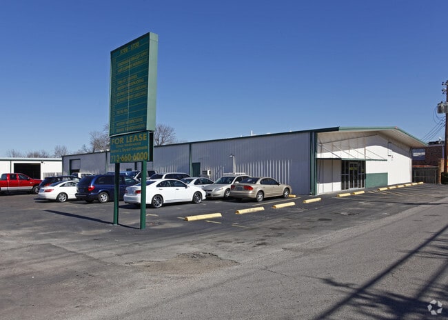
5708 Clarewood Dr, Houston, TX 77081


NEARBY LISTINGS FOR SALE OR LEASE
Property Detail
5708 Clarewood Dr
0370580230007
Westmoreland Farms
Warehouse
TRS 7 & 8 BLK 23 WESTMORELAND FARMS
X
Harris
48201C0855L
Texas
2024
4.45 AC
2025
Hwy 59/Hwy 90 (Alt)
421502
Houston
73,400 SF
Houston-Pasadena-The Woodlands, TX
DEMOGRAPHICS near 5708 Clarewood Dr
1 Mile
3 Mile
5 Mile
2024 Total Population
49,271
246,528
553,304
2029 Population
51,031
254,046
569,851
Pop Growth 2024-2029
+ 3.57%
+ 3.05%
+ 2.99%
Average Age
32
36
37
2024 Total Households
17,515
102,733
235,558
HH Growth 2024-2029
+ 3.55%
+ 3.11%
+ 3.05%
Median Household Inc
$34,265
$57,821
$58,863
Avg Household Size
2.70
2.30
2.30
2024 Avg HH Vehicles
1.00
1.00
1.00
Median Home Value
$578,604
$496,049
$452,556
Median Year Built
1977
1979
1981
Nearby Places
Map Layers
Map Styles
 Street
 Aerial
- Restaurants
- Banks
- Shops
- Fitness
- Groceries
PUBLIC TRANSPORTATION
COMMUTER RAIL
DRIVE
WALK
Distance
17 min
9.9 mi
AIRPORT
William P Hobby
DRIVE
WALK
Distance
William P Hobby
33 min
18.7 mi
George Bush Intcntl/Houston
DRIVE
WALK
Distance
George Bush Intcntl/Houston
39 min
28.3 mi
Freight Ports
Port of Houston
DRIVE
WALK
Distance
Port of Houston
30 min
18.5 mi
SALE & LEASE HISTORY
LISTING DATE
SALE/LEASE

Feb 05, 2018
For Lease
Dec 01, 2016
For Lease
Nearby Properties
Address
Land Use
TOTAL SIZE
Lot Size
Zoning
Address
Land Use
TOTAL SIZE
Lot Size
Zoning
576,253 SF
5.91 AC
Address
Land Use
TOTAL SIZE
Lot Size
Zoning
716,631 SF
7.04 AC
Address
Land Use
TOTAL SIZE
Lot Size
Zoning
2,626,393 SF
6.70 AC
Address
Land Use
TOTAL SIZE
Lot Size
Zoning
329,832 SF
1.75 AC
Address
Land Use
TOTAL SIZE
Lot Size
Zoning
1,062,592 SF
7.41 AC
Address
Land Use
TOTAL SIZE
Lot Size
Zoning
771,702 SF
2.51 AC
Address
Land Use
TOTAL SIZE
Lot Size
Zoning
576,200 SF
2.65 AC
Address
Land Use
TOTAL SIZE
Lot Size
Zoning
777,791 SF
47.90 AC
Address
Land Use
TOTAL SIZE
Lot Size
Zoning
612,663 SF
7 AC
Address
Land Use
TOTAL SIZE
Lot Size
Zoning
549,506 SF
2.05 AC
Address
Land Use
TOTAL SIZE
Lot Size
Zoning
392,218 SF
1.21 AC
Address
Land Use
TOTAL SIZE
Lot Size
Zoning
305,760 SF
2.22 AC
Address
Land Use
TOTAL SIZE
Lot Size
Zoning
1,819,963 SF
5.30 AC
Address
Land Use
TOTAL SIZE
Lot Size
Zoning
214,297 SF
15.23 AC
Address
Land Use
TOTAL SIZE
Lot Size
Zoning
1,202,191 SF
39.08 AC
Address
Land Use
TOTAL SIZE
Lot Size
Zoning
216,178 SF
1.28 AC
Address
Land Use
TOTAL SIZE
Lot Size
Zoning
128,404 SF
2.88 AC
Address
Land Use
TOTAL SIZE
Lot Size
Zoning
323,456 SF
3.91 AC
Address
Land Use
TOTAL SIZE
Lot Size
Zoning
760,932 SF
14.37 AC
Address
Land Use
TOTAL SIZE
Lot Size
Zoning
561,732 SF
6.10 AC
Address
Land Use
TOTAL SIZE
Lot Size
Zoning
281,973 SF
11.56 AC
Address
Land Use
TOTAL SIZE
Lot Size
Zoning
126,877 SF
34.71 AC
Address
Land Use
TOTAL SIZE
Lot Size
Zoning
521,287 SF
3.90 AC
Address
Land Use
TOTAL SIZE
Lot Size
Zoning
597,397 SF
2.93 AC
Address
Land Use
TOTAL SIZE
Lot Size
Zoning
1,011,299 SF
4 AC
Address
Land Use
TOTAL SIZE
Lot Size
Zoning
589,957 SF
5.30 AC
Address
Land Use
TOTAL SIZE
Lot Size
Zoning
541,054 SF
6.25 AC
Address
Land Use
TOTAL SIZE
Lot Size
Zoning
499,500 SF
1.72 AC
Address
Land Use
TOTAL SIZE
Lot Size
Zoning
1,083,841 SF
6.43 AC
Address
Land Use
TOTAL SIZE
Lot Size
Zoning
550,115 SF
6.38 AC
The World's #1 Commercial Real Estate Marketplace
Connect with us
© 2026 CoStar Group
The information above has been obtained from sources believed reliable. While we do not doubt its accuracy we have not verified it and make no guarantee, warranty or representation about it. It is your responsibility to independently confirm its accuracy and completeness. Any projections, opinions, assumptions, or estimates used are for example only and do not represent the current or future performance of the property. The value of this transaction to you depends on tax and other factors which should be evaluated by your tax, financial, and legal advisors. You and your advisors should conduct a careful, independent investigation of the property to determine to your satisfaction the suitability of the property for your needs.