Property Record
5717 Linglestown Rd, Harrisburg, PA 17112
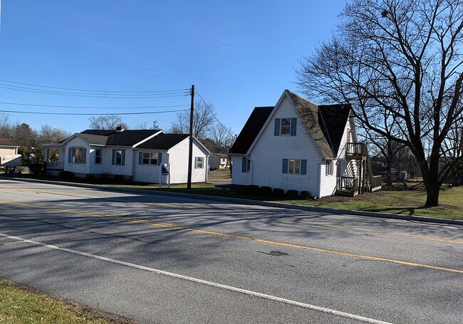
Property Detail
5717 Linglestown Rd
35-015-061
Dauphin
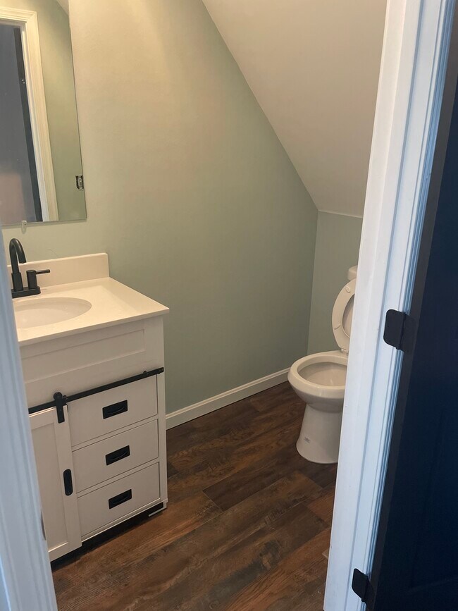
Officebuilding
Pennsylvania
B and X Area of moderate flood hazard, usually the area between the limits of the 100-year and 500-year floods.
0.60 AC
2026
Harrisburg Area East
2026
Philadelphia
022502
Harrisburg-Carlisle, PA
1,488 SF
NEARBY LISTINGS FOR SALE OR LEASE
DEMOGRAPHICS near 5717 Linglestown Rd
1 mile
3 mile
5 mile
2025 Total Population
5,153
35,792
94,168
2030 Population
5,197
36,547
95,993
Pop Growth 2025-2030
+ 0.85%
+ 2.11%
+ 1.94%
Average Age
43
42
42
2025 Total Households
1,991
14,539
38,729
HH Growth 2025-2030
+ 0.90%
+ 2.23%
+ 2.04%
Median Household Inc
$115,988
$100,323
$92,466
Avg Household Size
2.50
2.40
2.40
2025 Avg HH Vehicles
2.00
2.00
2.00
Median Home Value
$297,828
$292,242
$276,671
Median Year Built
1982
1984
1980
Nearby Places
Map Layers
Map Styles
 Street
 Aerial
Layers
 Traffic
 Biking
Places
Listings with unknown addresses are not visible on the map
- Restaurants
- Banks
- Shops
- Fitness
- Groceries
PUBLIC TRANSPORTATION
COMMUTER RAIL
Drive
Walk
Distance
18 min
8.6 mi
AIRPORT
Harrisburg International
Drive
Walk
Distance
Harrisburg International
24 min
15.6 mi
SALE & LEASE HISTORY
LISTING DATE
SALE/LEASE

Jul 10, 2022
For Lease
Feb 03, 2020
For Sale
Dec 04, 2018
For Sale
Nearby Properties
Address
Land Use
TOTAL SIZE
Lot Size
Zoning
Address
Land Use
TOTAL SIZE
Lot Size
Zoning
2,856 SF
103 AC
Address
Land Use
TOTAL SIZE
Lot Size
Zoning
130,542 SF
28.94 AC
Address
Land Use
TOTAL SIZE
Lot Size
Zoning
2,129 SF
19.90 AC
Address
Land Use
TOTAL SIZE
Lot Size
Zoning
2,823 SF
36.87 AC
Address
Land Use
TOTAL SIZE
Lot Size
Zoning
24.77 AC
Address
Land Use
TOTAL SIZE
Lot Size
Zoning
31,240 SF
20.25 AC
Address
Land Use
TOTAL SIZE
Lot Size
Zoning
82,881 SF
16.90 AC
Address
Land Use
TOTAL SIZE
Lot Size
Zoning
11,928 SF
8.40 AC
Address
Land Use
TOTAL SIZE
Lot Size
Zoning
9.88 AC
Address
Land Use
TOTAL SIZE
Lot Size
Zoning
199,920 SF
16.67 AC
Address
Land Use
TOTAL SIZE
Lot Size
Zoning
880 SF
18.68 AC
Address
Land Use
TOTAL SIZE
Lot Size
Zoning
1,920 SF
38.44 AC
Address
Land Use
TOTAL SIZE
Lot Size
Zoning
7,264 SF
13.84 AC
Address
Land Use
TOTAL SIZE
Lot Size
Zoning
64,329 SF
14.70 AC
Address
Land Use
TOTAL SIZE
Lot Size
Zoning
1,484 SF
13.93 AC
Address
Land Use
TOTAL SIZE
Lot Size
Zoning
78,519 SF
48.60 AC
Address
Land Use
TOTAL SIZE
Lot Size
Zoning
84,210 SF
14.90 AC
Address
Land Use
TOTAL SIZE
Lot Size
Zoning
371,502 SF
29.96 AC
Address
Land Use
TOTAL SIZE
Lot Size
Zoning
10,044 SF
12.94 AC
Address
Land Use
TOTAL SIZE
Lot Size
Zoning
8,230 SF
7.82 AC
Address
Land Use
TOTAL SIZE
Lot Size
Zoning
3.90 AC
Address
Land Use
TOTAL SIZE
Lot Size
Zoning
42,030 SF
10.29 AC
Address
Land Use
TOTAL SIZE
Lot Size
Zoning
54,630 SF
9.02 AC
Address
Land Use
TOTAL SIZE
Lot Size
Zoning
Address
Land Use
TOTAL SIZE
Lot Size
Zoning
72,474 SF
18 AC
Address
Land Use
TOTAL SIZE
Lot Size
Zoning
109,600 SF
11.13 AC
Address
Land Use
TOTAL SIZE
Lot Size
Zoning
16,872 SF
7.29 AC
Address
Land Use
TOTAL SIZE
Lot Size
Zoning
148,690 SF
16.03 AC
Address
Land Use
TOTAL SIZE
Lot Size
Zoning
89,040 SF
6.96 AC
Address
Land Use
TOTAL SIZE
Lot Size
Zoning
8,552 SF
14.04 AC
The World's #1 Commercial Real Estate Marketplace
Connect with us
© 2026 CoStar Group
The information above has been obtained from sources believed reliable. While we do not doubt its accuracy we have not verified it and make no guarantee, warranty or representation about it. It is your responsibility to independently confirm its accuracy and completeness. Any projections, opinions, assumptions, or estimates used are for example only and do not represent the current or future performance of the property. The value of this transaction to you depends on tax and other factors which should be evaluated by your tax, financial, and legal advisors. You and your advisors should conduct a careful, independent investigation of the property to determine to your satisfaction the suitability of the property for your needs.