Property Record
572 Central Dr, Virginia Beach, VA 23454


NEARBY LISTINGS FOR SALE OR LEASE
Property Detail
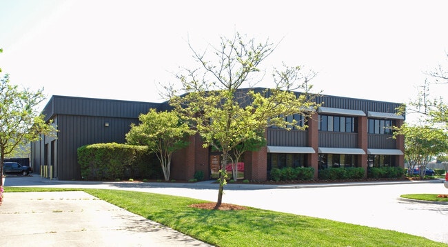
572 Central Dr
Virginia Beach-Norfolk-Newport News, VA-NC
London Bridge Industri Al Park Ii Phase
1496-77-2339
LONDON BRIDGE INDUSTRI AL PARK II PHASE 1 PAR 26C 1.298 ACS
Industrialgeneral
Virginia Beach
X
Virginia
5155310108G
02600
2024
1.30 AC
2025
Lynnhaven
045407
Hampton Roads
21,300 SF
DEMOGRAPHICS near 572 Central Dr
1 Mile
3 Mile
5 Mile
2024 Total Population
2,148
77,933
227,659
2029 Population
2,139
77,032
225,633
Pop Growth 2024-2029
(0.42%)
(1.16%)
(0.89%)
Average Age
38
38
39
2024 Total Households
833
29,656
88,754
HH Growth 2024-2029
(0.60%)
(1.28%)
(0.95%)
Median Household Inc
$77,500
$71,076
$81,069
Avg Household Size
2.50
2.50
2.50
2024 Avg HH Vehicles
2.00
2.00
2.00
Median Home Value
$285,975
$261,519
$316,669
Median Year Built
1978
1977
1982
Nearby Places
Map Layers
Map Styles
 Street
 Aerial
- Restaurants
- Banks
- Shops
- Fitness
- Groceries
PUBLIC TRANSPORTATION
AIRPORT
Norfolk International
DRIVE
WALK
Distance
Norfolk International
26 min
15.1 mi
Newport News/Williamsburg International
DRIVE
WALK
Distance
Newport News/Williamsburg International
61 min
40.6 mi
SALE & LEASE HISTORY
LISTING DATE
SALE/LEASE

Sep 25, 2016
For Lease
Nov 02, 2016
For Sale
May 05, 2025
For Sale
Jun 10, 2020
For Sale
Jul 18, 2025
For Lease
Nearby Properties
Address
Land Use
TOTAL SIZE
Lot Size
Zoning
Address
Land Use
TOTAL SIZE
Lot Size
Zoning
1,991 SF
201.95 AC
I2
Address
Land Use
TOTAL SIZE
Lot Size
Zoning
100 SF
13.35 AC
B2
Address
Land Use
TOTAL SIZE
Lot Size
Zoning
1 SF
44.31 AC
A18
Address
Land Use
TOTAL SIZE
Lot Size
Zoning
1 SF
25.89 AC
A18
Address
Land Use
TOTAL SIZE
Lot Size
Zoning
1 SF
30.13 AC
A18
Address
Land Use
TOTAL SIZE
Lot Size
Zoning
795,994 SF
52.17 AC
I1
Address
Land Use
TOTAL SIZE
Lot Size
Zoning
1 SF
18.64 AC
PDH1
Address
Land Use
TOTAL SIZE
Lot Size
Zoning
1 SF
0.02 AC
A18
Address
Land Use
TOTAL SIZE
Lot Size
Zoning
1 SF
0.01 AC
A18
Address
Land Use
TOTAL SIZE
Lot Size
Zoning
219,000 SF
75.18 AC
I1
Address
Land Use
TOTAL SIZE
Lot Size
Zoning
358,274 SF
30.64 AC
B2
Address
Land Use
TOTAL SIZE
Lot Size
Zoning
1 SF
0.01 AC
A18
Address
Land Use
TOTAL SIZE
Lot Size
Zoning
150,339 SF
0.01 AC
B2
Address
Land Use
TOTAL SIZE
Lot Size
Zoning
1 SF
0.01 AC
A18
Address
Land Use
TOTAL SIZE
Lot Size
Zoning
1 SF
9.68 AC
A18
Address
Land Use
TOTAL SIZE
Lot Size
Zoning
190,955 SF
17.69 AC
A12
Address
Land Use
TOTAL SIZE
Lot Size
Zoning
117,195 SF
21.99 AC
R10
Address
Land Use
TOTAL SIZE
Lot Size
Zoning
1 SF
15.50 AC
PDH1
Address
Land Use
TOTAL SIZE
Lot Size
Zoning
1 SF
12.75 AC
A12
Address
Land Use
TOTAL SIZE
Lot Size
Zoning
1 SF
9.98 AC
A18
Address
Land Use
TOTAL SIZE
Lot Size
Zoning
775,440 SF
45.57 AC
I2
Address
Land Use
TOTAL SIZE
Lot Size
Zoning
1 SF
0.01 AC
A18
Address
Land Use
TOTAL SIZE
Lot Size
Zoning
1 SF
14.77 AC
A12
Address
Land Use
TOTAL SIZE
Lot Size
Zoning
196,053 SF
12.75 AC
I1
Address
Land Use
TOTAL SIZE
Lot Size
Zoning
1 SF
8.61 AC
A24
Address
Land Use
TOTAL SIZE
Lot Size
Zoning
7,655 SF
10.15 AC
B2
Address
Land Use
TOTAL SIZE
Lot Size
Zoning
284,490 SF
19.52 AC
I2
Address
Land Use
TOTAL SIZE
Lot Size
Zoning
137,695 SF
12.41 AC
B2
Address
Land Use
TOTAL SIZE
Lot Size
Zoning
169,746 SF
0.01 AC
B2
Address
Land Use
TOTAL SIZE
Lot Size
Zoning
77,569 SF
123.73 AC
The World's #1 Commercial Real Estate Marketplace
Connect with us
© 2026 CoStar Group
The information above has been obtained from sources believed reliable. While we do not doubt its accuracy we have not verified it and make no guarantee, warranty or representation about it. It is your responsibility to independently confirm its accuracy and completeness. Any projections, opinions, assumptions, or estimates used are for example only and do not represent the current or future performance of the property. The value of this transaction to you depends on tax and other factors which should be evaluated by your tax, financial, and legal advisors. You and your advisors should conduct a careful, independent investigation of the property to determine to your satisfaction the suitability of the property for your needs.