Property Record
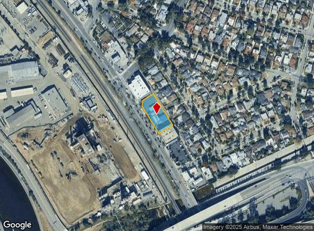
5720 San Fernando Rd, Glendale, CA 91202

This Property Is For Sale
NEARBY LISTINGS FOR SALE OR LEASE
Property Detail
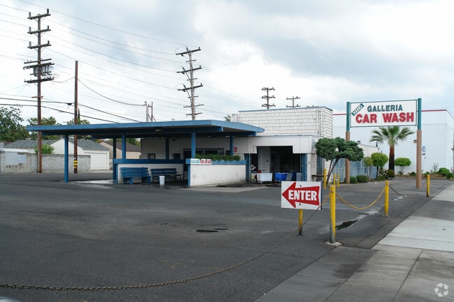
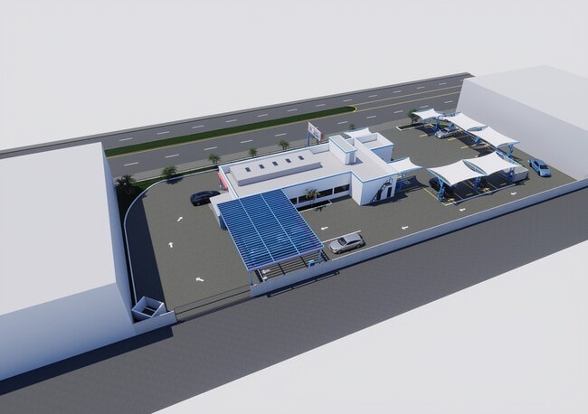
5720 San Fernando Rd
Los Angeles-Long Beach-Glendale, CA
9480
5635-017-021
TRACT NO 9480 LOT COM AT MOST E COR OF LOT 10 TH SW ON SE LINE OF SD LOT 103.04 FT TH NW ON NE LINE OF SAN FERNANDO RD 200 FT TH N 3 0610 E 39.36 FT TH N 56 4230 E TO SW LINE OF ALLEY TH SE 6 AND ALL OF LOTS 7, 8, 9 AND LOT 10
Carwash
Los Angeles
X
California
06037C1345F
10
2024
0.54 AC
2025
Glendale
301701
Los Angeles
2,700 SF
DEMOGRAPHICS near 5720 San Fernando Rd
1 Mile
3 Mile
5 Mile
2024 Total Population
24,679
198,233
522,728
2029 Population
23,756
191,305
506,880
Pop Growth 2024-2029
(3.74%)
(3.49%)
(3.03%)
Average Age
43
43
42
2024 Total Households
9,720
79,999
218,011
HH Growth 2024-2029
(3.98%)
(3.73%)
(3.19%)
Median Household Inc
$69,346
$71,391
$78,532
Avg Household Size
2.50
2.40
2.30
2024 Avg HH Vehicles
2.00
2.00
2.00
Median Home Value
$788,224
$908,519
$978,371
Median Year Built
1965
1964
1960
Nearby Places
- Restaurants
- Banks
- Shops
- Fitness
- Groceries
PUBLIC TRANSPORTATION
COMMUTER RAIL
Glendale (Antelope Valley Line - Southern California Regional Rail Authority (Metrolink), Ventura County Line - Southern California Regional Rail Authority (Metrolink))
DRIVE
WALK
Distance
Glendale (Antelope Valley Line - Southern California Regional Rail Authority (Metrolink), Ventura County Line - Southern California Regional Rail Authority (Metrolink))
5 min
2.7 mi
Downtown Burbank (Antelope Valley Line - Southern California Regional Rail Authority (Metrolink), Ventura County Line - Southern California Regional Rail Authority (Metrolink))
DRIVE
WALK
Distance
Downtown Burbank (Antelope Valley Line - Southern California Regional Rail Authority (Metrolink), Ventura County Line - Southern California Regional Rail Authority (Metrolink))
8 min
3.5 mi
AIRPORT
Bob Hope
DRIVE
WALK
Distance
Bob Hope
15 min
8.9 mi
Los Angeles International
DRIVE
WALK
Distance
Los Angeles International
38 min
27.3 mi
Long Beach (Daugherty Field)
DRIVE
WALK
Distance
Long Beach (Daugherty Field)
42 min
30.9 mi
Freight Ports
Port of Long Beach
DRIVE
WALK
Distance
Port of Long Beach
45 min
32.8 mi
Nearby Properties
Address
Land Use
TOTAL SIZE
Lot Size
Zoning
Address
Land Use
TOTAL SIZE
Lot Size
Zoning
207,766 SF
42.81 AC
BUM1*
Address
Land Use
TOTAL SIZE
Lot Size
Zoning
272,288 SF
24.26 AC
GLC3-C2-R4
Address
Land Use
TOTAL SIZE
Lot Size
Zoning
590,292 SF
8.21 AC
GLC3*
Address
Land Use
TOTAL SIZE
Lot Size
Zoning
616,662 SF
19.66 AC
BUM1*
Address
Land Use
TOTAL SIZE
Lot Size
Zoning
359,197 SF
13.49 AC
GLENDALE M
Address
Land Use
TOTAL SIZE
Lot Size
Zoning
477,885 SF
2.52 AC
GLC3*
Address
Land Use
TOTAL SIZE
Lot Size
Zoning
979,623 SF
13.36 AC
GLM2
Address
Land Use
TOTAL SIZE
Lot Size
Zoning
920,082 SF
2.51 AC
GLC2-R4*
Address
Land Use
TOTAL SIZE
Lot Size
Zoning
452,048 SF
21.58 AC
BCCM
Address
Land Use
TOTAL SIZE
Lot Size
Zoning
309,008 SF
11.91 AC
LAM3
Address
Land Use
TOTAL SIZE
Lot Size
Zoning
985,517 SF
4.08 AC
GLC3
Address
Land Use
TOTAL SIZE
Lot Size
Zoning
2.77 AC
GLC3
Address
Land Use
TOTAL SIZE
Lot Size
Zoning
349,519 SF
2.16 AC
GLM1*
Address
Land Use
TOTAL SIZE
Lot Size
Zoning
317,292 SF
36.67 AC
LAM3
Address
Land Use
TOTAL SIZE
Lot Size
Zoning
245,031 SF
2.21 AC
GLM2
Address
Land Use
TOTAL SIZE
Lot Size
Zoning
338,886 SF
3.37 AC
GLC2
Address
Land Use
TOTAL SIZE
Lot Size
Zoning
235,936 SF
1.58 AC
GLC2*
Address
Land Use
TOTAL SIZE
Lot Size
Zoning
457,694 SF
1.42 AC
GLC3*
Address
Land Use
TOTAL SIZE
Lot Size
Zoning
265,301 SF
0.17 AC
GLC3*
Address
Land Use
TOTAL SIZE
Lot Size
Zoning
122,988 SF
3.32 AC
GLC3*
Address
Land Use
TOTAL SIZE
Lot Size
Zoning
766,497 SF
2.10 AC
GLC2*
Address
Land Use
TOTAL SIZE
Lot Size
Zoning
220,624 SF
1.50 AC
GLC3-C2*
Address
Land Use
TOTAL SIZE
Lot Size
Zoning
638,414 SF
2.53 AC
GLC3-C2*
Address
Land Use
TOTAL SIZE
Lot Size
Zoning
558,532 SF
5.20 AC
BUC4*
Address
Land Use
TOTAL SIZE
Lot Size
Zoning
214,087 SF
1.65 AC
GLC3*
Address
Land Use
TOTAL SIZE
Lot Size
Zoning
660,463 SF
6.88 AC
BUR4*
Address
Land Use
TOTAL SIZE
Lot Size
Zoning
223,599 SF
1.43 AC
GLC3*
Address
Land Use
TOTAL SIZE
Lot Size
Zoning
189,663 SF
1.36 AC
GLC2*
Address
Land Use
TOTAL SIZE
Lot Size
Zoning
612,976 SF
3.53 AC
BUC2*
Address
Land Use
TOTAL SIZE
Lot Size
Zoning
779,800 SF
5.39 AC
GLC2-C3*
The World's #1 Commercial Real Estate Marketplace
Connect with us
© 2025 CoStar Group
The information above has been obtained from sources believed reliable. While we do not doubt its accuracy we have not verified it and make no guarantee, warranty or representation about it. It is your responsibility to independently confirm its accuracy and completeness. Any projections, opinions, assumptions, or estimates used are for example only and do not represent the current or future performance of the property. The value of this transaction to you depends on tax and other factors which should be evaluated by your tax, financial, and legal advisors. You and your advisors should conduct a careful, independent investigation of the property to determine to your satisfaction the suitability of the property for your needs.