Property Record
573 10Th St E, Palmetto, FL 34221


Property Detail
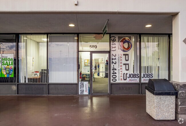
573 10Th St E
26014-1010-9
COM AT NW COR OF NE1/4 OF SW1/4 SEC 13; TH S 00 DEG 00 MIN 39 SEC W 31.48 FT; TH S 89 DEG 50 MIN 21 SEC E ALG S LN OF U S 301 A DIST OF 155 FT TO POB;
Regionalshoppingcenterormallwithanchorstore
MANATEE
PL_CG
Florida
AE The base floodplain where base flood elevations are provided. AE Zones are now used on new format FIRMs instead of A1-A30 Zones.
6.56 AC
2024
Manatee
2025
Tampa/St Petersburg
001502
North Port-Bradenton-Sarasota, FL
63,362 SF
NEARBY LISTINGS FOR SALE OR LEASE
DEMOGRAPHICS near 573 10Th St E
1 mile
3 mile
5 mile
2025 Total Population
11,332
64,526
175,665
2030 Population
12,945
72,423
196,618
Pop Growth 2025-2030
+ 14.23%
+ 12.24%
+ 11.93%
Average Age
42
42
45
2025 Total Households
4,278
25,475
73,074
HH Growth 2025-2030
+ 14.73%
+ 12.65%
+ 12.29%
Median Household Inc
$58,505
$58,921
$61,720
Avg Household Size
2.50
2.40
2.30
2025 Avg HH Vehicles
2.00
2.00
2.00
Median Home Value
$281,276
$315,600
$299,054
Median Year Built
1991
1982
1983
Nearby Places
Map Layers
Map Styles
 Street
 Aerial
Transit
 Traffic
 Biking
Places
Listings with unknown addresses are not visible on the map
- Restaurants
- Banks
- Shops
- Fitness
- Groceries
PUBLIC TRANSPORTATION
AIRPORT
Sarasota/Bradenton International
Drive
Walk
Distance
Sarasota/Bradenton International
20 min
10.3 mi
St Pete-Clearwater International
Drive
Walk
Distance
St Pete-Clearwater International
49 min
34.0 mi
Freight Ports
Port Manatee
Drive
Walk
Distance
Port Manatee
17 min
9.6 mi
SALE & LEASE HISTORY
LISTING DATE
SALE/LEASE

Sep 25, 2016
For Lease
Jun 29, 2018
For Lease
Nearby Properties
Address
Land Use
TOTAL SIZE
Lot Size
Zoning
Address
Land Use
TOTAL SIZE
Lot Size
Zoning
881,490 SF
83.09 AC
BR_R-3
Address
Land Use
TOTAL SIZE
Lot Size
Zoning
595,475 SF
16.90 AC
BR_T5
Address
Land Use
TOTAL SIZE
Lot Size
Zoning
349,711 SF
49.51 AC
BR_SD1
Address
Land Use
TOTAL SIZE
Lot Size
Zoning
405,843 SF
9.09 AC
BR_T5
Address
Land Use
TOTAL SIZE
Lot Size
Zoning
277,678 SF
7.80 AC
BR_T4-O, B
Address
Land Use
TOTAL SIZE
Lot Size
Zoning
427,250 SF
38.18 AC
A-1 SUBURB
Address
Land Use
TOTAL SIZE
Lot Size
Zoning
98,722 SF
10.24 AC
PL_P
Address
Land Use
TOTAL SIZE
Lot Size
Zoning
432,078 SF
1.64 AC
BR_T6
Address
Land Use
TOTAL SIZE
Lot Size
Zoning
169,485 SF
7.87 AC
PD-MU
Address
Land Use
TOTAL SIZE
Lot Size
Zoning
318,507 SF
10.47 AC
BR_T4R,BR_
Address
Land Use
TOTAL SIZE
Lot Size
Zoning
2,401,721 SF
142.14 AC
PD-UI
Address
Land Use
TOTAL SIZE
Lot Size
Zoning
257,072 SF
10.07 AC
BR_T5
Address
Land Use
TOTAL SIZE
Lot Size
Zoning
541,781 SF
3.48 AC
BR_T5
Address
Land Use
TOTAL SIZE
Lot Size
Zoning
885,776 SF
46.22 AC
LM LIGHT M
Address
Land Use
TOTAL SIZE
Lot Size
Zoning
318,680 SF
1.31 AC
BR_FBC,BR_
Address
Land Use
TOTAL SIZE
Lot Size
Zoning
499,823 SF
39.50 AC
PL_P
Address
Land Use
TOTAL SIZE
Lot Size
Zoning
270,900 SF
44.35 AC
PD-MU
Address
Land Use
TOTAL SIZE
Lot Size
Zoning
185,617 SF
13.68 AC
BR_R-2
Address
Land Use
TOTAL SIZE
Lot Size
Zoning
166,810 SF
3.16 AC
BR_T4-O
Address
Land Use
TOTAL SIZE
Lot Size
Zoning
276,469 SF
10.90 AC
PD-MU
Address
Land Use
TOTAL SIZE
Lot Size
Zoning
163,582 SF
8.61 AC
PL_P
Address
Land Use
TOTAL SIZE
Lot Size
Zoning
196,346 SF
33.03 AC
BR_R-1
Address
Land Use
TOTAL SIZE
Lot Size
Zoning
360,846 SF
1.13 AC
BR_T5
Address
Land Use
TOTAL SIZE
Lot Size
Zoning
285,307 SF
5.17 AC
BR_T4-O
Address
Land Use
TOTAL SIZE
Lot Size
Zoning
229,863 SF
31.01 AC
PL_CG,PL_C
Address
Land Use
TOTAL SIZE
Lot Size
Zoning
86,462 SF
0.85 AC
BR_T6
Address
Land Use
TOTAL SIZE
Lot Size
Zoning
97,813 SF
2.51 AC
BR_T6
Address
Land Use
TOTAL SIZE
Lot Size
Zoning
257,697 SF
5.32 AC
PL_PD-H
Address
Land Use
TOTAL SIZE
Lot Size
Zoning
96,342 SF
0.58 AC
BR_T5
Address
Land Use
TOTAL SIZE
Lot Size
Zoning
228,067 SF
4.39 AC
BR_T4-O
The World's #1 Commercial Real Estate Marketplace
Connect with us
© 2026 CoStar Group
The information above has been obtained from sources believed reliable. While we do not doubt its accuracy we have not verified it and make no guarantee, warranty or representation about it. It is your responsibility to independently confirm its accuracy and completeness. Any projections, opinions, assumptions, or estimates used are for example only and do not represent the current or future performance of the property. The value of this transaction to you depends on tax and other factors which should be evaluated by your tax, financial, and legal advisors. You and your advisors should conduct a careful, independent investigation of the property to determine to your satisfaction the suitability of the property for your needs.