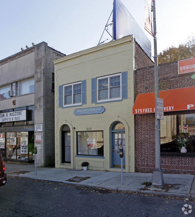
Property Record
573 Bloomfield Ave, Verona, NJ 07044
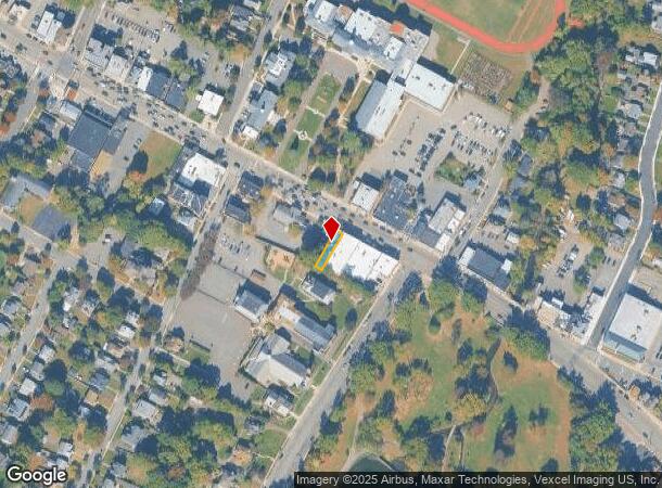
NEARBY LISTINGS FOR SALE OR LEASE
Property Detail
573 Bloomfield Ave
20-01806-0000-00017
19X114
Commercialnec
Essex
X
New Jersey
34013C0103F
17
2023
0.05 AC
2025
Suburban Essex/Rt 280
021200
Northern New Jersey
2,500 SF
Newark, NJ-PA
DEMOGRAPHICS near 573 Bloomfield Ave
1 Mile
3 Mile
5 Mile
2024 Total Population
16,200
124,289
391,327
2029 Population
16,078
123,012
386,490
Pop Growth 2024-2029
(0.75%)
(1.03%)
(1.24%)
Average Age
42
42
41
2024 Total Households
6,264
46,371
147,802
HH Growth 2024-2029
(1.02%)
(1.20%)
(1.40%)
Median Household Inc
$139,236
$136,921
$97,612
Avg Household Size
2.50
2.60
2.50
2024 Avg HH Vehicles
2.00
2.00
2.00
Median Home Value
$601,091
$619,055
$486,338
Median Year Built
1954
1954
1956
Nearby Places
Map Layers
Map Styles
 Street
 Aerial
- Restaurants
- Banks
- Shops
- Fitness
- Groceries
PUBLIC TRANSPORTATION
COMMUTER RAIL
Walnut Street (Montclair-Boonton Line - NJ Transit Commuter Rail (NJ Transit))
DRIVE
WALK
Distance
Walnut Street (Montclair-Boonton Line - NJ Transit Commuter Rail (NJ Transit))
10 min
2.6 mi
Watchung Avenue (Montclair-Boonton Line - NJ Transit Commuter Rail (NJ Transit))
DRIVE
WALK
Distance
Watchung Avenue (Montclair-Boonton Line - NJ Transit Commuter Rail (NJ Transit))
9 min
3.0 mi
AIRPORT
Newark Liberty International
DRIVE
WALK
Distance
Newark Liberty International
25 min
17.8 mi
LaGuardia
DRIVE
WALK
Distance
LaGuardia
49 min
33.2 mi
John F Kennedy International
DRIVE
WALK
Distance
John F Kennedy International
61 min
38.8 mi
SALE & LEASE HISTORY
LISTING DATE
SALE/LEASE

Oct 28, 2019
For Lease
Nearby Properties
Address
Land Use
TOTAL SIZE
Lot Size
Zoning
Address
Land Use
TOTAL SIZE
Lot Size
Zoning
33.60 AC
P-C
Address
Land Use
TOTAL SIZE
Lot Size
Zoning
5 AC
H
Address
Land Use
TOTAL SIZE
Lot Size
Zoning
1,589 SF
R4
Address
Land Use
TOTAL SIZE
Lot Size
Zoning
Address
Land Use
TOTAL SIZE
Lot Size
Zoning
31.36 AC
P-6
Address
Land Use
TOTAL SIZE
Lot Size
Zoning
32.34 AC
RA
Address
Land Use
TOTAL SIZE
Lot Size
Zoning
55.77 AC
OB-1
Address
Land Use
TOTAL SIZE
Lot Size
Zoning
1.50 AC
RA
Address
Land Use
TOTAL SIZE
Lot Size
Zoning
1.95 AC
RA
Address
Land Use
TOTAL SIZE
Lot Size
Zoning
3.64 AC
R-M
Address
Land Use
TOTAL SIZE
Lot Size
Zoning
364.34 AC
R-1
Address
Land Use
TOTAL SIZE
Lot Size
Zoning
25.88 AC
Address
Land Use
TOTAL SIZE
Lot Size
Zoning
41.84 AC
OB-1
Address
Land Use
TOTAL SIZE
Lot Size
Zoning
61.69 AC
Address
Land Use
TOTAL SIZE
Lot Size
Zoning
1,760 SF
189.03 AC
R-2
Address
Land Use
TOTAL SIZE
Lot Size
Zoning
9.38 AC
R-G
Address
Land Use
TOTAL SIZE
Lot Size
Zoning
5.74 AC
B-2
Address
Land Use
TOTAL SIZE
Lot Size
Zoning
79,668 SF
3.42 AC
0-R
Address
Land Use
TOTAL SIZE
Lot Size
Zoning
31.56 AC
R-3
Address
Land Use
TOTAL SIZE
Lot Size
Zoning
38.40 AC
Address
Land Use
TOTAL SIZE
Lot Size
Zoning
1,832 SF
2.18 AC
R3
Address
Land Use
TOTAL SIZE
Lot Size
Zoning
4.08 AC
Address
Land Use
TOTAL SIZE
Lot Size
Zoning
16.44 AC
OB-1
Address
Land Use
TOTAL SIZE
Lot Size
Zoning
17.48 AC
M-2
Address
Land Use
TOTAL SIZE
Lot Size
Zoning
32.99 AC
R-4
Address
Land Use
TOTAL SIZE
Lot Size
Zoning
3.69 AC
P-C
Address
Land Use
TOTAL SIZE
Lot Size
Zoning
1,063 SF
14.08 AC
C-1
Address
Land Use
TOTAL SIZE
Lot Size
Zoning
10.72 AC
Address
Land Use
TOTAL SIZE
Lot Size
Zoning
5.06 AC
Address
Land Use
TOTAL SIZE
Lot Size
Zoning
92,287 SF
7.80 AC
B-3
The World's #1 Commercial Real Estate Marketplace
Connect with us
© 2025 CoStar Group
The information above has been obtained from sources believed reliable. While we do not doubt its accuracy we have not verified it and make no guarantee, warranty or representation about it. It is your responsibility to independently confirm its accuracy and completeness. Any projections, opinions, assumptions, or estimates used are for example only and do not represent the current or future performance of the property. The value of this transaction to you depends on tax and other factors which should be evaluated by your tax, financial, and legal advisors. You and your advisors should conduct a careful, independent investigation of the property to determine to your satisfaction the suitability of the property for your needs.