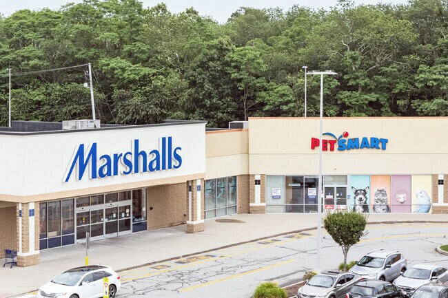
Property Record
573 Gar Hwy, Swansea, MA 02777


NEARBY LISTINGS FOR SALE OR LEASE
Property Detail
573 Gar Hwy
SWAN-000740-000013-000020
Bristol
Departmentstore
Massachusetts
X
20
25005C0327G
4.30 AC
2025
Attleboro/New Bedford
2025
Boston
645103
Providence-Warwick, RI-MA
54,751 SF
DEMOGRAPHICS near 573 Gar Hwy
1 Mile
3 Mile
5 Mile
2024 Total Population
1,419
26,348
125,802
2029 Population
1,397
26,221
125,260
Pop Growth 2024-2029
(1.55%)
(0.48%)
(0.43%)
Average Age
46
44
42
2024 Total Households
608
10,370
53,046
HH Growth 2024-2029
(1.64%)
(0.54%)
(0.46%)
Median Household Inc
$112,121
$100,890
$68,149
Avg Household Size
2.30
2.50
2.30
2024 Avg HH Vehicles
2.00
2.00
2.00
Median Home Value
$395,269
$385,524
$378,242
Median Year Built
1964
1965
1955
Nearby Places
Map Layers
Map Styles
 Street
 Aerial
- Restaurants
- Banks
- Shops
- Fitness
- Groceries
PUBLIC TRANSPORTATION
AIRPORT
Rhode Island Tf Green International
DRIVE
WALK
Distance
Rhode Island Tf Green International
31 min
19.6 mi
Freight Ports
Port of Davisville, RI
DRIVE
WALK
Distance
Port of Davisville, RI
47 min
32.0 mi
SALE & LEASE HISTORY
LISTING DATE
SALE/LEASE

Sep 25, 2016
For Lease
Apr 19, 2018
For Lease
Nearby Properties
Address
Land Use
TOTAL SIZE
Lot Size
Zoning
Address
Land Use
TOTAL SIZE
Lot Size
Zoning
226,473 SF
29.10 AC
R1
Address
Land Use
TOTAL SIZE
Lot Size
Zoning
105,949 SF
25.21 AC
R1
Address
Land Use
TOTAL SIZE
Lot Size
Zoning
255,600 SF
12.46 AC
R4
Address
Land Use
TOTAL SIZE
Lot Size
Zoning
155,364 SF
15.27 AC
C
Address
Land Use
TOTAL SIZE
Lot Size
Zoning
143,084 SF
12.60 AC
R1
Address
Land Use
TOTAL SIZE
Lot Size
Zoning
152,620 SF
20.73 AC
C
Address
Land Use
TOTAL SIZE
Lot Size
Zoning
137,976 SF
10.59 AC
C
Address
Land Use
TOTAL SIZE
Lot Size
Zoning
114,424 SF
12.94 AC
C
Address
Land Use
TOTAL SIZE
Lot Size
Zoning
70,741 SF
16.24 AC
Address
Land Use
TOTAL SIZE
Lot Size
Zoning
24,480 SF
4.69 AC
C
Address
Land Use
TOTAL SIZE
Lot Size
Zoning
223,380 SF
19.03 AC
C
Address
Land Use
TOTAL SIZE
Lot Size
Zoning
51,308 SF
10.34 AC
C
Address
Land Use
TOTAL SIZE
Lot Size
Zoning
68,859 SF
7.07 AC
C
Address
Land Use
TOTAL SIZE
Lot Size
Zoning
177,003 SF
26.96 AC
C
Address
Land Use
TOTAL SIZE
Lot Size
Zoning
58,028 SF
6.61 AC
C
Address
Land Use
TOTAL SIZE
Lot Size
Zoning
91,510 SF
Address
Land Use
TOTAL SIZE
Lot Size
Zoning
20,187 SF
7.02 AC
C
Address
Land Use
TOTAL SIZE
Lot Size
Zoning
55,600 SF
4.08 AC
C
Address
Land Use
TOTAL SIZE
Lot Size
Zoning
1,800 SF
3.39 AC
R1
Address
Land Use
TOTAL SIZE
Lot Size
Zoning
11,936 SF
14.15 AC
C
Address
Land Use
TOTAL SIZE
Lot Size
Zoning
22,545 SF
7 AC
R1
Address
Land Use
TOTAL SIZE
Lot Size
Zoning
36,188 SF
65 AC
R1
Address
Land Use
TOTAL SIZE
Lot Size
Zoning
91,235 SF
Address
Land Use
TOTAL SIZE
Lot Size
Zoning
27,306 SF
15.61 AC
C
Address
Land Use
TOTAL SIZE
Lot Size
Zoning
112,123 SF
Address
Land Use
TOTAL SIZE
Lot Size
Zoning
23,758 SF
6 AC
C
Address
Land Use
TOTAL SIZE
Lot Size
Zoning
2,878 SF
29.25 AC
R1
Address
Land Use
TOTAL SIZE
Lot Size
Zoning
36,316 SF
8.38 AC
C
Address
Land Use
TOTAL SIZE
Lot Size
Zoning
6,540 SF
27.30 AC
The World's #1 Commercial Real Estate Marketplace
Connect with us
© 2026 CoStar Group
The information above has been obtained from sources believed reliable. While we do not doubt its accuracy we have not verified it and make no guarantee, warranty or representation about it. It is your responsibility to independently confirm its accuracy and completeness. Any projections, opinions, assumptions, or estimates used are for example only and do not represent the current or future performance of the property. The value of this transaction to you depends on tax and other factors which should be evaluated by your tax, financial, and legal advisors. You and your advisors should conduct a careful, independent investigation of the property to determine to your satisfaction the suitability of the property for your needs.