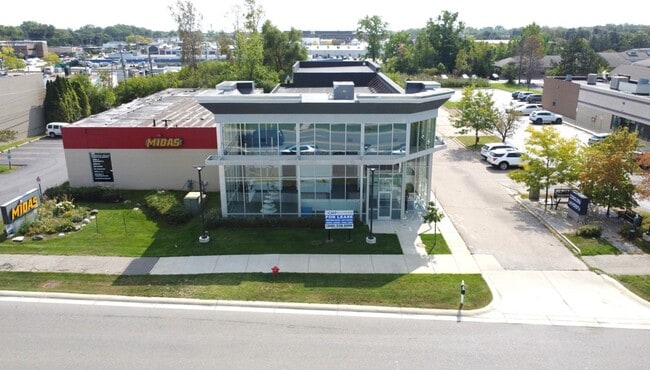
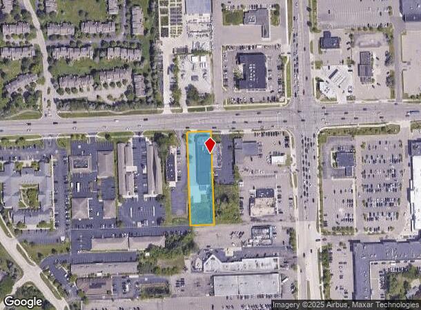
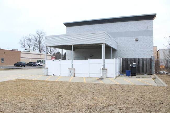
Property Record
5731 W Maple Rd, West Bloomfield, MI 48322
NEARBY LISTINGS FOR SALE OR LEASE
Property Detail
5731 W Maple Rd
18-34-200-009
T2N, R9E, SEC 34 W 100 FT OF E 492.7 FT OF N 435 FT OF E 60 ACRES OF NE 1/4 EXC N 43 FT THEREOF TAKEN FOR MAPLE RD 0.90 A
Laundromat
Oakland
X
Michigan
26125C0511F
0.90 AC
2024
Bloomfield West
2024
Detroit
157800
Detroit-Warren-Dearborn, MI
9,413 SF
DEMOGRAPHICS near 5731 W Maple Rd
1 Mile
3 Mile
5 Mile
2024 Total Population
9,529
60,682
147,329
2029 Population
9,489
60,012
145,949
Pop Growth 2024-2029
(0.42%)
(1.10%)
(0.94%)
Average Age
45
45
45
2024 Total Households
3,896
23,488
58,590
HH Growth 2024-2029
(0.08%)
(0.99%)
(0.84%)
Median Household Inc
$125,984
$117,718
$111,143
Avg Household Size
2.40
2.50
2.40
2024 Avg HH Vehicles
2.00
2.00
2.00
Median Home Value
$346,140
$369,199
$380,274
Median Year Built
1977
1976
1977
Nearby Places
Map Layers
Map Styles
 Street
 Aerial
- Restaurants
- Banks
- Shops
- Fitness
- Groceries
PUBLIC TRANSPORTATION
COMMUTER RAIL
Pontiac Amtrak Station (Wolverine - Amtrak)
DRIVE
WALK
Distance
Pontiac Amtrak Station (Wolverine - Amtrak)
17 min
8.6 mi
Troy Amtrak Station (Wolverine - Amtrak)
DRIVE
WALK
Distance
Troy Amtrak Station (Wolverine - Amtrak)
19 min
9.1 mi
AIRPORT
Detroit Metro Wayne County
DRIVE
WALK
Distance
Detroit Metro Wayne County
41 min
32.2 mi
Windsor International
DRIVE
WALK
Distance
Windsor International
55 min
33.0 mi
Freight Ports
Port of Toledo
DRIVE
WALK
Distance
Port of Toledo
91 min
73.8 mi
SALE & LEASE HISTORY
LISTING DATE
SALE/LEASE

Jan 07, 2025
For Sale
Apr 28, 2021
For Lease
Nearby Properties
Address
Land Use
TOTAL SIZE
Lot Size
Zoning
Address
Land Use
TOTAL SIZE
Lot Size
Zoning
308,794 SF
76.30 AC
RI
Address
Land Use
TOTAL SIZE
Lot Size
Zoning
315,206 SF
3.85 AC
AI
Address
Land Use
TOTAL SIZE
Lot Size
Zoning
121,382 SF
10.84 AC
BI
Address
Land Use
TOTAL SIZE
Lot Size
Zoning
427,062 SF
31.20 AC
AI
Address
Land Use
TOTAL SIZE
Lot Size
Zoning
411,118 SF
43.95 AC
AI
Address
Land Use
TOTAL SIZE
Lot Size
Zoning
204,652 SF
9.62 AC
BI
Address
Land Use
TOTAL SIZE
Lot Size
Zoning
271,650 SF
12.88 AC
BI
Address
Land Use
TOTAL SIZE
Lot Size
Zoning
352,098 SF
28.94 AC
BI
Address
Land Use
TOTAL SIZE
Lot Size
Zoning
Address
Land Use
TOTAL SIZE
Lot Size
Zoning
246,695 SF
18.46 AC
BI
Address
Land Use
TOTAL SIZE
Lot Size
Zoning
260,330 SF
21.04 AC
AI
Address
Land Use
TOTAL SIZE
Lot Size
Zoning
276,825 SF
19.05 AC
AI
Address
Land Use
TOTAL SIZE
Lot Size
Zoning
142,043 SF
17.87 AC
AI
Address
Land Use
TOTAL SIZE
Lot Size
Zoning
244,500 SF
7.80 AC
AI
Address
Land Use
TOTAL SIZE
Lot Size
Zoning
158,279 SF
3.63 AC
BI
Address
Land Use
TOTAL SIZE
Lot Size
Zoning
274,691 SF
19.57 AC
AI
Address
Land Use
TOTAL SIZE
Lot Size
Zoning
167,790 SF
13.33 AC
BI
Address
Land Use
TOTAL SIZE
Lot Size
Zoning
89,878 SF
11.31 AC
BI
Address
Land Use
TOTAL SIZE
Lot Size
Zoning
243,820 SF
19.71 AC
AI
Address
Land Use
TOTAL SIZE
Lot Size
Zoning
45,893 SF
5.62 AC
AI
Address
Land Use
TOTAL SIZE
Lot Size
Zoning
253,037 SF
16.97 AC
AI
Address
Land Use
TOTAL SIZE
Lot Size
Zoning
139,227 SF
13.13 AC
BI
Address
Land Use
TOTAL SIZE
Lot Size
Zoning
102,093 SF
4.44 AC
BI
Address
Land Use
TOTAL SIZE
Lot Size
Zoning
198,917 SF
13.17 AC
AI
Address
Land Use
TOTAL SIZE
Lot Size
Zoning
97,626 SF
9.42 AC
BI
Address
Land Use
TOTAL SIZE
Lot Size
Zoning
0.96 AC
AI
Address
Land Use
TOTAL SIZE
Lot Size
Zoning
45,271 SF
8.33 AC
BI
Address
Land Use
TOTAL SIZE
Lot Size
Zoning
87,292 SF
2 AC
BI
Address
Land Use
TOTAL SIZE
Lot Size
Zoning
66,230 SF
6 AC
BI
Address
Land Use
TOTAL SIZE
Lot Size
Zoning
The World's #1 Commercial Real Estate Marketplace
Connect with us
© 2025 CoStar Group
The information above has been obtained from sources believed reliable. While we do not doubt its accuracy we have not verified it and make no guarantee, warranty or representation about it. It is your responsibility to independently confirm its accuracy and completeness. Any projections, opinions, assumptions, or estimates used are for example only and do not represent the current or future performance of the property. The value of this transaction to you depends on tax and other factors which should be evaluated by your tax, financial, and legal advisors. You and your advisors should conduct a careful, independent investigation of the property to determine to your satisfaction the suitability of the property for your needs.