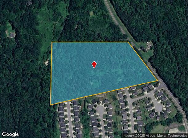
Property Record
5735 Eckerson Rd, Greensboro, NC 27405
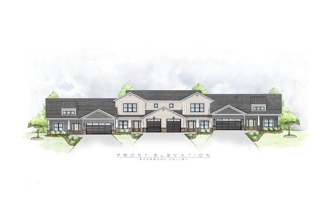
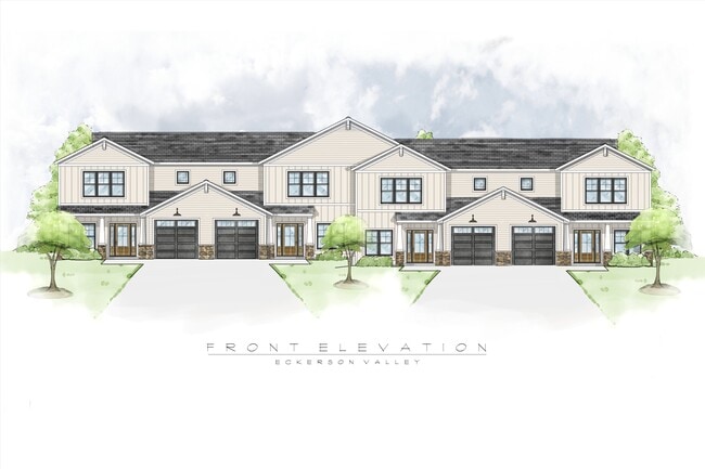
This Property Is For Sale
NEARBY LISTINGS FOR SALE OR LEASE
Property Detail
5735 Eckerson Rd
Greensboro/Winston-Salem
Watlington
Greensboro-High Point, NC
Guilford
0127262
North Carolina
Residentialnec
11.70 AC
X
NE Guilford County
3710788700J
DEMOGRAPHICS near 5735 Eckerson Rd
1 Mile
3 Mile
5 Mile
2024 Total Population
2,636
17,147
51,260
2029 Population
2,608
17,401
51,515
Pop Growth 2024-2029
(1.06%)
+ 1.48%
+ 0.50%
Average Age
40
38
38
2024 Total Households
1,009
6,224
19,374
HH Growth 2024-2029
(1.09%)
+ 1.37%
+ 0.43%
Median Household Inc
$90,049
$61,107
$56,383
Avg Household Size
2.60
2.60
2.50
2024 Avg HH Vehicles
2.00
2.00
2.00
Median Home Value
$168,726
$170,228
$166,804
Median Year Built
1998
2000
1991
Nearby Places
- Restaurants
- Banks
- Shops
- Fitness
- Groceries
PUBLIC TRANSPORTATION
COMMUTER RAIL
Greensboro Station (Piedmont - North Carolina by Train (NC Train))
DRIVE
WALK
Distance
Greensboro Station (Piedmont - North Carolina by Train (NC Train))
16 min
8.8 mi
AIRPORT
Piedmont Triad International
DRIVE
WALK
Distance
Piedmont Triad International
29 min
17.1 mi
Freight Ports
Virginia Port Authority - Richmond
DRIVE
WALK
Distance
Virginia Port Authority - Richmond
230 min
177.9 mi
Nearby Properties
Address
Land Use
TOTAL SIZE
Lot Size
Zoning
Address
Land Use
TOTAL SIZE
Lot Size
Zoning
1,587,604 SF
285.58 AC
HI
Address
Land Use
TOTAL SIZE
Lot Size
Zoning
807,600 SF
93.09 AC
PUD
Address
Land Use
TOTAL SIZE
Lot Size
Zoning
500,160 SF
52.97 AC
LI
Address
Land Use
TOTAL SIZE
Lot Size
Zoning
302,814 SF
58.64 AC
PI
Address
Land Use
TOTAL SIZE
Lot Size
Zoning
504,000 SF
42.01 AC
HI
Address
Land Use
TOTAL SIZE
Lot Size
Zoning
584,848 SF
32.91 AC
HI
Address
Land Use
TOTAL SIZE
Lot Size
Zoning
25,679 SF
366.35 AC
PI
Address
Land Use
TOTAL SIZE
Lot Size
Zoning
236,322 SF
19.64 AC
HI
Address
Land Use
TOTAL SIZE
Lot Size
Zoning
257,713 SF
24.07 AC
HI
Address
Land Use
TOTAL SIZE
Lot Size
Zoning
243,880 SF
29.56 AC
HI
Address
Land Use
TOTAL SIZE
Lot Size
Zoning
119,348 SF
27.60 AC
PI
Address
Land Use
TOTAL SIZE
Lot Size
Zoning
73,111 SF
80.21 AC
PI
Address
Land Use
TOTAL SIZE
Lot Size
Zoning
84,289 SF
18.36 AC
PUD
Address
Land Use
TOTAL SIZE
Lot Size
Zoning
218,130 SF
49.82 AC
HI
Address
Land Use
TOTAL SIZE
Lot Size
Zoning
63,318 SF
9.08 AC
C-H
Address
Land Use
TOTAL SIZE
Lot Size
Zoning
94,412 SF
11.58 AC
HI
Address
Land Use
TOTAL SIZE
Lot Size
Zoning
47,360 SF
32.01 AC
PI
Address
Land Use
TOTAL SIZE
Lot Size
Zoning
87,592 SF
11.95 AC
LI
Address
Land Use
TOTAL SIZE
Lot Size
Zoning
138,573 SF
74.67 AC
PI
Address
Land Use
TOTAL SIZE
Lot Size
Zoning
29,540 SF
6.54 AC
C-L
Address
Land Use
TOTAL SIZE
Lot Size
Zoning
156.66 AC
HI
Address
Land Use
TOTAL SIZE
Lot Size
Zoning
66,661 SF
19.83 AC
PI
Address
Land Use
TOTAL SIZE
Lot Size
Zoning
784 SF
263.60 AC
R-3
Address
Land Use
TOTAL SIZE
Lot Size
Zoning
5,960 SF
121.18 AC
PI
Address
Land Use
TOTAL SIZE
Lot Size
Zoning
72,100 SF
8.25 AC
HI
Address
Land Use
TOTAL SIZE
Lot Size
Zoning
83,696 SF
7.08 AC
HI
Address
Land Use
TOTAL SIZE
Lot Size
Zoning
16.78 AC
HB
Address
Land Use
TOTAL SIZE
Lot Size
Zoning
28,810 SF
181.26 AC
R-3
Address
Land Use
TOTAL SIZE
Lot Size
Zoning
76,860 SF
3.06 AC
HI
Address
Land Use
TOTAL SIZE
Lot Size
Zoning
97,368 SF
6.40 AC
LI
The World's #1 Commercial Real Estate Marketplace
Connect with us
© 2025 CoStar Group
The information above has been obtained from sources believed reliable. While we do not doubt its accuracy we have not verified it and make no guarantee, warranty or representation about it. It is your responsibility to independently confirm its accuracy and completeness. Any projections, opinions, assumptions, or estimates used are for example only and do not represent the current or future performance of the property. The value of this transaction to you depends on tax and other factors which should be evaluated by your tax, financial, and legal advisors. You and your advisors should conduct a careful, independent investigation of the property to determine to your satisfaction the suitability of the property for your needs.