Property Record
5734 State Highway 300 Rd, Longview, TX 75604


NEARBY LISTINGS FOR SALE OR LEASE
-
-
View all Longview listings for sale on LoopNet.com
Property Detail
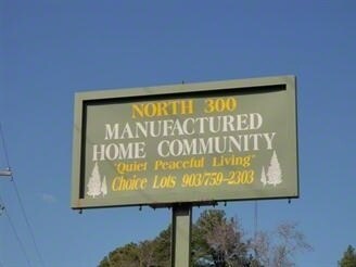
5734 State Highway 300 Rd
Longview, TX
Sanchez D Sur
110272
AB 186 D SANCHEZ SUR TR 29-04 SEC 1
Commercialnec
Gregg
AE
Texas
48183C0079F
29-4
2024
27.37 AC
2025
Tyler & Longview
010100
Other Market Areas
65 SF
DEMOGRAPHICS near 5734 State Highway 300 Rd
1 Mile
3 Mile
5 Mile
2024 Total Population
985
11,122
45,174
2029 Population
1,011
11,365
46,111
Pop Growth 2024-2029
+ 2.64%
+ 2.18%
+ 2.07%
Average Age
38
37
38
2024 Total Households
364
4,145
17,567
HH Growth 2024-2029
+ 2.75%
+ 2.24%
+ 2.04%
Median Household Inc
$101,429
$70,833
$68,602
Avg Household Size
2.70
2.60
2.50
2024 Avg HH Vehicles
2.00
2.00
2.00
Median Home Value
$262,871
$232,139
$195,925
Median Year Built
1994
1989
1983
Nearby Places
Map Layers
Map Styles
 Street
 Aerial
- Restaurants
- Banks
- Shops
- Fitness
- Groceries
PUBLIC TRANSPORTATION
COMMUTER RAIL
Longview (Texas Eagle - Amtrak)
DRIVE
WALK
Distance
Longview (Texas Eagle - Amtrak)
14 min
9.5 mi
Freight Ports
Port of Shreveport
DRIVE
WALK
Distance
Port of Shreveport
96 min
81.7 mi
SALE & LEASE HISTORY
LISTING DATE
SALE/LEASE

Apr 18, 2017
For Sale
Nearby Properties
Address
Land Use
TOTAL SIZE
Lot Size
Zoning
Address
Land Use
TOTAL SIZE
Lot Size
Zoning
822,337 SF
142.52 AC
Address
Land Use
TOTAL SIZE
Lot Size
Zoning
1,000,263 SF
109.31 AC
Address
Land Use
TOTAL SIZE
Lot Size
Zoning
Address
Land Use
TOTAL SIZE
Lot Size
Zoning
77,400 SF
39.90 AC
Address
Land Use
TOTAL SIZE
Lot Size
Zoning
77,400 SF
22.68 AC
B
Address
Land Use
TOTAL SIZE
Lot Size
Zoning
29,628 SF
5.81 AC
Address
Land Use
TOTAL SIZE
Lot Size
Zoning
2,400 SF
7.55 AC
Address
Land Use
TOTAL SIZE
Lot Size
Zoning
17,150 SF
15.01 AC
Address
Land Use
TOTAL SIZE
Lot Size
Zoning
7,656 SF
1.84 AC
Address
Land Use
TOTAL SIZE
Lot Size
Zoning
42,553 SF
6.53 AC
Address
Land Use
TOTAL SIZE
Lot Size
Zoning
14,900 SF
3.99 AC
B
Address
Land Use
TOTAL SIZE
Lot Size
Zoning
34,160 SF
4.92 AC
B
Address
Land Use
TOTAL SIZE
Lot Size
Zoning
20,662 SF
1.01 AC
Address
Land Use
TOTAL SIZE
Lot Size
Zoning
20,200 SF
4.53 AC
Address
Land Use
TOTAL SIZE
Lot Size
Zoning
37,132 SF
4.51 AC
Address
Land Use
TOTAL SIZE
Lot Size
Zoning
3,500 SF
12.41 AC
B
Address
Land Use
TOTAL SIZE
Lot Size
Zoning
10,355 SF
11.55 AC
Address
Land Use
TOTAL SIZE
Lot Size
Zoning
Address
Land Use
TOTAL SIZE
Lot Size
Zoning
13,857 SF
3.43 AC
Address
Land Use
TOTAL SIZE
Lot Size
Zoning
Address
Land Use
TOTAL SIZE
Lot Size
Zoning
900 SF
5.16 AC
Address
Land Use
TOTAL SIZE
Lot Size
Zoning
18,311 SF
10 AC
Address
Land Use
TOTAL SIZE
Lot Size
Zoning
31,368 SF
3.34 AC
Address
Land Use
TOTAL SIZE
Lot Size
Zoning
14,150 SF
5.70 AC
Address
Land Use
TOTAL SIZE
Lot Size
Zoning
37,009 SF
5.59 AC
Address
Land Use
TOTAL SIZE
Lot Size
Zoning
231.87 AC
Address
Land Use
TOTAL SIZE
Lot Size
Zoning
24,200 SF
4.36 AC
Address
Land Use
TOTAL SIZE
Lot Size
Zoning
8,712 SF
2.96 AC
Address
Land Use
TOTAL SIZE
Lot Size
Zoning
75.67 AC
Address
Land Use
TOTAL SIZE
Lot Size
Zoning
193.59 AC
The World's #1 Commercial Real Estate Marketplace
Connect with us
© 2025 CoStar Group
The information above has been obtained from sources believed reliable. While we do not doubt its accuracy we have not verified it and make no guarantee, warranty or representation about it. It is your responsibility to independently confirm its accuracy and completeness. Any projections, opinions, assumptions, or estimates used are for example only and do not represent the current or future performance of the property. The value of this transaction to you depends on tax and other factors which should be evaluated by your tax, financial, and legal advisors. You and your advisors should conduct a careful, independent investigation of the property to determine to your satisfaction the suitability of the property for your needs.