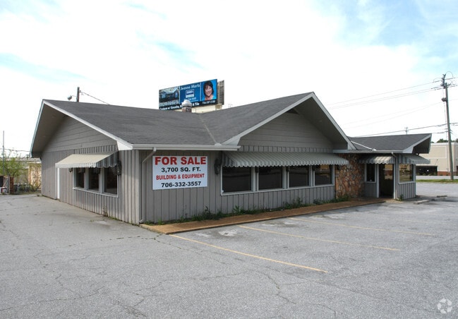
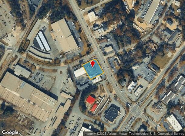
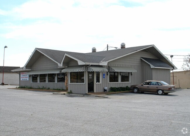
Property Record
5739 Whitesville Rd, Columbus, GA 31904
NEARBY LISTINGS FOR SALE OR LEASE
Property Detail
5739 Whitesville Rd
Columbus, GA-AL
Restaurant
189-013-002
PT LT 1 BK G PROP OF DEVELOPERS INVESTORS
Commercialnec
Muscogee
X
Georgia
01113C0075C
1
2025
0.68 AC
2025
Greater Columbus
000200
Columbus GA
3,125 SF
DEMOGRAPHICS near 5739 Whitesville Rd
1 Mile
3 Mile
5 Mile
2024 Total Population
3,888
58,529
142,325
2029 Population
3,784
57,245
140,389
Pop Growth 2024-2029
(2.67%)
(2.19%)
(1.36%)
Average Age
38
39
39
2024 Total Households
1,625
24,018
59,284
HH Growth 2024-2029
(2.89%)
(2.34%)
(1.44%)
Median Household Inc
$58,053
$59,129
$55,333
Avg Household Size
2.30
2.30
2.30
2024 Avg HH Vehicles
2.00
2.00
2.00
Median Home Value
$143,317
$182,121
$178,799
Median Year Built
1973
1975
1977
Nearby Places
Map Layers
Map Styles
 Street
 Aerial
- Restaurants
- Banks
- Shops
- Fitness
- Groceries
PUBLIC TRANSPORTATION
AIRPORT
Columbus
DRIVE
WALK
Distance
Columbus
5 min
2.0 mi
Nearby Properties
Address
Land Use
TOTAL SIZE
Lot Size
Zoning
Address
Land Use
TOTAL SIZE
Lot Size
Zoning
2,744 SF
2.04 AC
Address
Land Use
TOTAL SIZE
Lot Size
Zoning
81,423 SF
11.54 AC
Address
Land Use
TOTAL SIZE
Lot Size
Zoning
2,744 SF
41.16 AC
Address
Land Use
TOTAL SIZE
Lot Size
Zoning
2,744 SF
41.16 AC
Address
Land Use
TOTAL SIZE
Lot Size
Zoning
304,921 SF
75.14 AC
Address
Land Use
TOTAL SIZE
Lot Size
Zoning
174,892 SF
19.03 AC
Address
Land Use
TOTAL SIZE
Lot Size
Zoning
11,230 SF
25.05 AC
Address
Land Use
TOTAL SIZE
Lot Size
Zoning
15,330 SF
33.84 AC
Address
Land Use
TOTAL SIZE
Lot Size
Zoning
9,266 SF
50.07 AC
Address
Land Use
TOTAL SIZE
Lot Size
Zoning
8,620 SF
25.15 AC
Address
Land Use
TOTAL SIZE
Lot Size
Zoning
71,337 SF
17.24 AC
Address
Land Use
TOTAL SIZE
Lot Size
Zoning
216,360 SF
17.51 AC
Address
Land Use
TOTAL SIZE
Lot Size
Zoning
14,253 SF
6.71 AC
Address
Land Use
TOTAL SIZE
Lot Size
Zoning
6,932 SF
26.83 AC
Address
Land Use
TOTAL SIZE
Lot Size
Zoning
248,961 SF
35.15 AC
Address
Land Use
TOTAL SIZE
Lot Size
Zoning
Address
Land Use
TOTAL SIZE
Lot Size
Zoning
37,202 SF
8.03 AC
Address
Land Use
TOTAL SIZE
Lot Size
Zoning
10,683 SF
588.24 AC
Address
Land Use
TOTAL SIZE
Lot Size
Zoning
176,877 SF
26.35 AC
Address
Land Use
TOTAL SIZE
Lot Size
Zoning
4,360 SF
25.18 AC
Address
Land Use
TOTAL SIZE
Lot Size
Zoning
5,708 SF
30 AC
Address
Land Use
TOTAL SIZE
Lot Size
Zoning
Address
Land Use
TOTAL SIZE
Lot Size
Zoning
52,756 SF
11.40 AC
Address
Land Use
TOTAL SIZE
Lot Size
Zoning
64,793 SF
34.48 AC
Address
Land Use
TOTAL SIZE
Lot Size
Zoning
3,271 SF
27.64 AC
Address
Land Use
TOTAL SIZE
Lot Size
Zoning
Address
Land Use
TOTAL SIZE
Lot Size
Zoning
4,187 SF
12.56 AC
Address
Land Use
TOTAL SIZE
Lot Size
Zoning
47,849 SF
22.26 AC
Address
Land Use
TOTAL SIZE
Lot Size
Zoning
6,254 SF
13.04 AC
Address
Land Use
TOTAL SIZE
Lot Size
Zoning
The World's #1 Commercial Real Estate Marketplace
Connect with us
© 2025 CoStar Group
The information above has been obtained from sources believed reliable. While we do not doubt its accuracy we have not verified it and make no guarantee, warranty or representation about it. It is your responsibility to independently confirm its accuracy and completeness. Any projections, opinions, assumptions, or estimates used are for example only and do not represent the current or future performance of the property. The value of this transaction to you depends on tax and other factors which should be evaluated by your tax, financial, and legal advisors. You and your advisors should conduct a careful, independent investigation of the property to determine to your satisfaction the suitability of the property for your needs.