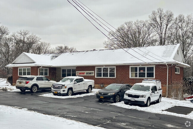
Property Record
574 Route 303, Blauvelt, NY 10913


NEARBY LISTINGS FOR SALE OR LEASE
Property Detail
574 Route 303
New York-Jersey City-White Plains, NY-NJ
45/93/859/8
392489-070-014-0004-016-000-0000
Rockland
Commercialbuilding
New York
X
16.0
36087C0187G
1.03 AC
2023
Rockland County
2024
Northern New Jersey
013002
DEMOGRAPHICS near 574 Route 303
1 Mile
3 Mile
5 Mile
2024 Total Population
4,543
45,381
143,354
2029 Population
4,561
45,301
143,123
Pop Growth 2024-2029
+ 0.40%
(0.18%)
(0.16%)
Average Age
40
43
43
2024 Total Households
1,324
16,607
51,577
HH Growth 2024-2029
+ 0.38%
(0.30%)
(0.29%)
Median Household Inc
$148,850
$127,809
$125,537
Avg Household Size
3.00
2.60
2.70
2024 Avg HH Vehicles
2.00
2.00
2.00
Median Home Value
$662,431
$653,824
$642,702
Median Year Built
1965
1964
1964
Nearby Places
Map Layers
Map Styles
 Street
 Aerial
- Restaurants
- Banks
- Shops
- Fitness
- Groceries
PUBLIC TRANSPORTATION
COMMUTER RAIL
Pearl River (Pascack Valley Line - NJ Transit Commuter Rail (NJ Transit))
DRIVE
WALK
Distance
Pearl River (Pascack Valley Line - NJ Transit Commuter Rail (NJ Transit))
12 min
5.9 mi
Montvale (Pascack Valley Line - NJ Transit Commuter Rail (NJ Transit))
DRIVE
WALK
Distance
Montvale (Pascack Valley Line - NJ Transit Commuter Rail (NJ Transit))
11 min
6.0 mi
AIRPORT
Westchester County
DRIVE
WALK
Distance
Westchester County
31 min
21.6 mi
LaGuardia
DRIVE
WALK
Distance
LaGuardia
44 min
27.1 mi
Newark Liberty International
DRIVE
WALK
Distance
Newark Liberty International
41 min
30.8 mi
Freight Ports
NY - Red Hook Container Terminal
DRIVE
WALK
Distance
NY - Red Hook Container Terminal
55 min
33.0 mi
SALE & LEASE HISTORY
LISTING DATE
SALE/LEASE

Apr 21, 2025
For Sale
Nearby Properties
Address
Land Use
TOTAL SIZE
Lot Size
Zoning
Address
Land Use
TOTAL SIZE
Lot Size
Zoning
415,374 SF
8.43 AC
H
Address
Land Use
TOTAL SIZE
Lot Size
Zoning
4,540,462 SF
30.89 AC
Address
Land Use
TOTAL SIZE
Lot Size
Zoning
220,594 SF
22.30 AC
R-40
Address
Land Use
TOTAL SIZE
Lot Size
Zoning
237,408 SF
14.97 AC
R-40
Address
Land Use
TOTAL SIZE
Lot Size
Zoning
35,631 SF
8.60 AC
LI
Address
Land Use
TOTAL SIZE
Lot Size
Zoning
231,978 SF
48.30 AC
R-40
Address
Land Use
TOTAL SIZE
Lot Size
Zoning
191,148 SF
32.26 AC
R-40
Address
Land Use
TOTAL SIZE
Lot Size
Zoning
114,520 SF
6.71 AC
R4
Address
Land Use
TOTAL SIZE
Lot Size
Zoning
25.52 AC
Address
Land Use
TOTAL SIZE
Lot Size
Zoning
47,432 SF
9.81 AC
RG
Address
Land Use
TOTAL SIZE
Lot Size
Zoning
108,264 SF
14.90 AC
R-18
Address
Land Use
TOTAL SIZE
Lot Size
Zoning
6,810 SF
120.70 AC
R-40
Address
Land Use
TOTAL SIZE
Lot Size
Zoning
31.50 AC
R-15
Address
Land Use
TOTAL SIZE
Lot Size
Zoning
302.70 AC
R-40
Address
Land Use
TOTAL SIZE
Lot Size
Zoning
63,268 SF
104.70 AC
R-40
Address
Land Use
TOTAL SIZE
Lot Size
Zoning
66,920 SF
17.70 AC
LO
Address
Land Use
TOTAL SIZE
Lot Size
Zoning
207,436 SF
18.03 AC
LIO
Address
Land Use
TOTAL SIZE
Lot Size
Zoning
1.10 AC
R-3
Address
Land Use
TOTAL SIZE
Lot Size
Zoning
225,000 SF
33.93 AC
LIO
Address
Land Use
TOTAL SIZE
Lot Size
Zoning
56,436 SF
7.06 AC
R-40
Address
Land Use
TOTAL SIZE
Lot Size
Zoning
134,157 SF
4.96 AC
R-40
Address
Land Use
TOTAL SIZE
Lot Size
Zoning
26.70 AC
R-40
Address
Land Use
TOTAL SIZE
Lot Size
Zoning
249,150 SF
61.41 AC
R-40
Address
Land Use
TOTAL SIZE
Lot Size
Zoning
68,444 SF
23.70 AC
R-15
Address
Land Use
TOTAL SIZE
Lot Size
Zoning
335,928 SF
54.80 AC
LI
Address
Land Use
TOTAL SIZE
Lot Size
Zoning
984 SF
3.10 AC
LI
Address
Land Use
TOTAL SIZE
Lot Size
Zoning
81,972 SF
5.36 AC
R-40
Address
Land Use
TOTAL SIZE
Lot Size
Zoning
247,911 SF
45.09 AC
OP
Address
Land Use
TOTAL SIZE
Lot Size
Zoning
265,255 SF
18.77 AC
LIO
Address
Land Use
TOTAL SIZE
Lot Size
Zoning
441.47 AC
R-40
The World's #1 Commercial Real Estate Marketplace
Connect with us
© 2026 CoStar Group
The information above has been obtained from sources believed reliable. While we do not doubt its accuracy we have not verified it and make no guarantee, warranty or representation about it. It is your responsibility to independently confirm its accuracy and completeness. Any projections, opinions, assumptions, or estimates used are for example only and do not represent the current or future performance of the property. The value of this transaction to you depends on tax and other factors which should be evaluated by your tax, financial, and legal advisors. You and your advisors should conduct a careful, independent investigation of the property to determine to your satisfaction the suitability of the property for your needs.