Property Record
574 W Lacey Blvd, Hanford, CA 93230

NEARBY LISTINGS FOR SALE OR LEASE
Property Detail
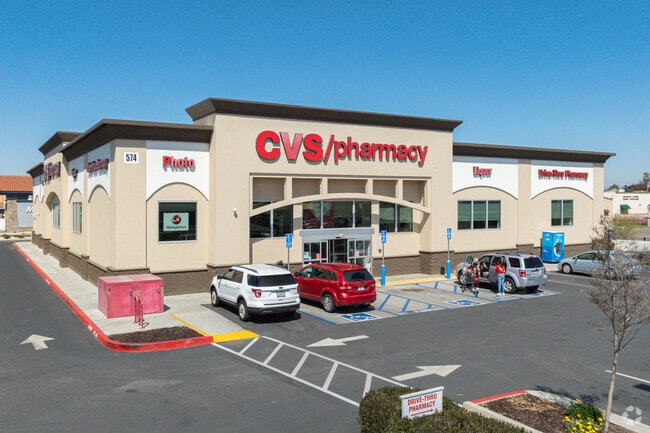
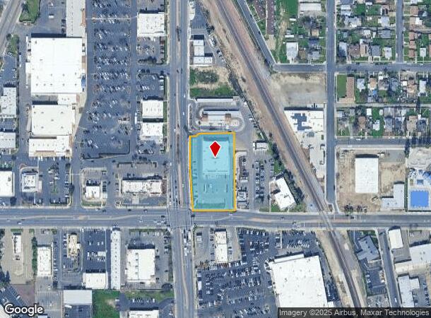
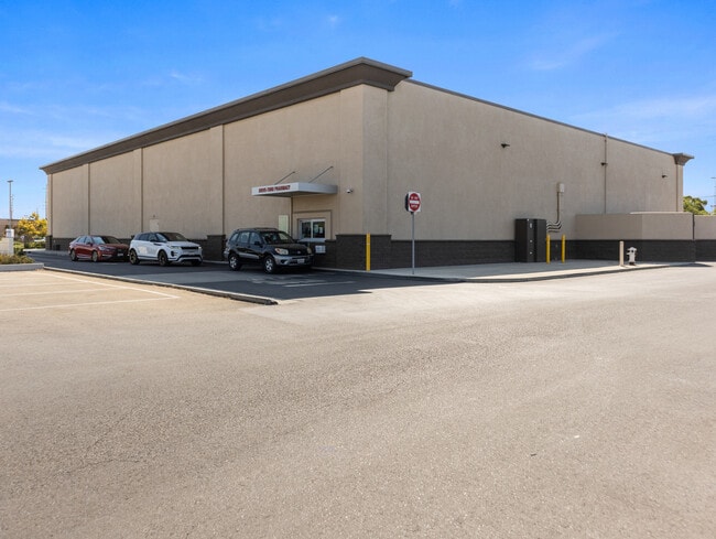
574 W Lacey Blvd
010-510-001-000
DESIGNATED REMAINDER OF PM 20-19 SEC 25/18/21
Regionalshoppingcenterormallwithanchorstore
Kings
X
California
06031C0185C
1.54 AC
2024
Hanford/Armona
2025
Fresno
000902
Hanford-Corcoran, CA
14,500 SF
DEMOGRAPHICS near 574 W Lacey Blvd
1 Mile
3 Mile
5 Mile
2024 Total Population
11,923
65,900
70,914
2029 Population
12,171
67,309
72,333
Pop Growth 2024-2029
+ 2.08%
+ 2.14%
+ 2.00%
Average Age
35
36
36
2024 Total Households
4,135
21,598
23,154
HH Growth 2024-2029
+ 2.03%
+ 2.13%
+ 1.99%
Median Household Inc
$45,933
$68,503
$68,721
Avg Household Size
2.80
3.00
3.00
2024 Avg HH Vehicles
1.00
2.00
2.00
Median Home Value
$243,770
$298,627
$301,771
Median Year Built
1971
1986
1985
Nearby Places
Map Layers
Map Styles
 Street
 Aerial
- Restaurants
- Banks
- Shops
- Fitness
- Groceries
PUBLIC TRANSPORTATION
COMMUTER RAIL
Hanford (San Joaquins - Amtrak)
DRIVE
WALK
Distance
Hanford (San Joaquins - Amtrak)
2 min
6 min
0.3 mi
Freight Ports
Port of Stockton
DRIVE
WALK
Distance
Port of Stockton
193 min
174.6 mi
SALE & LEASE HISTORY
LISTING DATE
SALE/LEASE

Sep 18, 2025
For Sale
Jan 21, 2025
For Sale
Nearby Properties
Address
Land Use
TOTAL SIZE
Lot Size
Zoning
Address
Land Use
TOTAL SIZE
Lot Size
Zoning
190,329 SF
27.94 AC
O
Address
Land Use
TOTAL SIZE
Lot Size
Zoning
14.37 AC
O
Address
Land Use
TOTAL SIZE
Lot Size
Zoning
24.69 AC
RM2
Address
Land Use
TOTAL SIZE
Lot Size
Zoning
62,349 SF
1.11 AC
O
Address
Land Use
TOTAL SIZE
Lot Size
Zoning
152,210 SF
8.91 AC
R-M
Address
Land Use
TOTAL SIZE
Lot Size
Zoning
95,040 SF
7.90 AC
RM3
Address
Land Use
TOTAL SIZE
Lot Size
Zoning
149,560 SF
14.25 AC
C-R
Address
Land Use
TOTAL SIZE
Lot Size
Zoning
206,251 SF
19.55 AC
PF
Address
Land Use
TOTAL SIZE
Lot Size
Zoning
139,410 SF
12.60 AC
AL10
Address
Land Use
TOTAL SIZE
Lot Size
Zoning
123,414 SF
9.85 AC
C-R
Address
Land Use
TOTAL SIZE
Lot Size
Zoning
48,606 SF
0.80 AC
O
Address
Land Use
TOTAL SIZE
Lot Size
Zoning
76,233 SF
13.60 AC
RC
Address
Land Use
TOTAL SIZE
Lot Size
Zoning
93,373 SF
4 AC
NC
Address
Land Use
TOTAL SIZE
Lot Size
Zoning
39,703 SF
0.97 AC
SC
Address
Land Use
TOTAL SIZE
Lot Size
Zoning
127,832 SF
12.64 AC
RC
Address
Land Use
TOTAL SIZE
Lot Size
Zoning
11.56 AC
RM2
Address
Land Use
TOTAL SIZE
Lot Size
Zoning
18,444 SF
4.60 AC
R-H
Address
Land Use
TOTAL SIZE
Lot Size
Zoning
7.65 AC
RC
Address
Land Use
TOTAL SIZE
Lot Size
Zoning
27,459 SF
1.93 AC
R-M
Address
Land Use
TOTAL SIZE
Lot Size
Zoning
53,577 SF
1.46 AC
C-H
Address
Land Use
TOTAL SIZE
Lot Size
Zoning
96,199 SF
10.07 AC
RC
Address
Land Use
TOTAL SIZE
Lot Size
Zoning
48,150 SF
2.76 AC
NC
Address
Land Use
TOTAL SIZE
Lot Size
Zoning
2.11 AC
PF
Address
Land Use
TOTAL SIZE
Lot Size
Zoning
58,416 SF
5.46 AC
MXC
Address
Land Use
TOTAL SIZE
Lot Size
Zoning
1,739 SF
29.72 AC
ML
Address
Land Use
TOTAL SIZE
Lot Size
Zoning
14.10 AC
MH
Address
Land Use
TOTAL SIZE
Lot Size
Zoning
3.25 AC
RM3
Address
Land Use
TOTAL SIZE
Lot Size
Zoning
2.12 AC
O
Address
Land Use
TOTAL SIZE
Lot Size
Zoning
1.59 AC
R-H
The World's #1 Commercial Real Estate Marketplace
Connect with us
© 2026 CoStar Group
The information above has been obtained from sources believed reliable. While we do not doubt its accuracy we have not verified it and make no guarantee, warranty or representation about it. It is your responsibility to independently confirm its accuracy and completeness. Any projections, opinions, assumptions, or estimates used are for example only and do not represent the current or future performance of the property. The value of this transaction to you depends on tax and other factors which should be evaluated by your tax, financial, and legal advisors. You and your advisors should conduct a careful, independent investigation of the property to determine to your satisfaction the suitability of the property for your needs.