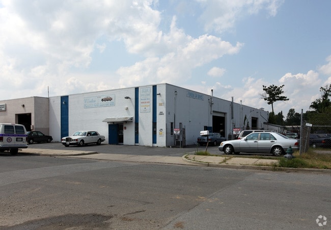
Property Record
5740 Spring St, Clinton, MD 20735


Property Detail
5740 Spring St
09-0948752
SPRING PARK
Autorepair
Prince Georges
IE
Maryland
B and X Area of moderate flood hazard, usually the area between the limits of the 100-year and 500-year floods.
11
2024
0.46 AC
2025
Branch Ave Corridor
801211
Washington, DC
9,971 SF
Washington-Arlington-Alexandria, DC-VA-MD-WV
NEARBY LISTINGS FOR SALE OR LEASE
DEMOGRAPHICS near 5740 Spring St
1 mile
3 mile
5 mile
2025 Total Population
8,118
61,116
186,050
2030 Population
8,177
61,986
188,489
Pop Growth 2025-2030
+ 0.73%
+ 1.42%
+ 1.31%
Average Age
43
42
42
2025 Total Households
2,796
21,822
70,481
HH Growth 2025-2030
+ 0.82%
+ 1.45%
+ 1.37%
Median Household Inc
$122,612
$105,458
$92,630
Avg Household Size
2.80
2.70
2.60
2025 Avg HH Vehicles
2.00
2.00
2.00
Median Home Value
$397,810
$402,777
$390,371
Median Year Built
1969
1977
1976
Nearby Places
Map Layers
Map Styles
 Street
 Aerial
Transit
 Traffic
 Biking
Places
Listings with unknown addresses are not visible on the map
- Restaurants
- Banks
- Shops
- Fitness
- Groceries
PUBLIC TRANSPORTATION
AIRPORT
Ronald Reagan Washington Ntl
Drive
Walk
Distance
Ronald Reagan Washington Ntl
30 min
15.6 mi
Baltimore/Washington International Thurgood Marshall
Drive
Walk
Distance
Baltimore/Washington International Thurgood Marshall
56 min
36.8 mi
Freight Ports
Port of Baltimore
Drive
Walk
Distance
Port of Baltimore
66 min
43.4 mi
Nearby Properties
Address
Land Use
TOTAL SIZE
Lot Size
Zoning
Address
Land Use
TOTAL SIZE
Lot Size
Zoning
963,250 SF
10.71 AC
RTOLE
Address
Land Use
TOTAL SIZE
Lot Size
Zoning
417 SF
7.66 AC
RTOLE
Address
Land Use
TOTAL SIZE
Lot Size
Zoning
203.33 AC
IE
Address
Land Use
TOTAL SIZE
Lot Size
Zoning
450 SF
20.72 AC
RMF20
Address
Land Use
TOTAL SIZE
Lot Size
Zoning
353,064 SF
53.19 AC
CGO
Address
Land Use
TOTAL SIZE
Lot Size
Zoning
111.87 AC
IE
Address
Land Use
TOTAL SIZE
Lot Size
Zoning
98.14 AC
IE
Address
Land Use
TOTAL SIZE
Lot Size
Zoning
29.24 AC
RMF20
Address
Land Use
TOTAL SIZE
Lot Size
Zoning
73.26 AC
IE
Address
Land Use
TOTAL SIZE
Lot Size
Zoning
223,219 SF
22 AC
CGO
Address
Land Use
TOTAL SIZE
Lot Size
Zoning
124.59 AC
IE
Address
Land Use
TOTAL SIZE
Lot Size
Zoning
74.38 AC
IE
Address
Land Use
TOTAL SIZE
Lot Size
Zoning
300,005 SF
9.94 AC
RR
Address
Land Use
TOTAL SIZE
Lot Size
Zoning
111.72 AC
IE
Address
Land Use
TOTAL SIZE
Lot Size
Zoning
36,272 SF
3.94 AC
RTOLE
Address
Land Use
TOTAL SIZE
Lot Size
Zoning
269.41 AC
IE
Address
Land Use
TOTAL SIZE
Lot Size
Zoning
11.65 AC
RMF20
Address
Land Use
TOTAL SIZE
Lot Size
Zoning
157.68 AC
IE
Address
Land Use
TOTAL SIZE
Lot Size
Zoning
138.27 AC
IE
Address
Land Use
TOTAL SIZE
Lot Size
Zoning
250.35 AC
IE
Address
Land Use
TOTAL SIZE
Lot Size
Zoning
434,910 SF
0.46 AC
RR
Address
Land Use
TOTAL SIZE
Lot Size
Zoning
115,888 SF
12.36 AC
CGO
Address
Land Use
TOTAL SIZE
Lot Size
Zoning
160,870 SF
3.75 AC
RMF48
Address
Land Use
TOTAL SIZE
Lot Size
Zoning
174,894 SF
7.54 AC
CGO
Address
Land Use
TOTAL SIZE
Lot Size
Zoning
55,724 SF
10.09 AC
IE
Address
Land Use
TOTAL SIZE
Lot Size
Zoning
67.32 AC
IE
Address
Land Use
TOTAL SIZE
Lot Size
Zoning
169.75 AC
IE
Address
Land Use
TOTAL SIZE
Lot Size
Zoning
78,658 SF
9.13 AC
RR
Address
Land Use
TOTAL SIZE
Lot Size
Zoning
101,979 SF
2.11 AC
CGO
Address
Land Use
TOTAL SIZE
Lot Size
Zoning
161,410 SF
30 AC
RSF95
The World's #1 Commercial Real Estate Marketplace
Connect with us
© 2026 CoStar Group
The information above has been obtained from sources believed reliable. While we do not doubt its accuracy we have not verified it and make no guarantee, warranty or representation about it. It is your responsibility to independently confirm its accuracy and completeness. Any projections, opinions, assumptions, or estimates used are for example only and do not represent the current or future performance of the property. The value of this transaction to you depends on tax and other factors which should be evaluated by your tax, financial, and legal advisors. You and your advisors should conduct a careful, independent investigation of the property to determine to your satisfaction the suitability of the property for your needs.