Property Record
5750 Sam Calloway Rd, Fort Worth, TX 76114
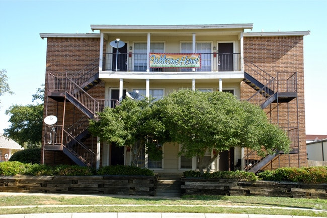
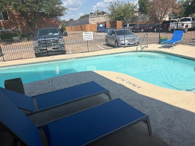

Property Detail
5750 Sam Calloway Rd
Dallas-Fort Worth-Arlington, TX
CALLOWAY LAND SUBDIVISION BLOCK 1 LOT 4A
05757126
Tarrant
Multifamilydwelling
Texas
B and X Area of moderate flood hazard, usually the area between the limits of the 100-year and 500-year floods.
4a
2024
1.48 AC
2025
Calloway Park
100602
Dallas/Ft Worth
37,181 SF
NEARBY LISTINGS FOR SALE OR LEASE
DEMOGRAPHICS near 5750 Sam Calloway Rd
1 mile
3 mile
5 mile
2025 Total Population
11,349
90,503
249,091
2030 Population
12,307
96,900
265,281
Pop Growth 2025-2030
+ 8.44%
+ 7.07%
+ 6.50%
Average Age
39
38
37
2025 Total Households
4,350
34,723
98,736
HH Growth 2025-2030
+ 8.32%
+ 6.93%
+ 6.72%
Median Household Inc
$73,116
$66,084
$65,267
Avg Household Size
2.50
2.50
2.40
2025 Avg HH Vehicles
2.00
2.00
2.00
Median Home Value
$311,417
$309,196
$295,401
Median Year Built
1962
1968
1980
Nearby Places
Map Layers
Map Styles
 Street
 Aerial
Layers
 Traffic
 Biking
Places
Listings with unknown addresses are not visible on the map
- Restaurants
- Banks
- Shops
- Fitness
- Groceries
PUBLIC TRANSPORTATION
COMMUTER RAIL
Fort Worth (Heartland Flyer - Amtrak, Texas Eagle - Amtrak)
Drive
Walk
Distance
Fort Worth (Heartland Flyer - Amtrak, Texas Eagle - Amtrak)
13 min
6.7 mi
Texas And Pacific (T&P) (Trinity Railway Express - Dallas Area Rapid Transit (DART))
Drive
Walk
Distance
Texas And Pacific (T&P) (Trinity Railway Express - Dallas Area Rapid Transit (DART))
14 min
6.9 mi
AIRPORT
Dallas-Fort Worth International
Drive
Walk
Distance
Dallas-Fort Worth International
42 min
30.2 mi
Freight Ports
Port of Shreveport
Drive
Walk
Distance
Port of Shreveport
260 min
240.1 mi
Nearby Properties
Address
Land Use
TOTAL SIZE
Lot Size
Zoning
Address
Land Use
TOTAL SIZE
Lot Size
Zoning
802,865 SF
17.38 AC
Address
Land Use
TOTAL SIZE
Lot Size
Zoning
508,378 SF
6.02 AC
Address
Land Use
TOTAL SIZE
Lot Size
Zoning
765,141 SF
56.28 AC
Address
Land Use
TOTAL SIZE
Lot Size
Zoning
469,191 SF
4.20 AC
Address
Land Use
TOTAL SIZE
Lot Size
Zoning
437,641 SF
6.60 AC
Address
Land Use
TOTAL SIZE
Lot Size
Zoning
627,866 SF
6.85 AC
Address
Land Use
TOTAL SIZE
Lot Size
Zoning
378,038 SF
7.01 AC
Address
Land Use
TOTAL SIZE
Lot Size
Zoning
401,487 SF
6.16 AC
Address
Land Use
TOTAL SIZE
Lot Size
Zoning
220,000 SF
9.92 AC
Address
Land Use
TOTAL SIZE
Lot Size
Zoning
531,597 SF
31.71 AC
Address
Land Use
TOTAL SIZE
Lot Size
Zoning
180,612 SF
Address
Land Use
TOTAL SIZE
Lot Size
Zoning
424,333 SF
12.59 AC
Address
Land Use
TOTAL SIZE
Lot Size
Zoning
183,899 SF
9.23 AC
Address
Land Use
TOTAL SIZE
Lot Size
Zoning
155,269 SF
Address
Land Use
TOTAL SIZE
Lot Size
Zoning
174,093 SF
0.14 AC
Address
Land Use
TOTAL SIZE
Lot Size
Zoning
271,065 SF
9.03 AC
Address
Land Use
TOTAL SIZE
Lot Size
Zoning
152,640 SF
15.91 AC
Address
Land Use
TOTAL SIZE
Lot Size
Zoning
254,610 SF
15.92 AC
Address
Land Use
TOTAL SIZE
Lot Size
Zoning
184,611 SF
1.32 AC
Address
Land Use
TOTAL SIZE
Lot Size
Zoning
137,500 SF
10.45 AC
Address
Land Use
TOTAL SIZE
Lot Size
Zoning
215,548 SF
7.79 AC
Address
Land Use
TOTAL SIZE
Lot Size
Zoning
357,676 SF
9.03 AC
Address
Land Use
TOTAL SIZE
Lot Size
Zoning
293,358 SF
6.95 AC
Address
Land Use
TOTAL SIZE
Lot Size
Zoning
136,717 SF
12.07 AC
Address
Land Use
TOTAL SIZE
Lot Size
Zoning
130,279 SF
10.75 AC
Address
Land Use
TOTAL SIZE
Lot Size
Zoning
118,265 SF
6.63 AC
Address
Land Use
TOTAL SIZE
Lot Size
Zoning
349,035 SF
29.04 AC
Address
Land Use
TOTAL SIZE
Lot Size
Zoning
321,124 SF
13.20 AC
Address
Land Use
TOTAL SIZE
Lot Size
Zoning
203,179 SF
11.57 AC
Address
Land Use
TOTAL SIZE
Lot Size
Zoning
230,766 SF
9.24 AC
The World's #1 Commercial Real Estate Marketplace
Connect with us
© 2026 CoStar Group
The information above has been obtained from sources believed reliable. While we do not doubt its accuracy we have not verified it and make no guarantee, warranty or representation about it. It is your responsibility to independently confirm its accuracy and completeness. Any projections, opinions, assumptions, or estimates used are for example only and do not represent the current or future performance of the property. The value of this transaction to you depends on tax and other factors which should be evaluated by your tax, financial, and legal advisors. You and your advisors should conduct a careful, independent investigation of the property to determine to your satisfaction the suitability of the property for your needs.