Property Record
5751 Highway 45, Eight Mile, AL 36613

Save to a Folder
{{folder.Name}}
{{folder.ListingIds.length}} Properties
{{folder.ListingIds.length}} Property
Create a New Folder
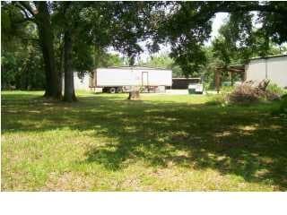
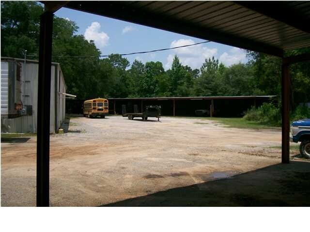
Property Detail
5751 Highway 45
Mobile, AL
COM AT SE COR OF LOT 11 J E GOODEN FARM SUBDIV MBK 2 PG 10 FROM SD PT TH NWLY ALG ARC OF CURVE OF W R/W/L OF HWY 45 138.7 FT
23-01-02-0-000-022.001
MOBILE
Storesoffices
Alabama
B and X Area of moderate flood hazard, usually the area between the limits of the 100-year and 500-year floods.
11
2025
0.61 AC
2025
Prichard/Saraland
006107
Mobile
3,479 SF
NEARBY LISTINGS FOR SALE OR LEASE
DEMOGRAPHICS near 5751 Highway 45
1 mile
3 mile
5 mile
2025 Total Population
545
7,388
32,627
2030 Population
545
7,350
32,486
Pop Growth 2025-2030
0.00%
(0.51%)
(0.43%)
Average Age
42
42
41
2025 Total Households
204
2,802
12,459
HH Growth 2025-2030
0.00%
(0.57%)
(0.48%)
Median Household Inc
$59,444
$58,951
$50,968
Avg Household Size
2.70
2.60
2.60
2025 Avg HH Vehicles
2.00
2.00
2.00
Median Home Value
$227,027
$204,065
$192,945
Median Year Built
1988
1985
1979
Nearby Places
Map Layers
Map Styles
 Street
 Aerial
Layers
 Traffic
 Biking
Places
Listings with unknown addresses are not visible on the map
- Restaurants
- Banks
- Shops
- Fitness
- Groceries
PUBLIC TRANSPORTATION
AIRPORT
Mobile Regional
Drive
Walk
Distance
Mobile Regional
25 min
14.4 mi
Mobile International
Drive
Walk
Distance
Mobile International
26 min
17.2 mi
Freight Ports
Port of Mobile
Drive
Walk
Distance
Port of Mobile
16 min
12.0 mi
Nearby Properties
Address
Land Use
TOTAL SIZE
Lot Size
Zoning
Address
Land Use
TOTAL SIZE
Lot Size
Zoning
66,138 SF
35.24 AC
Address
Land Use
TOTAL SIZE
Lot Size
Zoning
63,390 SF
107.45 AC
Address
Land Use
TOTAL SIZE
Lot Size
Zoning
35,775 SF
22.48 AC
Address
Land Use
TOTAL SIZE
Lot Size
Zoning
35,828 SF
26.30 AC
Address
Land Use
TOTAL SIZE
Lot Size
Zoning
93,199 SF
622 AC
Address
Land Use
TOTAL SIZE
Lot Size
Zoning
66,678 SF
2.29 AC
Address
Land Use
TOTAL SIZE
Lot Size
Zoning
57,084 SF
1.97 AC
Address
Land Use
TOTAL SIZE
Lot Size
Zoning
45,980 SF
10.72 AC
Address
Land Use
TOTAL SIZE
Lot Size
Zoning
54,965 SF
1.97 AC
Address
Land Use
TOTAL SIZE
Lot Size
Zoning
87,532 SF
17 AC
Address
Land Use
TOTAL SIZE
Lot Size
Zoning
40,245 SF
1.99 AC
Address
Land Use
TOTAL SIZE
Lot Size
Zoning
48,304 SF
3.28 AC
Address
Land Use
TOTAL SIZE
Lot Size
Zoning
44,368 SF
5.20 AC
Address
Land Use
TOTAL SIZE
Lot Size
Zoning
8,244 SF
8.47 AC
Address
Land Use
TOTAL SIZE
Lot Size
Zoning
32,457 SF
1.54 AC
Address
Land Use
TOTAL SIZE
Lot Size
Zoning
13,524 SF
4.12 AC
Address
Land Use
TOTAL SIZE
Lot Size
Zoning
9,328 SF
1.86 AC
Address
Land Use
TOTAL SIZE
Lot Size
Zoning
7,246 SF
2.06 AC
Address
Land Use
TOTAL SIZE
Lot Size
Zoning
25,032 SF
4.30 AC
Address
Land Use
TOTAL SIZE
Lot Size
Zoning
28,519 SF
5 AC
Address
Land Use
TOTAL SIZE
Lot Size
Zoning
12,300 SF
2.41 AC
Address
Land Use
TOTAL SIZE
Lot Size
Zoning
15,560 SF
3.27 AC
Address
Land Use
TOTAL SIZE
Lot Size
Zoning
6,864 SF
1.24 AC
Address
Land Use
TOTAL SIZE
Lot Size
Zoning
4,249 SF
1.65 AC
Address
Land Use
TOTAL SIZE
Lot Size
Zoning
1.04 AC
Address
Land Use
TOTAL SIZE
Lot Size
Zoning
14,220 SF
3 AC
Address
Land Use
TOTAL SIZE
Lot Size
Zoning
549 AC
Address
Land Use
TOTAL SIZE
Lot Size
Zoning
4,853 SF
0.75 AC
Address
Land Use
TOTAL SIZE
Lot Size
Zoning
3,222 SF
1.07 AC
Address
Land Use
TOTAL SIZE
Lot Size
Zoning
3,637 SF
0.98 AC
The World's #1 Commercial Real Estate Marketplace
Connect with us
© 2026 CoStar Group
The information above has been obtained from sources believed reliable. While we do not doubt its accuracy we have not verified it and make no guarantee, warranty or representation about it. It is your responsibility to independently confirm its accuracy and completeness. Any projections, opinions, assumptions, or estimates used are for example only and do not represent the current or future performance of the property. The value of this transaction to you depends on tax and other factors which should be evaluated by your tax, financial, and legal advisors. You and your advisors should conduct a careful, independent investigation of the property to determine to your satisfaction the suitability of the property for your needs.