Property Record
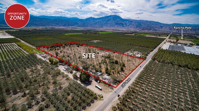
57541 Van Buren St, Thermal, CA 92274

Property Detail
57541 Van Buren St
764-170-016
9.90 ACRES IN POR NE 1/4 OF SEC 25 T6S R7E FOR TOTAL DESCRIPTION SEE ASSESSORS MAPS
Horticulturegrowinghousesagricultural
RIVERSIDE
A120
California
B and X Area of moderate flood hazard, usually the area between the limits of the 100-year and 500-year floods.
58.60 AC
2025
Coachella Valley
2025
Inland Empire (California)
045615
Riverside-San Bernardino-Ontario, CA
5,413 SF
NEARBY LISTINGS FOR SALE OR LEASE
DEMOGRAPHICS near 57541 Van Buren St
1 mile
3 mile
5 mile
2025 Total Population
150
13,895
66,310
2030 Population
160
14,927
69,801
Pop Growth 2025-2030
+ 6.67%
+ 7.43%
+ 5.26%
Average Age
37
45
40
2025 Total Households
40
4,725
20,380
HH Growth 2025-2030
+ 5.00%
+ 8.44%
+ 6.75%
Median Household Inc
$72,499
$97,879
$83,542
Avg Household Size
3.70
2.90
3.20
2025 Avg HH Vehicles
3.00
2.00
2.00
Median Home Value
$499,999
$774,642
$574,096
Median Year Built
1985
2004
2001
Nearby Places
Map Layers
Map Styles
 Street
 Aerial
Layers
 Traffic
 Biking
Places
Listings with unknown addresses are not visible on the map
- Restaurants
- Banks
- Shops
- Fitness
- Groceries
PUBLIC TRANSPORTATION
AIRPORT
Palm Springs International
Drive
Walk
Distance
Palm Springs International
42 min
28.8 mi
Freight Ports
Port of San Diego
Drive
Walk
Distance
Port of San Diego
188 min
153.0 mi
SALE & LEASE HISTORY
LISTING DATE
SALE/LEASE

Mar 14, 2023
For Sale
Nearby Properties
Address
Land Use
TOTAL SIZE
Lot Size
Zoning
Address
Land Use
TOTAL SIZE
Lot Size
Zoning
76.89 AC
A120
Address
Land Use
TOTAL SIZE
Lot Size
Zoning
1,589 SF
65.71 AC
A110
Address
Land Use
TOTAL SIZE
Lot Size
Zoning
19,059 SF
8.15 AC
Address
Land Use
TOTAL SIZE
Lot Size
Zoning
21,170 SF
7.27 AC
RM
Address
Land Use
TOTAL SIZE
Lot Size
Zoning
25,370 SF
6.61 AC
A1050
Address
Land Use
TOTAL SIZE
Lot Size
Zoning
42,249 SF
4.97 AC
Address
Land Use
TOTAL SIZE
Lot Size
Zoning
79.09 AC
A110
Address
Land Use
TOTAL SIZE
Lot Size
Zoning
27,675 SF
4.82 AC
RM
Address
Land Use
TOTAL SIZE
Lot Size
Zoning
40,060 SF
3.17 AC
Address
Land Use
TOTAL SIZE
Lot Size
Zoning
301.87 AC
MIX
Address
Land Use
TOTAL SIZE
Lot Size
Zoning
59.03 AC
A110
Address
Land Use
TOTAL SIZE
Lot Size
Zoning
38.20 AC
A120
Address
Land Use
TOTAL SIZE
Lot Size
Zoning
40,258 SF
39.09 AC
A120
Address
Land Use
TOTAL SIZE
Lot Size
Zoning
79.40 AC
A120
Address
Land Use
TOTAL SIZE
Lot Size
Zoning
4.77 AC
Address
Land Use
TOTAL SIZE
Lot Size
Zoning
77.60 AC
A120
Address
Land Use
TOTAL SIZE
Lot Size
Zoning
10,906 SF
20 AC
A120
Address
Land Use
TOTAL SIZE
Lot Size
Zoning
11.48 AC
C1
Address
Land Use
TOTAL SIZE
Lot Size
Zoning
40 AC
A120
Address
Land Use
TOTAL SIZE
Lot Size
Zoning
7,367 SF
19.55 AC
A120
Address
Land Use
TOTAL SIZE
Lot Size
Zoning
5,353 SF
3.34 AC
MIX
Address
Land Use
TOTAL SIZE
Lot Size
Zoning
3,884 SF
12.25 AC
A120
Address
Land Use
TOTAL SIZE
Lot Size
Zoning
160 AC
A110
The World's #1 Commercial Real Estate Marketplace
Connect with us
© 2026 CoStar Group
The information above has been obtained from sources believed reliable. While we do not doubt its accuracy we have not verified it and make no guarantee, warranty or representation about it. It is your responsibility to independently confirm its accuracy and completeness. Any projections, opinions, assumptions, or estimates used are for example only and do not represent the current or future performance of the property. The value of this transaction to you depends on tax and other factors which should be evaluated by your tax, financial, and legal advisors. You and your advisors should conduct a careful, independent investigation of the property to determine to your satisfaction the suitability of the property for your needs.