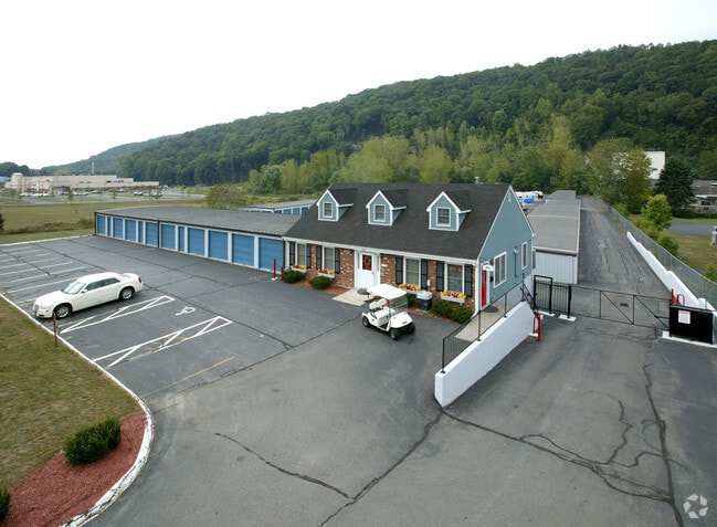
Property Record
576 Danbury Rd, New Milford, CT 06776
NEARBY LISTINGS FOR SALE OR LEASE
-
-
View all New Milford listings for sale on LoopNet.com
Property Detail
576 Danbury Rd
Torrington, CT
Litchfield
NMIL-000004-000000-000015
Connecticut
Commercialnec
15
2025
4.01 AC
2025
New Milford/SW Litchfield
253400
Hartford
1,280 SF
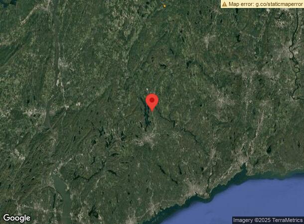
DEMOGRAPHICS near 576 Danbury Rd
1 Mile
3 Mile
5 Mile
2024 Total Population
1,351
17,262
44,947
2029 Population
1,357
17,532
45,476
Pop Growth 2024-2029
+ 0.44%
+ 1.56%
+ 1.18%
Average Age
43
43
43
2024 Total Households
534
6,682
17,459
HH Growth 2024-2029
+ 0.37%
+ 1.59%
+ 1.15%
Median Household Inc
$116,720
$115,407
$113,505
Avg Household Size
2.50
2.50
2.50
2024 Avg HH Vehicles
2.00
2.00
2.00
Median Home Value
$390,963
$405,634
$396,338
Median Year Built
1971
1969
1973
Nearby Places
Map Layers
Map Styles
 Street
 Aerial
- Restaurants
- Banks
- Shops
- Fitness
- Groceries
PUBLIC TRANSPORTATION
COMMUTER RAIL
Danbury Station (New Haven Line - Metro-North Commuter Railroad Company (Metro-North))
DRIVE
WALK
Distance
Danbury Station (New Haven Line - Metro-North Commuter Railroad Company (Metro-North))
17 min
9.6 mi
AIRPORT
Tweed/New Haven
DRIVE
WALK
Distance
Tweed/New Haven
66 min
39.7 mi
Westchester County
DRIVE
WALK
Distance
Westchester County
57 min
43.3 mi
Freight Ports
Port of New Haven
DRIVE
WALK
Distance
Port of New Haven
60 min
37.6 mi
Nearby Properties
Address
Land Use
TOTAL SIZE
Lot Size
Zoning
Address
Land Use
TOTAL SIZE
Lot Size
Zoning
45.66 AC
IC/R40
Address
Land Use
TOTAL SIZE
Lot Size
Zoning
79.31 AC
R-80
Address
Land Use
TOTAL SIZE
Lot Size
Zoning
42.62 AC
B1/RI
Address
Land Use
TOTAL SIZE
Lot Size
Zoning
77,492 SF
30.25 AC
Address
Land Use
TOTAL SIZE
Lot Size
Zoning
2,173 SF
4.76 AC
TCD
Address
Land Use
TOTAL SIZE
Lot Size
Zoning
6.54 AC
TCD-P
Address
Land Use
TOTAL SIZE
Lot Size
Zoning
151,200 SF
12.48 AC
I-1
Address
Land Use
TOTAL SIZE
Lot Size
Zoning
110,200 SF
4.96 AC
I-1 HO
Address
Land Use
TOTAL SIZE
Lot Size
Zoning
54.60 AC
R-80
Address
Land Use
TOTAL SIZE
Lot Size
Zoning
70,343 SF
37 AC
R20
Address
Land Use
TOTAL SIZE
Lot Size
Zoning
4.65 AC
TCD
Address
Land Use
TOTAL SIZE
Lot Size
Zoning
60,042 SF
7.20 AC
TCD
Address
Land Use
TOTAL SIZE
Lot Size
Zoning
29,862 SF
1.41 AC
TCD
Address
Land Use
TOTAL SIZE
Lot Size
Zoning
10.07 AC
I-1
Address
Land Use
TOTAL SIZE
Lot Size
Zoning
17,044 SF
7.36 AC
RA40
Address
Land Use
TOTAL SIZE
Lot Size
Zoning
4.80 AC
I-1
Address
Land Use
TOTAL SIZE
Lot Size
Zoning
99,524 SF
9.41 AC
I-1
Address
Land Use
TOTAL SIZE
Lot Size
Zoning
2,400 SF
1,190.70 AC
R80
Address
Land Use
TOTAL SIZE
Lot Size
Zoning
1.92 AC
MC
Address
Land Use
TOTAL SIZE
Lot Size
Zoning
25,450 SF
9.16 AC
I
Address
Land Use
TOTAL SIZE
Lot Size
Zoning
9,080 SF
8.72 AC
MC
Address
Land Use
TOTAL SIZE
Lot Size
Zoning
6,618 SF
2.59 AC
MC
Address
Land Use
TOTAL SIZE
Lot Size
Zoning
2,811 SF
2 AC
MR
Address
Land Use
TOTAL SIZE
Lot Size
Zoning
20.20 AC
RR4
Address
Land Use
TOTAL SIZE
Lot Size
Zoning
60,025 SF
6.98 AC
I-1
Address
Land Use
TOTAL SIZE
Lot Size
Zoning
63,661 SF
9.25 AC
I-1
Address
Land Use
TOTAL SIZE
Lot Size
Zoning
72,592 SF
7.89 AC
IC
Address
Land Use
TOTAL SIZE
Lot Size
Zoning
3,062 SF
51.33 AC
I-C/R4
Address
Land Use
TOTAL SIZE
Lot Size
Zoning
49,888 SF
5.86 AC
C-GS
The World's #1 Commercial Real Estate Marketplace
Connect with us
© 2025 CoStar Group
The information above has been obtained from sources believed reliable. While we do not doubt its accuracy we have not verified it and make no guarantee, warranty or representation about it. It is your responsibility to independently confirm its accuracy and completeness. Any projections, opinions, assumptions, or estimates used are for example only and do not represent the current or future performance of the property. The value of this transaction to you depends on tax and other factors which should be evaluated by your tax, financial, and legal advisors. You and your advisors should conduct a careful, independent investigation of the property to determine to your satisfaction the suitability of the property for your needs.