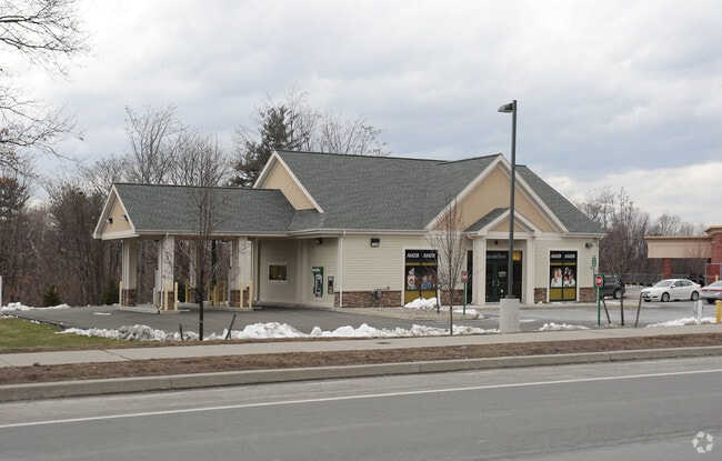
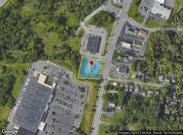
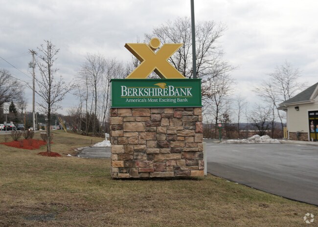
Property Record
576 N Greenbush Rd, Rensselaer, NY 12144
NEARBY LISTINGS FOR SALE OR LEASE
Property Detail
576 N Greenbush Rd
3200-144-10-33.113
Rensselaer
Financialbuilding
New York
ARE
33.113
36083C0239D
0.95 AC
2025
Outer Rensselaer County
2024
Albany/Schenectady/Troy
052301
Albany-Schenectady-Troy, NY
2,491 SF
DEMOGRAPHICS near 576 N Greenbush Rd
1 Mile
3 Mile
5 Mile
2024 Total Population
4,257
34,628
139,296
2029 Population
4,295
34,558
137,612
Pop Growth 2024-2029
+ 0.89%
(0.20%)
(1.21%)
Average Age
43
41
38
2024 Total Households
1,850
15,820
60,175
HH Growth 2024-2029
+ 0.86%
(0.03%)
(1.24%)
Median Household Inc
$109,129
$72,357
$62,452
Avg Household Size
2.30
2.10
2.10
2024 Avg HH Vehicles
2.00
2.00
1.00
Median Home Value
$280,575
$231,664
$213,327
Median Year Built
1992
1972
1957
Nearby Places
- Restaurants
- Banks
- Shops
- Fitness
- Groceries
PUBLIC TRANSPORTATION
COMMUTER RAIL
DRIVE
WALK
Distance
7 min
3.2 mi
AIRPORT
Albany International
DRIVE
WALK
Distance
Albany International
23 min
12.5 mi
Freight Ports
Albany, NY Port
DRIVE
WALK
Distance
Albany, NY Port
13 min
6.5 mi
Nearby Properties
Address
Land Use
TOTAL SIZE
Lot Size
Zoning
Address
Land Use
TOTAL SIZE
Lot Size
Zoning
1.42 AC
C3
Address
Land Use
TOTAL SIZE
Lot Size
Zoning
541,564 SF
7.40 AC
C3
Address
Land Use
TOTAL SIZE
Lot Size
Zoning
207.50 AC
CM
Address
Land Use
TOTAL SIZE
Lot Size
Zoning
177,030 SF
0.06 AC
C3
Address
Land Use
TOTAL SIZE
Lot Size
Zoning
296,914 SF
68.73 AC
PDD
Address
Land Use
TOTAL SIZE
Lot Size
Zoning
428,555 SF
1.20 AC
C3
Address
Land Use
TOTAL SIZE
Lot Size
Zoning
11,900 SF
28.60 AC
86
Address
Land Use
TOTAL SIZE
Lot Size
Zoning
179,713 SF
126.43 AC
OC
Address
Land Use
TOTAL SIZE
Lot Size
Zoning
104,077 SF
6.64 AC
B-2
Address
Land Use
TOTAL SIZE
Lot Size
Zoning
556,800 SF
0.39 AC
CM
Address
Land Use
TOTAL SIZE
Lot Size
Zoning
316,634 SF
27.82 AC
OI
Address
Land Use
TOTAL SIZE
Lot Size
Zoning
161,972 SF
26.62 AC
OI
Address
Land Use
TOTAL SIZE
Lot Size
Zoning
171,096 SF
18.04 AC
B-2
Address
Land Use
TOTAL SIZE
Lot Size
Zoning
470,768 SF
2.20 AC
C3
Address
Land Use
TOTAL SIZE
Lot Size
Zoning
194,018 SF
73.71 AC
R-B
Address
Land Use
TOTAL SIZE
Lot Size
Zoning
87,000 SF
0.28 AC
C3
Address
Land Use
TOTAL SIZE
Lot Size
Zoning
220,480 SF
8.40 AC
M1
Address
Land Use
TOTAL SIZE
Lot Size
Zoning
2.25 AC
Address
Land Use
TOTAL SIZE
Lot Size
Zoning
170,387 SF
0.54 AC
C3
Address
Land Use
TOTAL SIZE
Lot Size
Zoning
88,040 SF
1.80 AC
C3
Address
Land Use
TOTAL SIZE
Lot Size
Zoning
100,664 SF
0.91 AC
C3
Address
Land Use
TOTAL SIZE
Lot Size
Zoning
62,714 SF
8.74 AC
OI
Address
Land Use
TOTAL SIZE
Lot Size
Zoning
45,782 SF
0.84 AC
C3
Address
Land Use
TOTAL SIZE
Lot Size
Zoning
179,260 SF
0.35 AC
C3
Address
Land Use
TOTAL SIZE
Lot Size
Zoning
222,459 SF
1.20 AC
C3
Address
Land Use
TOTAL SIZE
Lot Size
Zoning
99,223 SF
15.47 AC
R-B
Address
Land Use
TOTAL SIZE
Lot Size
Zoning
204,692 SF
30.97 AC
OC
Address
Land Use
TOTAL SIZE
Lot Size
Zoning
100,176 SF
3.23 AC
C1
Address
Land Use
TOTAL SIZE
Lot Size
Zoning
64,600 SF
13.16 AC
Address
Land Use
TOTAL SIZE
Lot Size
Zoning
302,782 SF
1.43 AC
C3
The World's #1 Commercial Real Estate Marketplace
Connect with us
© 2025 CoStar Group
The information above has been obtained from sources believed reliable. While we do not doubt its accuracy we have not verified it and make no guarantee, warranty or representation about it. It is your responsibility to independently confirm its accuracy and completeness. Any projections, opinions, assumptions, or estimates used are for example only and do not represent the current or future performance of the property. The value of this transaction to you depends on tax and other factors which should be evaluated by your tax, financial, and legal advisors. You and your advisors should conduct a careful, independent investigation of the property to determine to your satisfaction the suitability of the property for your needs.