Property Record
57633 Road 225, North Fork, CA 93643
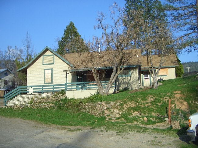


Property Detail
57633 Road 225
060-110-016
SEC 18 T8S R23E
Commercialnec
Madera
CRG
California
D Areas with possible but undetermined flood hazards.
2.68 AC
2024
Outlying Madera County
2025
Fresno
000102
Fresno, CA
NEARBY LISTINGS FOR SALE OR LEASE
-
-
View all North Fork listings for sale on LoopNet.com
DEMOGRAPHICS near 57633 Road 225
1 mile
3 mile
5 mile
2025 Total Population
568
2,371
3,755
2030 Population
597
2,524
4,035
Pop Growth 2025-2030
+ 5.11%
+ 6.45%
+ 7.46%
Average Age
44
45
46
2025 Total Households
226
936
1,483
HH Growth 2025-2030
+ 5.31%
+ 6.30%
+ 7.15%
Median Household Inc
$51,875
$55,199
$58,640
Avg Household Size
2.40
2.40
2.30
2025 Avg HH Vehicles
2.00
2.00
2.00
Median Home Value
$391,428
$406,838
$445,339
Median Year Built
1982
1982
1983
Nearby Places
Map Layers
Map Styles
 Street
 Aerial
Layers
 Traffic
 Biking
Places
Listings with unknown addresses are not visible on the map
- Restaurants
- Banks
- Shops
- Fitness
- Groceries
SALE & LEASE HISTORY
LISTING DATE
SALE/LEASE

Sep 23, 2016
For Sale
Oct 13, 2017
For Sale
Nov 19, 2022
For Sale
Jan 23, 2017
For Sale
Jan 03, 2019
For Sale
Nearby Properties
Address
Land Use
TOTAL SIZE
Lot Size
Zoning
Address
Land Use
TOTAL SIZE
Lot Size
Zoning
1,260 SF
0.55 AC
CUM
Address
Land Use
TOTAL SIZE
Lot Size
Zoning
40 AC
ARE-40
Address
Land Use
TOTAL SIZE
Lot Size
Zoning
9,633 SF
0.72 AC
CUM
Address
Land Use
TOTAL SIZE
Lot Size
Zoning
2,982 SF
10.70 AC
RRM
Address
Land Use
TOTAL SIZE
Lot Size
Zoning
1,501 SF
14.01 AC
RM
Address
Land Use
TOTAL SIZE
Lot Size
Zoning
1,800 SF
34.34 AC
RM
Address
Land Use
TOTAL SIZE
Lot Size
Zoning
2,178 SF
41.42 AC
ARE-40
Address
Land Use
TOTAL SIZE
Lot Size
Zoning
4,325 SF
4.15 AC
Address
Land Use
TOTAL SIZE
Lot Size
Zoning
1,921 SF
56.70 AC
RM
Address
Land Use
TOTAL SIZE
Lot Size
Zoning
4,160 SF
2.09 AC
CUM
Address
Land Use
TOTAL SIZE
Lot Size
Zoning
880 SF
3.01 AC
RUM
Address
Land Use
TOTAL SIZE
Lot Size
Zoning
2,437 SF
7.90 AC
AR-5
Address
Land Use
TOTAL SIZE
Lot Size
Zoning
2,261 SF
6.54 AC
AR-5
Address
Land Use
TOTAL SIZE
Lot Size
Zoning
2,432 SF
83.51 AC
RRS-3
Address
Land Use
TOTAL SIZE
Lot Size
Zoning
2,388 SF
10.99 AC
RM
Address
Land Use
TOTAL SIZE
Lot Size
Zoning
29.46 AC
ARE40
Address
Land Use
TOTAL SIZE
Lot Size
Zoning
1,248 SF
11.30 AC
RMS
Address
Land Use
TOTAL SIZE
Lot Size
Zoning
4,831 SF
19.32 AC
RRS-5
Address
Land Use
TOTAL SIZE
Lot Size
Zoning
1,260 SF
18.40 AC
ARE-20
Address
Land Use
TOTAL SIZE
Lot Size
Zoning
1,440 SF
17.44 AC
RMS
Address
Land Use
TOTAL SIZE
Lot Size
Zoning
2,166 SF
10 AC
RMS
Address
Land Use
TOTAL SIZE
Lot Size
Zoning
2,717 SF
6.94 AC
RRS-2 1/2
Address
Land Use
TOTAL SIZE
Lot Size
Zoning
4,000 SF
1.69 AC
IA
Address
Land Use
TOTAL SIZE
Lot Size
Zoning
2,665 SF
10.17 AC
RM
Address
Land Use
TOTAL SIZE
Lot Size
Zoning
6,740 SF
1.87 AC
RMS
Address
Land Use
TOTAL SIZE
Lot Size
Zoning
2,309 SF
15.36 AC
RM
Address
Land Use
TOTAL SIZE
Lot Size
Zoning
1,881 SF
4.20 AC
RRS-2 1/2
Address
Land Use
TOTAL SIZE
Lot Size
Zoning
3.67 AC
RRS3
Address
Land Use
TOTAL SIZE
Lot Size
Zoning
1.20 AC
CRG
Address
Land Use
TOTAL SIZE
Lot Size
Zoning
2,255 SF
8.56 AC
RRS-2 1/2
The World's #1 Commercial Real Estate Marketplace
Connect with us
© 2026 CoStar Group
The information above has been obtained from sources believed reliable. While we do not doubt its accuracy we have not verified it and make no guarantee, warranty or representation about it. It is your responsibility to independently confirm its accuracy and completeness. Any projections, opinions, assumptions, or estimates used are for example only and do not represent the current or future performance of the property. The value of this transaction to you depends on tax and other factors which should be evaluated by your tax, financial, and legal advisors. You and your advisors should conduct a careful, independent investigation of the property to determine to your satisfaction the suitability of the property for your needs.