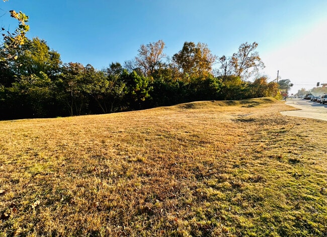
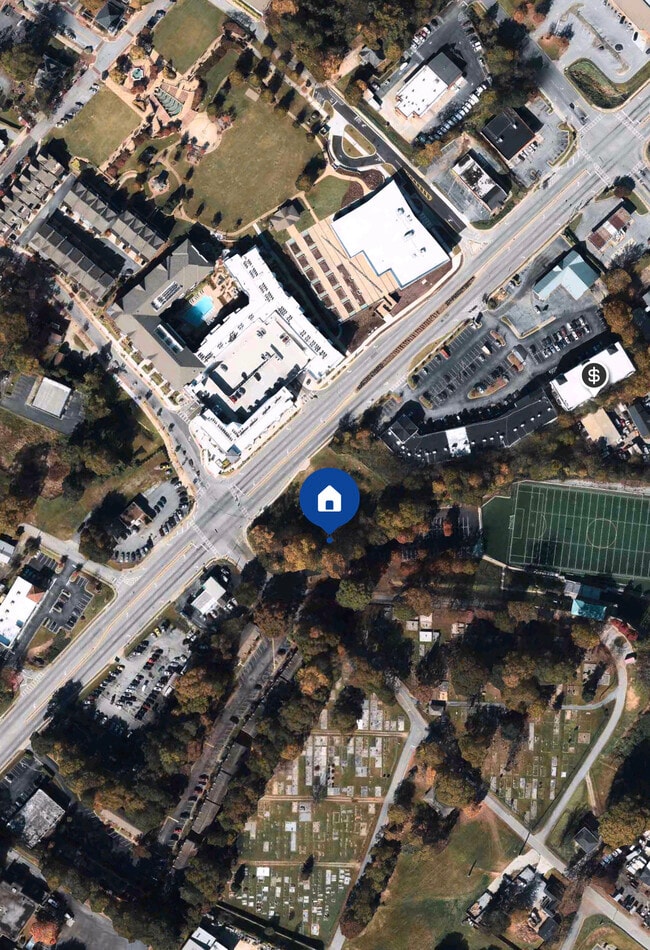
Property Record
5766 Buford Hwy, Norcross, GA 30071


Property Detail
5766 Buford Hwy
Atlanta-Sandy Springs-Roswell, GA
BUFORD HWY
6-243-007
GWINNETT
Commercialacreage
Georgia
C3
243
B and X Area of moderate flood hazard, usually the area between the limits of the 100-year and 500-year floods.
0.95 AC
2025
Norcross/Peachtree Corners
2025
Atlanta
050330
NEARBY LISTINGS FOR SALE OR LEASE
DEMOGRAPHICS near 5766 Buford Hwy
1 mile
3 mile
5 mile
2024 Total Population
11,044
92,410
258,821
2029 Population
11,648
96,103
266,965
Pop Growth 2024-2029
+ 5.47%
+ 4.00%
+ 3.15%
Average Age
37
36
37
2024 Total Households
3,635
33,564
93,627
HH Growth 2024-2029
+ 5.64%
+ 4.01%
+ 3.12%
Median Household Inc
$80,628
$63,838
$69,334
Avg Household Size
3.00
2.70
2.70
2024 Avg HH Vehicles
2.00
2.00
2.00
Median Home Value
$462,111
$389,599
$409,146
Median Year Built
1991
1988
1987
Nearby Places
Map Layers
Map Styles
 Street
 Aerial
Transit
 Traffic
 Biking
Places
Listings with unknown addresses are not visible on the map
- Restaurants
- Banks
- Shops
- Fitness
- Groceries
PUBLIC TRANSPORTATION
AIRPORT
Hartsfield - Jackson Atlanta International
Drive
Walk
Distance
Hartsfield - Jackson Atlanta International
36 min
28.8 mi
Freight Ports
Georgia Ports - Savannah
Drive
Walk
Distance
Georgia Ports - Savannah
1 min
217.2 mi
SALE & LEASE HISTORY
LISTING DATE
SALE/LEASE

Jun 05, 2017
For Sale
Aug 15, 2018
For Sale
Nearby Properties
Address
Land Use
TOTAL SIZE
Lot Size
Zoning
Address
Land Use
TOTAL SIZE
Lot Size
Zoning
599,105 SF
9.13 AC
M1
Address
Land Use
TOTAL SIZE
Lot Size
Zoning
709,399 SF
59.34 AC
RM13
Address
Land Use
TOTAL SIZE
Lot Size
Zoning
349,619 SF
24.50 AC
RM75
Address
Land Use
TOTAL SIZE
Lot Size
Zoning
524,000 SF
44.93 AC
RM
Address
Land Use
TOTAL SIZE
Lot Size
Zoning
545,074 SF
53.40 AC
RM8
Address
Land Use
TOTAL SIZE
Lot Size
Zoning
247,662 SF
29.53 AC
RM
Address
Land Use
TOTAL SIZE
Lot Size
Zoning
525,526 SF
80.61 AC
RA200
Address
Land Use
TOTAL SIZE
Lot Size
Zoning
286,481 SF
20.06 AC
M1
Address
Land Use
TOTAL SIZE
Lot Size
Zoning
358,622 SF
31.01 AC
RM13
Address
Land Use
TOTAL SIZE
Lot Size
Zoning
231,192 SF
12.88 AC
RM13
Address
Land Use
TOTAL SIZE
Lot Size
Zoning
303,866 SF
20.13 AC
RM
Address
Land Use
TOTAL SIZE
Lot Size
Zoning
285,440 SF
24.68 AC
RM
Address
Land Use
TOTAL SIZE
Lot Size
Zoning
424,948 SF
39.03 AC
RM13
Address
Land Use
TOTAL SIZE
Lot Size
Zoning
426,839 SF
37.47 AC
MUD
Address
Land Use
TOTAL SIZE
Lot Size
Zoning
208,466 SF
20.97 AC
RM
Address
Land Use
TOTAL SIZE
Lot Size
Zoning
250,886 SF
22.93 AC
RM13
Address
Land Use
TOTAL SIZE
Lot Size
Zoning
483,279 SF
8.27 AC
BH
Address
Land Use
TOTAL SIZE
Lot Size
Zoning
475,389 SF
5.37 AC
NX
Address
Land Use
TOTAL SIZE
Lot Size
Zoning
220,150 SF
21.08 AC
RM13
Address
Land Use
TOTAL SIZE
Lot Size
Zoning
459,745 SF
50.72 AC
RM10
Address
Land Use
TOTAL SIZE
Lot Size
Zoning
420,576 SF
27.06 AC
M2
Address
Land Use
TOTAL SIZE
Lot Size
Zoning
321,756 SF
26.28 AC
RM
Address
Land Use
TOTAL SIZE
Lot Size
Zoning
340,962 SF
34.50 AC
PRD
Address
Land Use
TOTAL SIZE
Lot Size
Zoning
255,398 SF
12.45 AC
MUR
Address
Land Use
TOTAL SIZE
Lot Size
Zoning
454,220 SF
30 AC
M1
Address
Land Use
TOTAL SIZE
Lot Size
Zoning
220,915 SF
2.38 AC
HX
Address
Land Use
TOTAL SIZE
Lot Size
Zoning
720,051 SF
99.46 AC
MUR
Address
Land Use
TOTAL SIZE
Lot Size
Zoning
390,776 SF
43.96 AC
RM8
Address
Land Use
TOTAL SIZE
Lot Size
Zoning
225,314 SF
68.32 AC
OI
Address
Land Use
TOTAL SIZE
Lot Size
Zoning
781,705 SF
60.29 AC
M1
The World's #1 Commercial Real Estate Marketplace
Connect with us
© 2026 CoStar Group
The information above has been obtained from sources believed reliable. While we do not doubt its accuracy we have not verified it and make no guarantee, warranty or representation about it. It is your responsibility to independently confirm its accuracy and completeness. Any projections, opinions, assumptions, or estimates used are for example only and do not represent the current or future performance of the property. The value of this transaction to you depends on tax and other factors which should be evaluated by your tax, financial, and legal advisors. You and your advisors should conduct a careful, independent investigation of the property to determine to your satisfaction the suitability of the property for your needs.