Property Record
5768 E Grand River Ave, Howell, MI 48843


NEARBY LISTINGS FOR SALE OR LEASE
Property Detail
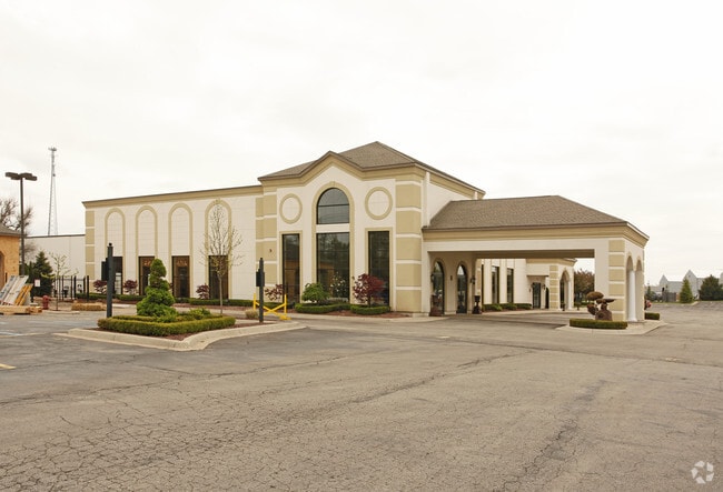
5768 E Grand River Ave
11-10-400-020
Part Of Sec 10 T2n R5e
Commercialnec
SEC 10 T2N R5E COMM AT SE COR TH N02*21'23"E 800.03 FT TH N66*28'53"W 1028.52 FT FOR POB TH S23*31'07"W 217.80 FT TH
X
Livingston
26093C0330D
Michigan
2025
7.26 AC
2025
Livingston County
742403
Detroit
30,459 SF
Detroit-Warren-Dearborn, MI
DEMOGRAPHICS near 5768 E Grand River Ave
1 Mile
3 Mile
5 Mile
2024 Total Population
2,285
16,548
53,458
2029 Population
2,360
17,021
55,013
Pop Growth 2024-2029
+ 3.28%
+ 2.86%
+ 2.91%
Average Age
45
45
43
2024 Total Households
993
6,869
21,211
HH Growth 2024-2029
+ 3.22%
+ 2.85%
+ 2.95%
Median Household Inc
$80,952
$86,671
$96,707
Avg Household Size
2.30
2.40
2.50
2024 Avg HH Vehicles
2.00
2.00
2.00
Median Home Value
$276,538
$328,801
$334,234
Median Year Built
1989
1992
1992
Nearby Places
Map Layers
Map Styles
 Street
 Aerial
- Restaurants
- Banks
- Shops
- Fitness
- Groceries
PUBLIC TRANSPORTATION
AIRPORT
Bishop International
DRIVE
WALK
Distance
Bishop International
58 min
42.4 mi
Freight Ports
Port of Toledo
DRIVE
WALK
Distance
Port of Toledo
105 min
85.6 mi
Nearby Properties
Address
Land Use
TOTAL SIZE
Lot Size
Zoning
Address
Land Use
TOTAL SIZE
Lot Size
Zoning
1,296 SF
19.42 AC
MUPUD
Address
Land Use
TOTAL SIZE
Lot Size
Zoning
172,817 SF
7.87 AC
OS
Address
Land Use
TOTAL SIZE
Lot Size
Zoning
93,620 SF
17.47 AC
MUPUD
Address
Land Use
TOTAL SIZE
Lot Size
Zoning
199,635 SF
19.85 AC
RPUD
Address
Land Use
TOTAL SIZE
Lot Size
Zoning
210,003 SF
29.17 AC
MUPUD
Address
Land Use
TOTAL SIZE
Lot Size
Zoning
240,114 SF
18.91 AC
R-M
Address
Land Use
TOTAL SIZE
Lot Size
Zoning
60,900 SF
5.74 AC
NRPUD
Address
Land Use
TOTAL SIZE
Lot Size
Zoning
166,550 SF
20 AC
IND
Address
Land Use
TOTAL SIZE
Lot Size
Zoning
53,494 SF
10 AC
MUPUD
Address
Land Use
TOTAL SIZE
Lot Size
Zoning
220,091 SF
21.88 AC
NRPUD
Address
Land Use
TOTAL SIZE
Lot Size
Zoning
134,688 SF
14.97 AC
NRPUD
Address
Land Use
TOTAL SIZE
Lot Size
Zoning
113,038 SF
9.73 AC
OR
Address
Land Use
TOTAL SIZE
Lot Size
Zoning
5,947 SF
104.68 AC
MHP
Address
Land Use
TOTAL SIZE
Lot Size
Zoning
96,896 SF
12.11 AC
HDR
Address
Land Use
TOTAL SIZE
Lot Size
Zoning
80,573 SF
13.72 AC
OR
Address
Land Use
TOTAL SIZE
Lot Size
Zoning
19.60 AC
OR
Address
Land Use
TOTAL SIZE
Lot Size
Zoning
41,261 SF
1.72 AC
OS
Address
Land Use
TOTAL SIZE
Lot Size
Zoning
51,408 SF
5.40 AC
OR
Address
Land Use
TOTAL SIZE
Lot Size
Zoning
51.99 AC
MHP
Address
Land Use
TOTAL SIZE
Lot Size
Zoning
121,265 SF
15.10 AC
RCD
Address
Land Use
TOTAL SIZE
Lot Size
Zoning
65,560 SF
2.56 AC
NRPUD
Address
Land Use
TOTAL SIZE
Lot Size
Zoning
73,296 SF
7 AC
HDR
Address
Land Use
TOTAL SIZE
Lot Size
Zoning
116,885 SF
13.78 AC
RCD
Address
Land Use
TOTAL SIZE
Lot Size
Zoning
39,260 SF
5.52 AC
R3
Address
Land Use
TOTAL SIZE
Lot Size
Zoning
44,348 SF
217.14 AC
PRF
Address
Land Use
TOTAL SIZE
Lot Size
Zoning
39,778 SF
10 AC
NSD
Address
Land Use
TOTAL SIZE
Lot Size
Zoning
59,526 SF
4.72 AC
OR
Address
Land Use
TOTAL SIZE
Lot Size
Zoning
66,582 SF
7.10 AC
PID
Address
Land Use
TOTAL SIZE
Lot Size
Zoning
88,520 SF
9.45 AC
NRPUD
Address
Land Use
TOTAL SIZE
Lot Size
Zoning
40,646 SF
8.51 AC
B-2
The World's #1 Commercial Real Estate Marketplace
Connect with us
© 2025 CoStar Group
The information above has been obtained from sources believed reliable. While we do not doubt its accuracy we have not verified it and make no guarantee, warranty or representation about it. It is your responsibility to independently confirm its accuracy and completeness. Any projections, opinions, assumptions, or estimates used are for example only and do not represent the current or future performance of the property. The value of this transaction to you depends on tax and other factors which should be evaluated by your tax, financial, and legal advisors. You and your advisors should conduct a careful, independent investigation of the property to determine to your satisfaction the suitability of the property for your needs.