Property Record
577 Diplomat Ct, Newport News, VA 23608


NEARBY LISTINGS FOR SALE OR LEASE
-
-
View all Newport News listings for sale on LoopNet.com
Property Detail
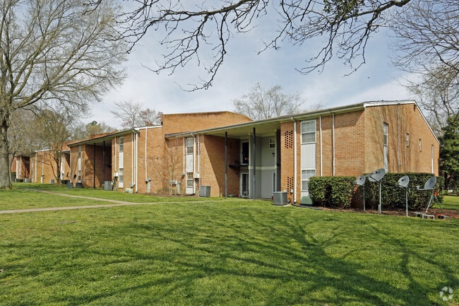
577 Diplomat Ct
Virginia Beach-Norfolk-Newport News, VA-NC
Diplomat Apts
072.00-02-10
1
Apartmenthouse5plusunits
Newport News
X
Virginia
51199C0120D
1
2026
9.57 AC
2025
McIntosh
032124
Hampton Roads
100 SF
DEMOGRAPHICS near 577 Diplomat Ct
1 Mile
3 Mile
5 Mile
2024 Total Population
12,413
68,365
118,573
2029 Population
12,273
67,341
118,121
Pop Growth 2024-2029
(1.13%)
(1.50%)
(0.38%)
Average Age
36
36
38
2024 Total Households
4,915
26,586
47,156
HH Growth 2024-2029
(1.16%)
(1.60%)
(0.46%)
Median Household Inc
$65,924
$63,366
$70,962
Avg Household Size
2.50
2.40
2.40
2024 Avg HH Vehicles
2.00
2.00
2.00
Median Home Value
$212,828
$225,800
$261,220
Median Year Built
1982
1983
1985
Nearby Places
Map Layers
Map Styles
 Street
 Aerial
- Restaurants
- Banks
- Shops
- Fitness
- Groceries
PUBLIC TRANSPORTATION
COMMUTER RAIL
Newport News (Northeast Regional - Amtrak)
DRIVE
WALK
Distance
Newport News (Northeast Regional - Amtrak)
10 min
6.9 mi
AIRPORT
Newport News/Williamsburg International
DRIVE
WALK
Distance
Newport News/Williamsburg International
8 min
3.1 mi
Norfolk International
DRIVE
WALK
Distance
Norfolk International
45 min
30.0 mi
Freight Ports
Virginia Port Authority - Newport News
DRIVE
WALK
Distance
Virginia Port Authority - Newport News
26 min
17.8 mi
SALE & LEASE HISTORY
LISTING DATE
SALE/LEASE

Nov 10, 2017
For Sale
Nearby Properties
Address
Land Use
TOTAL SIZE
Lot Size
Zoning
Address
Land Use
TOTAL SIZE
Lot Size
Zoning
67,766 SF
7,722.51 AC
R1
Address
Land Use
TOTAL SIZE
Lot Size
Zoning
0.19 AC
R1
Address
Land Use
TOTAL SIZE
Lot Size
Zoning
75,168 SF
824.63 AC
M1
Address
Land Use
TOTAL SIZE
Lot Size
Zoning
7,825 SF
0.03 AC
P1
Address
Land Use
TOTAL SIZE
Lot Size
Zoning
4,147 SF
141.50 AC
P1
Address
Land Use
TOTAL SIZE
Lot Size
Zoning
255,746 SF
46.05 AC
P1
Address
Land Use
TOTAL SIZE
Lot Size
Zoning
139,155 SF
15.01 AC
O2
Address
Land Use
TOTAL SIZE
Lot Size
Zoning
3,278 SF
7.44 AC
R9
Address
Land Use
TOTAL SIZE
Lot Size
Zoning
28.29 AC
R7
Address
Land Use
TOTAL SIZE
Lot Size
Zoning
290,280 SF
41.97 AC
C1
Address
Land Use
TOTAL SIZE
Lot Size
Zoning
100 SF
24 AC
R7
Address
Land Use
TOTAL SIZE
Lot Size
Zoning
14.98 AC
R7
Address
Land Use
TOTAL SIZE
Lot Size
Zoning
100 SF
10.46 AC
R8
Address
Land Use
TOTAL SIZE
Lot Size
Zoning
29.65 AC
R7
Address
Land Use
TOTAL SIZE
Lot Size
Zoning
197,355 SF
10.89 AC
R8
Address
Land Use
TOTAL SIZE
Lot Size
Zoning
5.04 AC
R9
Address
Land Use
TOTAL SIZE
Lot Size
Zoning
97,180 SF
53.17 AC
C1
Address
Land Use
TOTAL SIZE
Lot Size
Zoning
18.76 AC
R7
Address
Land Use
TOTAL SIZE
Lot Size
Zoning
365,956 SF
27.40 AC
M1
Address
Land Use
TOTAL SIZE
Lot Size
Zoning
13.31 AC
R7
Address
Land Use
TOTAL SIZE
Lot Size
Zoning
21.42 AC
R5
Address
Land Use
TOTAL SIZE
Lot Size
Zoning
276,537 SF
27 AC
C1
Address
Land Use
TOTAL SIZE
Lot Size
Zoning
125,000 SF
55.88 AC
P1
Address
Land Use
TOTAL SIZE
Lot Size
Zoning
16.48 AC
R7
Address
Land Use
TOTAL SIZE
Lot Size
Zoning
100 SF
6.90 AC
R7
Address
Land Use
TOTAL SIZE
Lot Size
Zoning
100 SF
13.60 AC
R7
Address
Land Use
TOTAL SIZE
Lot Size
Zoning
13.53 AC
R7
Address
Land Use
TOTAL SIZE
Lot Size
Zoning
207,183 SF
17.27 AC
C1
Address
Land Use
TOTAL SIZE
Lot Size
Zoning
139,150 SF
32.52 AC
P1
Address
Land Use
TOTAL SIZE
Lot Size
Zoning
55,570 SF
37.77 AC
M1
The World's #1 Commercial Real Estate Marketplace
Connect with us
© 2025 CoStar Group
The information above has been obtained from sources believed reliable. While we do not doubt its accuracy we have not verified it and make no guarantee, warranty or representation about it. It is your responsibility to independently confirm its accuracy and completeness. Any projections, opinions, assumptions, or estimates used are for example only and do not represent the current or future performance of the property. The value of this transaction to you depends on tax and other factors which should be evaluated by your tax, financial, and legal advisors. You and your advisors should conduct a careful, independent investigation of the property to determine to your satisfaction the suitability of the property for your needs.