Property Record
577 S Main St, Smiths Grove, KY 42171

NEARBY LISTINGS FOR SALE OR LEASE
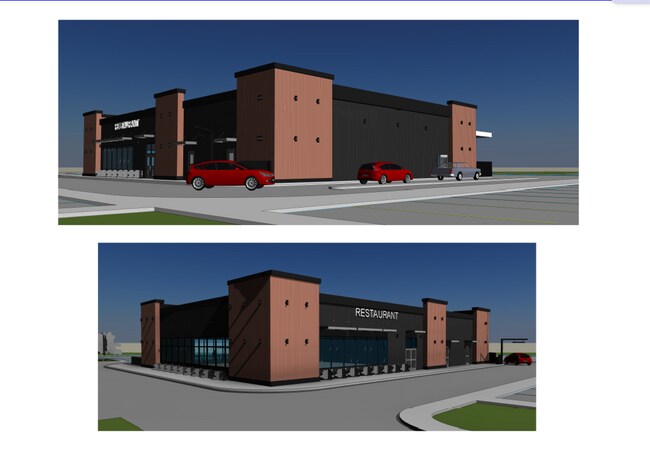
Property Detail
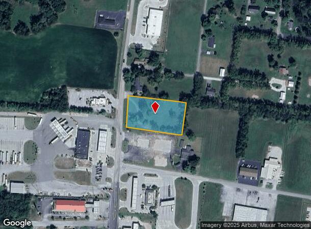
577 S Main St
Bowling Green, KY
Wilton D Pace Prop
080B-01-179
Warren
Residentialacreage
Kentucky
X
5
21009C0125C
1.62 AC
2025
Bowling Green Area
2025
Other Market Areas
011600
DEMOGRAPHICS near 577 S Main St
1 Mile
3 Mile
5 Mile
2024 Total Population
956
2,096
5,182
2029 Population
1,036
2,279
5,585
Pop Growth 2024-2029
+ 8.37%
+ 8.73%
+ 7.78%
Average Age
41
41
40
2024 Total Households
377
823
2,016
HH Growth 2024-2029
+ 8.75%
+ 9.11%
+ 7.94%
Median Household Inc
$65,192
$67,500
$66,250
Avg Household Size
2.50
2.50
2.50
2024 Avg HH Vehicles
2.00
2.00
2.00
Median Home Value
$179,244
$208,091
$197,986
Median Year Built
1974
1975
1989
Nearby Places
Map Layers
Map Styles
 Street
 Aerial
- Restaurants
- Banks
- Shops
- Fitness
- Groceries
SALE & LEASE HISTORY
LISTING DATE
SALE/LEASE

Jan 10, 2024
For Lease
Nearby Properties
Address
Land Use
TOTAL SIZE
Lot Size
Zoning
Address
Land Use
TOTAL SIZE
Lot Size
Zoning
4,674 SF
25.80 AC
Address
Land Use
TOTAL SIZE
Lot Size
Zoning
126,234 SF
30 AC
Address
Land Use
TOTAL SIZE
Lot Size
Zoning
18,140 SF
2.60 AC
Address
Land Use
TOTAL SIZE
Lot Size
Zoning
168.07 AC
Address
Land Use
TOTAL SIZE
Lot Size
Zoning
2,191 SF
110 AC
Address
Land Use
TOTAL SIZE
Lot Size
Zoning
Address
Land Use
TOTAL SIZE
Lot Size
Zoning
3,977 SF
4.95 AC
Address
Land Use
TOTAL SIZE
Lot Size
Zoning
43,920 SF
61.28 AC
Address
Land Use
TOTAL SIZE
Lot Size
Zoning
9,000 SF
0.78 AC
Address
Land Use
TOTAL SIZE
Lot Size
Zoning
74.06 AC
Address
Land Use
TOTAL SIZE
Lot Size
Zoning
1,500 SF
1 AC
Address
Land Use
TOTAL SIZE
Lot Size
Zoning
Address
Land Use
TOTAL SIZE
Lot Size
Zoning
23,000 SF
3.21 AC
Address
Land Use
TOTAL SIZE
Lot Size
Zoning
2,216 SF
201 AC
Address
Land Use
TOTAL SIZE
Lot Size
Zoning
35.35 AC
Address
Land Use
TOTAL SIZE
Lot Size
Zoning
Address
Land Use
TOTAL SIZE
Lot Size
Zoning
2,889 SF
5 AC
Address
Land Use
TOTAL SIZE
Lot Size
Zoning
912 SF
150 AC
Address
Land Use
TOTAL SIZE
Lot Size
Zoning
640 SF
187 AC
Address
Land Use
TOTAL SIZE
Lot Size
Zoning
122 AC
Address
Land Use
TOTAL SIZE
Lot Size
Zoning
108 AC
Address
Land Use
TOTAL SIZE
Lot Size
Zoning
2,940 SF
1 AC
Address
Land Use
TOTAL SIZE
Lot Size
Zoning
71.70 AC
Address
Land Use
TOTAL SIZE
Lot Size
Zoning
Address
Land Use
TOTAL SIZE
Lot Size
Zoning
6.60 AC
Address
Land Use
TOTAL SIZE
Lot Size
Zoning
4,318 SF
145 AC
Address
Land Use
TOTAL SIZE
Lot Size
Zoning
46,305 SF
9.03 AC
Address
Land Use
TOTAL SIZE
Lot Size
Zoning
Address
Land Use
TOTAL SIZE
Lot Size
Zoning
Address
Land Use
TOTAL SIZE
Lot Size
Zoning
98.92 AC
NONE
The World's #1 Commercial Real Estate Marketplace
Connect with us
© 2026 CoStar Group
The information above has been obtained from sources believed reliable. While we do not doubt its accuracy we have not verified it and make no guarantee, warranty or representation about it. It is your responsibility to independently confirm its accuracy and completeness. Any projections, opinions, assumptions, or estimates used are for example only and do not represent the current or future performance of the property. The value of this transaction to you depends on tax and other factors which should be evaluated by your tax, financial, and legal advisors. You and your advisors should conduct a careful, independent investigation of the property to determine to your satisfaction the suitability of the property for your needs.