Property Record
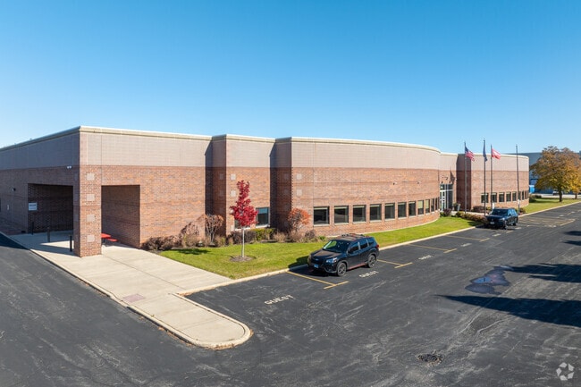
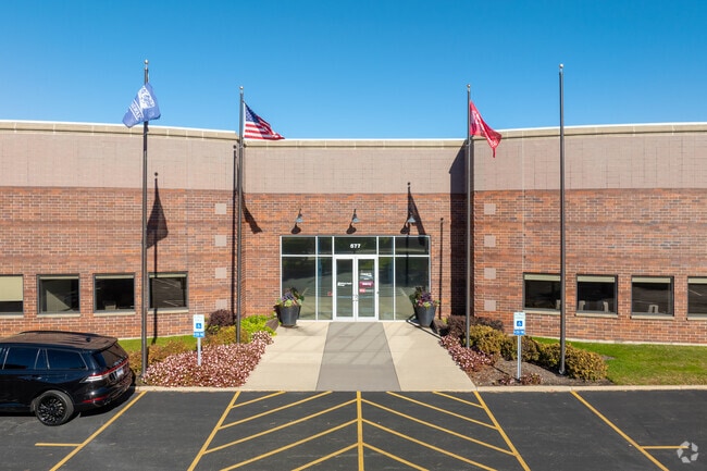
577 W Lamont Rd, Elmhurst, IL 60126
Property Detail
577 W Lamont Rd
03-27-211-004
GREENPOINT SUB ALL
Industrialgeneral
DUPAGE
I
Illinois
B and X Area of moderate flood hazard, usually the area between the limits of the 100-year and 500-year floods.
3
2024
3.83 AC
2024
West Suburbs
840705
Chicago
110,164 SF
Chicago-Naperville-Elgin, IL-IN
NEARBY LISTINGS FOR SALE OR LEASE
DEMOGRAPHICS near 577 W Lamont Rd
1 mile
3 mile
5 mile
2025 Total Population
5,120
104,626
251,330
2030 Population
5,111
105,696
253,366
Pop Growth 2025-2030
(0.18%)
+ 1.02%
+ 0.81%
Average Age
41
40
41
2025 Total Households
1,772
36,836
88,214
HH Growth 2025-2030
(0.17%)
+ 1.01%
+ 0.76%
Median Household Inc
$83,783
$91,150
$96,184
Avg Household Size
2.80
2.70
2.70
2025 Avg HH Vehicles
2.00
2.00
2.00
Median Home Value
$361,994
$337,611
$333,106
Median Year Built
1967
1966
1963
Nearby Places
Map Layers
Map Styles
 Street
 Aerial
Layers
 Traffic
 Biking
Places
Listings with unknown addresses are not visible on the map
- Restaurants
- Banks
- Shops
- Fitness
- Groceries
PUBLIC TRANSPORTATION
COMMUTER RAIL
Bensenville Station (Milwaukee District West Line - Northeast Illinois Regional Commuter Railroad (Metra))
Drive
Walk
Distance
Bensenville Station (Milwaukee District West Line - Northeast Illinois Regional Commuter Railroad (Metra))
7 min
3.1 mi
Elmhurst Station (Union Pacific West Line - Northeast Illinois Regional Commuter Railroad (Metra))
Drive
Walk
Distance
Elmhurst Station (Union Pacific West Line - Northeast Illinois Regional Commuter Railroad (Metra))
7 min
3.4 mi
AIRPORT
Chicago O'Hare International
Drive
Walk
Distance
Chicago O'Hare International
18 min
10.5 mi
Chicago Midway International
Drive
Walk
Distance
Chicago Midway International
30 min
18.3 mi
Freight Ports
Port Milwaukee
Drive
Walk
Distance
Port Milwaukee
103 min
84.0 mi
Nearby Properties
Address
Land Use
TOTAL SIZE
Lot Size
Zoning
Address
Land Use
TOTAL SIZE
Lot Size
Zoning
820,106 SF
14.78 AC
Address
Land Use
TOTAL SIZE
Lot Size
Zoning
Address
Land Use
TOTAL SIZE
Lot Size
Zoning
1,089,750 SF
59.83 AC
I
Address
Land Use
TOTAL SIZE
Lot Size
Zoning
312,131 SF
13.66 AC
M
Address
Land Use
TOTAL SIZE
Lot Size
Zoning
250,870 SF
19.23 AC
Address
Land Use
TOTAL SIZE
Lot Size
Zoning
309,570 SF
1.02 AC
Address
Land Use
TOTAL SIZE
Lot Size
Zoning
224,145 SF
2.48 AC
Address
Land Use
TOTAL SIZE
Lot Size
Zoning
240,073 SF
1.04 AC
Address
Land Use
TOTAL SIZE
Lot Size
Zoning
271,822 SF
26.29 AC
Address
Land Use
TOTAL SIZE
Lot Size
Zoning
204,600 SF
9.45 AC
M
Address
Land Use
TOTAL SIZE
Lot Size
Zoning
969,696 SF
44.30 AC
Address
Land Use
TOTAL SIZE
Lot Size
Zoning
28.36 AC
Address
Land Use
TOTAL SIZE
Lot Size
Zoning
14.35 AC
Address
Land Use
TOTAL SIZE
Lot Size
Zoning
469,492 SF
14.87 AC
I
Address
Land Use
TOTAL SIZE
Lot Size
Zoning
0.84 AC
Address
Land Use
TOTAL SIZE
Lot Size
Zoning
14.37 AC
I
Address
Land Use
TOTAL SIZE
Lot Size
Zoning
28,774 SF
4.30 AC
C
Address
Land Use
TOTAL SIZE
Lot Size
Zoning
139,923 SF
11.98 AC
I
Address
Land Use
TOTAL SIZE
Lot Size
Zoning
520,000 SF
2.96 AC
Address
Land Use
TOTAL SIZE
Lot Size
Zoning
186,486 SF
2.43 AC
A
Address
Land Use
TOTAL SIZE
Lot Size
Zoning
15.33 AC
M
Address
Land Use
TOTAL SIZE
Lot Size
Zoning
10.60 AC
Address
Land Use
TOTAL SIZE
Lot Size
Zoning
139,672 SF
15.41 AC
I
Address
Land Use
TOTAL SIZE
Lot Size
Zoning
600,000 SF
29.30 AC
Address
Land Use
TOTAL SIZE
Lot Size
Zoning
79,628 SF
9.31 AC
I
Address
Land Use
TOTAL SIZE
Lot Size
Zoning
588,533 SF
30.52 AC
Address
Land Use
TOTAL SIZE
Lot Size
Zoning
179,220 SF
9.29 AC
I
Address
Land Use
TOTAL SIZE
Lot Size
Zoning
168,240 SF
2.25 AC
C
Address
Land Use
TOTAL SIZE
Lot Size
Zoning
152,928 SF
3.98 AC
A
Address
Land Use
TOTAL SIZE
Lot Size
Zoning
248,880 SF
23.80 AC
C
The World's #1 Commercial Real Estate Marketplace
Connect with us
© 2026 CoStar Group
The information above has been obtained from sources believed reliable. While we do not doubt its accuracy we have not verified it and make no guarantee, warranty or representation about it. It is your responsibility to independently confirm its accuracy and completeness. Any projections, opinions, assumptions, or estimates used are for example only and do not represent the current or future performance of the property. The value of this transaction to you depends on tax and other factors which should be evaluated by your tax, financial, and legal advisors. You and your advisors should conduct a careful, independent investigation of the property to determine to your satisfaction the suitability of the property for your needs.