Property Record
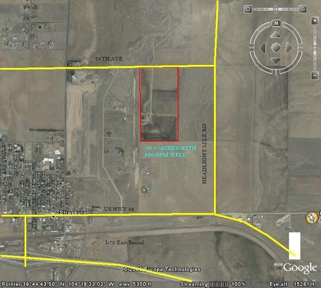
57700 E 24Th Ave, Strasburg, CO 80136

Property Detail
57700 E 24Th Ave
1813-00-0-00-191
SECT,TWN,RNG:34-3-62 DESC: W2 OF THE NE4 75/36A
Farms
ADAMS
A3
Colorado
AO River or stream flood hazard areas, and areas with a 1% or greater chance of shallow flooding each year. These areas have a 26% chance of flooding over the life of a 30-year mortgage.
75.36 AC
2024
Outlying Adams County
2025
Denver
008402
Denver-Aurora-Centennial, CO
1,832 SF
NEARBY LISTINGS FOR SALE OR LEASE
DEMOGRAPHICS near 57700 E 24Th Ave
1 mile
3 mile
5 mile
2025 Total Population
1,455
5,166
6,290
2030 Population
1,563
5,466
6,628
Pop Growth 2025-2030
+ 7.42%
+ 5.81%
+ 5.37%
Average Age
37
39
39
2025 Total Households
512
1,804
2,194
HH Growth 2025-2030
+ 7.62%
+ 6.04%
+ 5.61%
Median Household Inc
$126,804
$119,509
$117,391
Avg Household Size
2.80
2.80
2.80
2025 Avg HH Vehicles
3.00
3.00
3.00
Median Home Value
$473,364
$571,860
$597,897
Median Year Built
2007
2003
2002
Nearby Places
Map Layers
Map Styles
 Street
 Aerial
Layers
 Traffic
 Biking
Places
Listings with unknown addresses are not visible on the map
- Restaurants
- Banks
- Shops
- Fitness
- Groceries
PUBLIC TRANSPORTATION
AIRPORT
Denver International
Drive
Walk
Distance
Denver International
42 min
35.2 mi
Freight Ports
Tulsa Port Of Catoosa
Drive
Walk
Distance
Tulsa Port Of Catoosa
692 min
673.5 mi
Nearby Properties
Address
Land Use
TOTAL SIZE
Lot Size
Zoning
Address
Land Use
TOTAL SIZE
Lot Size
Zoning
134,202 SF
12.51 AC
R1C
Address
Land Use
TOTAL SIZE
Lot Size
Zoning
30,666 SF
2.43 AC
PUD
Address
Land Use
TOTAL SIZE
Lot Size
Zoning
48,888 SF
10.40 AC
A2
Address
Land Use
TOTAL SIZE
Lot Size
Zoning
46,554 SF
3.35 AC
Address
Land Use
TOTAL SIZE
Lot Size
Zoning
2,392 SF
37.76 AC
A3
Address
Land Use
TOTAL SIZE
Lot Size
Zoning
24,443 SF
2.98 AC
Address
Land Use
TOTAL SIZE
Lot Size
Zoning
28,370 SF
10.01 AC
A3
Address
Land Use
TOTAL SIZE
Lot Size
Zoning
9,100 SF
1.28 AC
A3
Address
Land Use
TOTAL SIZE
Lot Size
Zoning
3,816 SF
6.70 AC
Address
Land Use
TOTAL SIZE
Lot Size
Zoning
6,545 SF
1.02 AC
C5
Address
Land Use
TOTAL SIZE
Lot Size
Zoning
12,792 SF
17.62 AC
A2
Address
Land Use
TOTAL SIZE
Lot Size
Zoning
7,746 SF
0.40 AC
Address
Land Use
TOTAL SIZE
Lot Size
Zoning
8,906 SF
1.10 AC
PUD
Address
Land Use
TOTAL SIZE
Lot Size
Zoning
7,320 SF
1.24 AC
C5
Address
Land Use
TOTAL SIZE
Lot Size
Zoning
2,580 SF
0.34 AC
R1C
Address
Land Use
TOTAL SIZE
Lot Size
Zoning
5,292 SF
0.26 AC
C3
Address
Land Use
TOTAL SIZE
Lot Size
Zoning
1,521 SF
0.19 AC
PUD
Address
Land Use
TOTAL SIZE
Lot Size
Zoning
19,887 SF
28.56 AC
A3
Address
Land Use
TOTAL SIZE
Lot Size
Zoning
11,932 SF
6.44 AC
A1
Address
Land Use
TOTAL SIZE
Lot Size
Zoning
14,706 SF
3.10 AC
Address
Land Use
TOTAL SIZE
Lot Size
Zoning
4,410 SF
0.29 AC
C5
Address
Land Use
TOTAL SIZE
Lot Size
Zoning
2,240 SF
3.43 AC
Address
Land Use
TOTAL SIZE
Lot Size
Zoning
1,350 SF
0.17 AC
PUD
Address
Land Use
TOTAL SIZE
Lot Size
Zoning
2,240 SF
6.92 AC
Address
Land Use
TOTAL SIZE
Lot Size
Zoning
11,856 SF
1.57 AC
Address
Land Use
TOTAL SIZE
Lot Size
Zoning
13,892 SF
0.39 AC
Address
Land Use
TOTAL SIZE
Lot Size
Zoning
6,667 SF
0.34 AC
C3
Address
Land Use
TOTAL SIZE
Lot Size
Zoning
4,050 SF
0.62 AC
Address
Land Use
TOTAL SIZE
Lot Size
Zoning
7,648 SF
5 AC
The World's #1 Commercial Real Estate Marketplace
Connect with us
© 2026 CoStar Group
The information above has been obtained from sources believed reliable. While we do not doubt its accuracy we have not verified it and make no guarantee, warranty or representation about it. It is your responsibility to independently confirm its accuracy and completeness. Any projections, opinions, assumptions, or estimates used are for example only and do not represent the current or future performance of the property. The value of this transaction to you depends on tax and other factors which should be evaluated by your tax, financial, and legal advisors. You and your advisors should conduct a careful, independent investigation of the property to determine to your satisfaction the suitability of the property for your needs.