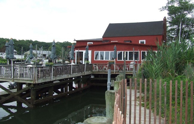
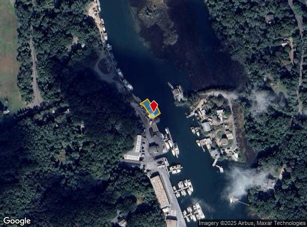
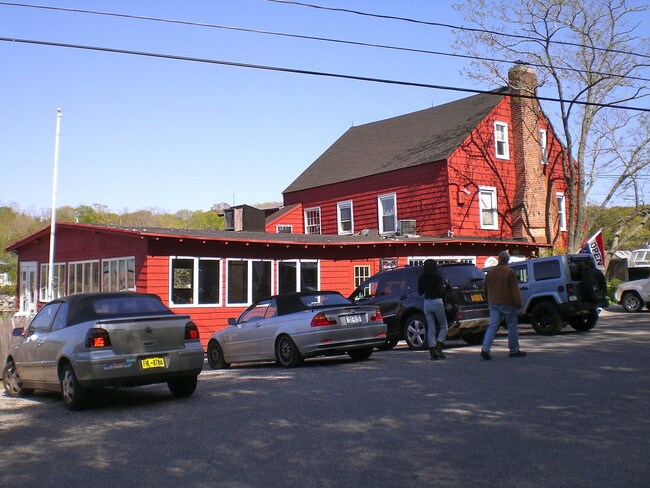
Property Record
5775 W Mill Rd, Mattituck, NY 11952

NEARBY LISTINGS FOR SALE OR LEASE
Property Detail
5775 W Mill Rd
Nassau County-Suffolk County, NY
BOOK 12461 PAGE 33 BILL 012714
1000-106-00-06-00-003-000
Suffolk
Restaurantbuilding
New York
AE
3
36103C0143H
0.25 AC
2024
Eastern Suffolk
2024
Long Island (New York)
170003
DEMOGRAPHICS near 5775 W Mill Rd
1 Mile
3 Mile
5 Mile
2024 Total Population
1,735
7,162
13,180
2029 Population
1,761
7,276
13,308
Pop Growth 2024-2029
+ 1.50%
+ 1.59%
+ 0.97%
Average Age
47
46
47
2024 Total Households
739
2,828
5,248
HH Growth 2024-2029
+ 1.35%
+ 1.34%
+ 0.74%
Median Household Inc
$95,644
$99,480
$103,731
Avg Household Size
2.30
2.40
2.40
2024 Avg HH Vehicles
2.00
2.00
2.00
Median Home Value
$685,022
$714,285
$733,360
Median Year Built
1975
1975
1976
Nearby Places
- Restaurants
- Banks
- Shops
- Fitness
- Groceries
PUBLIC TRANSPORTATION
COMMUTER RAIL
Mattituck Station (Greenport Branch - Long Island Rail Road)
DRIVE
WALK
Distance
Mattituck Station (Greenport Branch - Long Island Rail Road)
7 min
2.8 mi
Freight Ports
Port of Davisville, RI
DRIVE
WALK
Distance
Port of Davisville, RI
1 min
72.4 mi
SALE & LEASE HISTORY
LISTING DATE
SALE/LEASE

Sep 23, 2016
For Sale
Nearby Properties
Address
Land Use
TOTAL SIZE
Lot Size
Zoning
Address
Land Use
TOTAL SIZE
Lot Size
Zoning
214.30 AC
10
Address
Land Use
TOTAL SIZE
Lot Size
Zoning
30.40 AC
R-80
Address
Land Use
TOTAL SIZE
Lot Size
Zoning
5.01 AC
10
Address
Land Use
TOTAL SIZE
Lot Size
Zoning
11.39 AC
10
Address
Land Use
TOTAL SIZE
Lot Size
Zoning
1,980 SF
63.11 AC
09
Address
Land Use
TOTAL SIZE
Lot Size
Zoning
392 SF
52.39 AC
09
Address
Land Use
TOTAL SIZE
Lot Size
Zoning
2,392 SF
26.20 AC
09
Address
Land Use
TOTAL SIZE
Lot Size
Zoning
392 SF
19.31 AC
09
Address
Land Use
TOTAL SIZE
Lot Size
Zoning
0.79 AC
VILLA
Address
Land Use
TOTAL SIZE
Lot Size
Zoning
8.75 AC
B
Address
Land Use
TOTAL SIZE
Lot Size
Zoning
7.87 AC
RA80
Address
Land Use
TOTAL SIZE
Lot Size
Zoning
Address
Land Use
TOTAL SIZE
Lot Size
Zoning
5 AC
10
Address
Land Use
TOTAL SIZE
Lot Size
Zoning
783 SF
25.80 AC
09
Address
Land Use
TOTAL SIZE
Lot Size
Zoning
17.40 AC
RR
Address
Land Use
TOTAL SIZE
Lot Size
Zoning
Address
Land Use
TOTAL SIZE
Lot Size
Zoning
60.61 AC
04
Address
Land Use
TOTAL SIZE
Lot Size
Zoning
5.60 AC
RO R-40
Address
Land Use
TOTAL SIZE
Lot Size
Zoning
1.34 AC
HB
Address
Land Use
TOTAL SIZE
Lot Size
Zoning
32.26 AC
R-80 R-40
Address
Land Use
TOTAL SIZE
Lot Size
Zoning
7.20 AC
AC
Address
Land Use
TOTAL SIZE
Lot Size
Zoning
154.70 AC
AC R-40
Address
Land Use
TOTAL SIZE
Lot Size
Zoning
59.94 AC
LI
Address
Land Use
TOTAL SIZE
Lot Size
Zoning
2,244 SF
30.30 AC
RA80
Address
Land Use
TOTAL SIZE
Lot Size
Zoning
8.50 AC
MII
Address
Land Use
TOTAL SIZE
Lot Size
Zoning
32.60 AC
MII R-80
Address
Land Use
TOTAL SIZE
Lot Size
Zoning
15.10 AC
09
Address
Land Use
TOTAL SIZE
Lot Size
Zoning
40.20 AC
RA80
Address
Land Use
TOTAL SIZE
Lot Size
Zoning
5.65 AC
LI
Address
Land Use
TOTAL SIZE
Lot Size
Zoning
38.60 AC
10
The World's #1 Commercial Real Estate Marketplace
Connect with us
© 2025 CoStar Group
The information above has been obtained from sources believed reliable. While we do not doubt its accuracy we have not verified it and make no guarantee, warranty or representation about it. It is your responsibility to independently confirm its accuracy and completeness. Any projections, opinions, assumptions, or estimates used are for example only and do not represent the current or future performance of the property. The value of this transaction to you depends on tax and other factors which should be evaluated by your tax, financial, and legal advisors. You and your advisors should conduct a careful, independent investigation of the property to determine to your satisfaction the suitability of the property for your needs.