Property Record
57760 Main St, New Haven, MI 48048
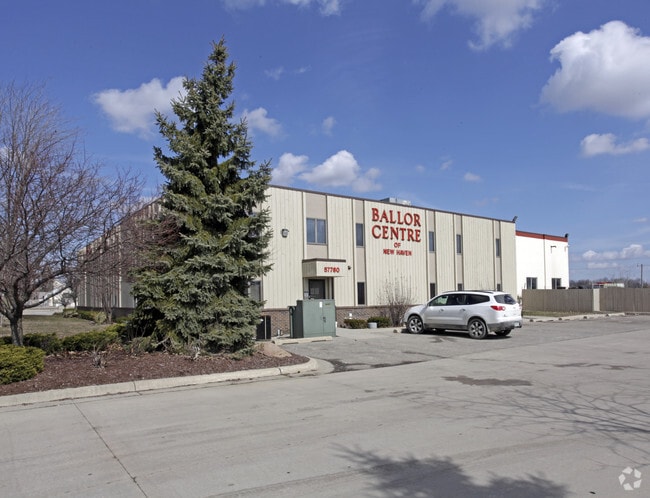


Property Detail
57760 Main St
26-06-33-428-023
SUPERVISORS PLAT OF NEW HAVEN GARDENS LOTS 5 THRU 9 &10 EXC COMM AT NW COR OF LOT 10, TH SELY 126.54 FT ALG NELY LINE OF LOT
Autorepair
MACOMB
LI
Michigan
AE The base floodplain where base flood elevations are provided. AE Zones are now used on new format FIRMs instead of A1-A30 Zones.
5-10
2025
3.83 AC
2025
St Clair & Lapeer Counties
218001
Detroit
14,588 SF
Detroit-Warren-Dearborn, MI
NEARBY LISTINGS FOR SALE OR LEASE
DEMOGRAPHICS near 57760 Main St
1 mile
3 mile
5 mile
2025 Total Population
6,133
23,843
65,920
2030 Population
6,348
24,395
67,271
Pop Growth 2025-2030
+ 3.51%
+ 2.32%
+ 2.05%
Average Age
36
39
41
2025 Total Households
1,888
8,065
24,813
HH Growth 2025-2030
+ 3.71%
+ 2.38%
+ 2.16%
Median Household Inc
$70,132
$85,071
$85,632
Avg Household Size
3.00
2.80
2.50
2025 Avg HH Vehicles
2.00
2.00
2.00
Median Home Value
$213,713
$267,556
$287,387
Median Year Built
2003
2000
1994
Nearby Places
Map Layers
Map Styles
 Street
 Aerial
Layers
 Traffic
 Biking
Places
Listings with unknown addresses are not visible on the map
- Restaurants
- Banks
- Shops
- Fitness
- Groceries
Nearby Properties
Address
Land Use
TOTAL SIZE
Lot Size
Zoning
Address
Land Use
TOTAL SIZE
Lot Size
Zoning
115,695 SF
Address
Land Use
TOTAL SIZE
Lot Size
Zoning
316,907 SF
21.18 AC
M2 GEN
Address
Land Use
TOTAL SIZE
Lot Size
Zoning
210,688 SF
20.13 AC
CG
Address
Land Use
TOTAL SIZE
Lot Size
Zoning
179,250 SF
26.35 AC
M2 GEN
Address
Land Use
TOTAL SIZE
Lot Size
Zoning
7,262 SF
127.87 AC
MH
Address
Land Use
TOTAL SIZE
Lot Size
Zoning
5,541 SF
130.51 AC
MHP MO
Address
Land Use
TOTAL SIZE
Lot Size
Zoning
3,799 SF
56.46 AC
MH
Address
Land Use
TOTAL SIZE
Lot Size
Zoning
26,578 SF
31.52 AC
IR
Address
Land Use
TOTAL SIZE
Lot Size
Zoning
88,116 SF
5.66 AC
IO
Address
Land Use
TOTAL SIZE
Lot Size
Zoning
30,878 SF
5.32 AC
IO
Address
Land Use
TOTAL SIZE
Lot Size
Zoning
55,821 SF
M2 GEN
Address
Land Use
TOTAL SIZE
Lot Size
Zoning
15,788 SF
4.28 AC
CG
Address
Land Use
TOTAL SIZE
Lot Size
Zoning
58,392 SF
3.66 AC
M1 LIG
Address
Land Use
TOTAL SIZE
Lot Size
Zoning
82,370 SF
19.14 AC
M2 GEN
Address
Land Use
TOTAL SIZE
Lot Size
Zoning
19,280 SF
3.97 AC
M2 GEN
Address
Land Use
TOTAL SIZE
Lot Size
Zoning
85,097 SF
4.87 AC
M2 GEN
Address
Land Use
TOTAL SIZE
Lot Size
Zoning
21,944 SF
131.37 AC
CG
Address
Land Use
TOTAL SIZE
Lot Size
Zoning
18,905 SF
6.40 AC
RO
Address
Land Use
TOTAL SIZE
Lot Size
Zoning
3,418 SF
60 AC
CG
Address
Land Use
TOTAL SIZE
Lot Size
Zoning
32,476 SF
Address
Land Use
TOTAL SIZE
Lot Size
Zoning
3,927 SF
85.22 AC
MF
Address
Land Use
TOTAL SIZE
Lot Size
Zoning
26,578 SF
22.50 AC
Address
Land Use
TOTAL SIZE
Lot Size
Zoning
1,034 SF
36.86 AC
MHP MO
Address
Land Use
TOTAL SIZE
Lot Size
Zoning
20,434 SF
2.89 AC
SF II
Address
Land Use
TOTAL SIZE
Lot Size
Zoning
49,682 SF
6.31 AC
M2 GEN
Address
Land Use
TOTAL SIZE
Lot Size
Zoning
68,000 SF
10.54 AC
CC
Address
Land Use
TOTAL SIZE
Lot Size
Zoning
13,145 SF
4.05 AC
GB
Address
Land Use
TOTAL SIZE
Lot Size
Zoning
27,720 SF
19.14 AC
M2 GEN
Address
Land Use
TOTAL SIZE
Lot Size
Zoning
31,641 SF
Address
Land Use
TOTAL SIZE
Lot Size
Zoning
15,042 SF
2.08 AC
GB
The World's #1 Commercial Real Estate Marketplace
Connect with us
© 2026 CoStar Group
The information above has been obtained from sources believed reliable. While we do not doubt its accuracy we have not verified it and make no guarantee, warranty or representation about it. It is your responsibility to independently confirm its accuracy and completeness. Any projections, opinions, assumptions, or estimates used are for example only and do not represent the current or future performance of the property. The value of this transaction to you depends on tax and other factors which should be evaluated by your tax, financial, and legal advisors. You and your advisors should conduct a careful, independent investigation of the property to determine to your satisfaction the suitability of the property for your needs.