Property Record
578 Upward Rd, Flat Rock, NC 28731


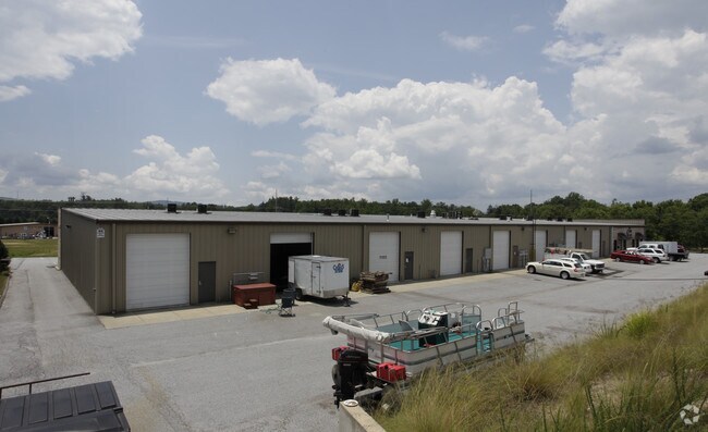
Property Detail
578 Upward Rd
9969907
Original BkPg/Doc 1154-471
Regionalshoppingcenterormallwithanchorstore
Henderson
9969907~RC
North Carolina
B and X Area of moderate flood hazard, usually the area between the limits of the 100-year and 500-year floods.
2081
2025
1.68 AC
2025
Henderson County
931000
Asheville
20,000 SF
Asheville, NC
NEARBY LISTINGS FOR SALE OR LEASE
DEMOGRAPHICS near 578 Upward Rd
1 mile
3 mile
5 mile
2025 Total Population
3,799
22,261
52,189
2030 Population
3,966
23,121
54,133
Pop Growth 2025-2030
+ 4.40%
+ 3.86%
+ 3.72%
Average Age
41
44
46
2025 Total Households
1,392
9,203
22,691
HH Growth 2025-2030
+ 4.53%
+ 3.99%
+ 3.84%
Median Household Inc
$53,695
$53,745
$56,755
Avg Household Size
2.60
2.30
2.20
2025 Avg HH Vehicles
2.00
2.00
2.00
Median Home Value
$237,555
$303,778
$345,631
Median Year Built
1982
1986
1985
Nearby Places
Map Layers
Map Styles
 Street
 Aerial
Layers
 Traffic
 Biking
Places
Listings with unknown addresses are not visible on the map
- Restaurants
- Banks
- Shops
- Fitness
- Groceries
PUBLIC TRANSPORTATION
AIRPORT
Asheville Regional
Drive
Walk
Distance
Asheville Regional
19 min
13.8 mi
Greenville Spartanburg International
Drive
Walk
Distance
Greenville Spartanburg International
56 min
37.9 mi
Nearby Properties
Address
Land Use
TOTAL SIZE
Lot Size
Zoning
Address
Land Use
TOTAL SIZE
Lot Size
Zoning
96,084 SF
13.96 AC
1013416~PI
Address
Land Use
TOTAL SIZE
Lot Size
Zoning
5,625 SF
15.53 AC
10007593~P
Address
Land Use
TOTAL SIZE
Lot Size
Zoning
29,233 SF
83.09 AC
10005104~O
Address
Land Use
TOTAL SIZE
Lot Size
Zoning
88,500 SF
50.24 AC
9906531~R-
Address
Land Use
TOTAL SIZE
Lot Size
Zoning
12,309 SF
6.52 AC
10005105~O
Address
Land Use
TOTAL SIZE
Lot Size
Zoning
44,485 SF
38.89 AC
9906409~OI
Address
Land Use
TOTAL SIZE
Lot Size
Zoning
18.65 AC
10006780~I
Address
Land Use
TOTAL SIZE
Lot Size
Zoning
90,000 SF
19.59 AC
1004354~R2
Address
Land Use
TOTAL SIZE
Lot Size
Zoning
70,145 SF
31.16 AC
201578~CC
Address
Land Use
TOTAL SIZE
Lot Size
Zoning
70,136 SF
3.33 AC
10000154~O
Address
Land Use
TOTAL SIZE
Lot Size
Zoning
88,754 SF
4 AC
1003459~OI
Address
Land Use
TOTAL SIZE
Lot Size
Zoning
97,368 SF
6.66 AC
1000569~PI
Address
Land Use
TOTAL SIZE
Lot Size
Zoning
516,587 SF
116.84 AC
9928729~I
Address
Land Use
TOTAL SIZE
Lot Size
Zoning
73,500 SF
16.40 AC
10010073~I
Address
Land Use
TOTAL SIZE
Lot Size
Zoning
51,166 SF
5.43 AC
9962201~R1
Address
Land Use
TOTAL SIZE
Lot Size
Zoning
40,975 SF
1.15 AC
9904361~C-
Address
Land Use
TOTAL SIZE
Lot Size
Zoning
72,560 SF
7.23 AC
10000067~P
Address
Land Use
TOTAL SIZE
Lot Size
Zoning
33,419 SF
1.56 AC
10005796~R
Address
Land Use
TOTAL SIZE
Lot Size
Zoning
11.77 AC
10009504~I
Address
Land Use
TOTAL SIZE
Lot Size
Zoning
9.06 AC
10009502~I
Address
Land Use
TOTAL SIZE
Lot Size
Zoning
228,704 SF
10.68 AC
9949735~RC
Address
Land Use
TOTAL SIZE
Lot Size
Zoning
79,651 SF
10.24 AC
9928981~C-
Address
Land Use
TOTAL SIZE
Lot Size
Zoning
50,573 SF
6.71 AC
10003742~P
Address
Land Use
TOTAL SIZE
Lot Size
Zoning
90,495 SF
15.65 AC
10005991~P
Address
Land Use
TOTAL SIZE
Lot Size
Zoning
59,100 SF
0.39 AC
9955527~C-
Address
Land Use
TOTAL SIZE
Lot Size
Zoning
53,319 SF
1.93 AC
10004263~C
Address
Land Use
TOTAL SIZE
Lot Size
Zoning
46,712 SF
2.12 AC
1016840~PC
Address
Land Use
TOTAL SIZE
Lot Size
Zoning
10,237 SF
1.38 AC
9904354~CM
Address
Land Use
TOTAL SIZE
Lot Size
Zoning
10,548 SF
7.98 AC
10003171~P
Address
Land Use
TOTAL SIZE
Lot Size
Zoning
1,612 SF
0.12 AC
9934124~C-
The World's #1 Commercial Real Estate Marketplace
Connect with us
© 2026 CoStar Group
The information above has been obtained from sources believed reliable. While we do not doubt its accuracy we have not verified it and make no guarantee, warranty or representation about it. It is your responsibility to independently confirm its accuracy and completeness. Any projections, opinions, assumptions, or estimates used are for example only and do not represent the current or future performance of the property. The value of this transaction to you depends on tax and other factors which should be evaluated by your tax, financial, and legal advisors. You and your advisors should conduct a careful, independent investigation of the property to determine to your satisfaction the suitability of the property for your needs.